MyTopo
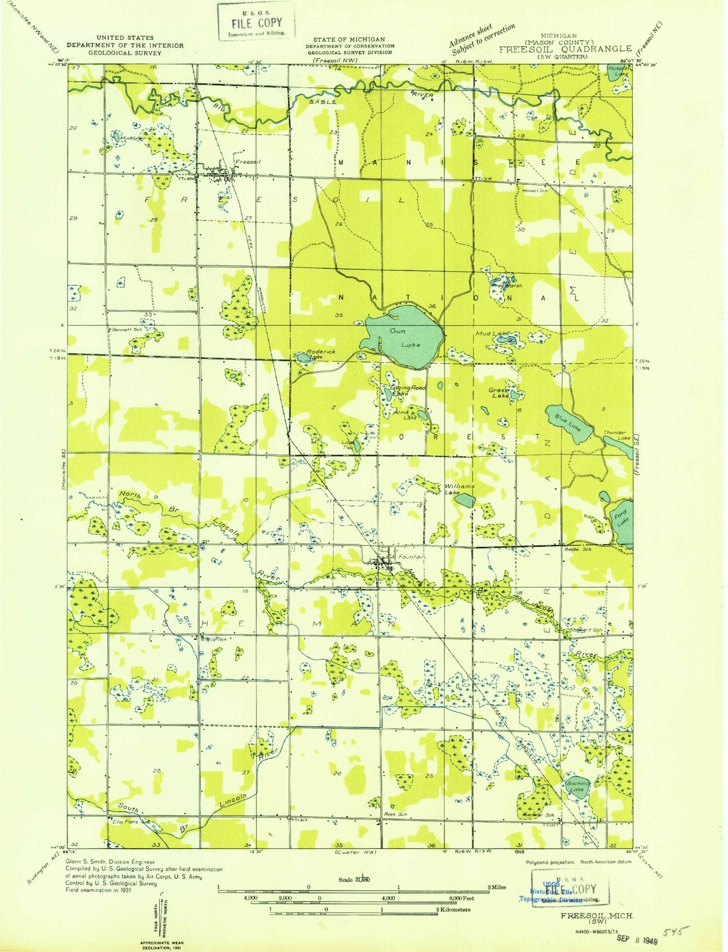
Classic USGS Free Soil Michigan 7.5'x7.5' Topo Map
Couldn't load pickup availability
Historical USGS topographic quad map of Free Soil in the state of Michigan. Map scale may vary for some years, but is generally around 1:24,000. Print size is approximately 24" x 27"
This quadrangle is in the following counties: Mason.
The map contains contour lines, roads, rivers, towns, and lakes. Printed on high-quality waterproof paper with UV fade-resistant inks, and shipped rolled.
Contains the following named places: Alma Lake, Bachellor Cemetery, Bachelor Evangelical Church, Bachelor Post Office, Batcheller, Batcheller Lake, Batcheller School, Batchelor Station, Camp Sauble State Prison, Chancellor Lake, Edging Lake, Elm Flats School, Ford Lake School, Fountain, Fountain Area Fire Department, Fountain Cemetery, Fountain Post Office, Fountain Station, Fountain United Methodist Church, Free Soil, Free Soil Post Office, Freesoil - Meade Township Fire Department, Freesoil Community School, Freesoil Station, Freesoil United Methodist Church, Frog Marsh, Frog Paradise Drain, Grass Lake, Gun Lake, Howell School, Lake Meade, Lake Two, Meade Cemetery, Mud Lake, Pickerel Lake, Reek School, Ritters Creek, Roderick Lake, Saint John Cantius Catholic Church, Saint John Cantius Cemetery, Sherman Township Hall, Stewart School, Township of Sherman, Village of Fountain, Village of Free Soil, Williams Lake, ZIP Code: 49410