MyTopo
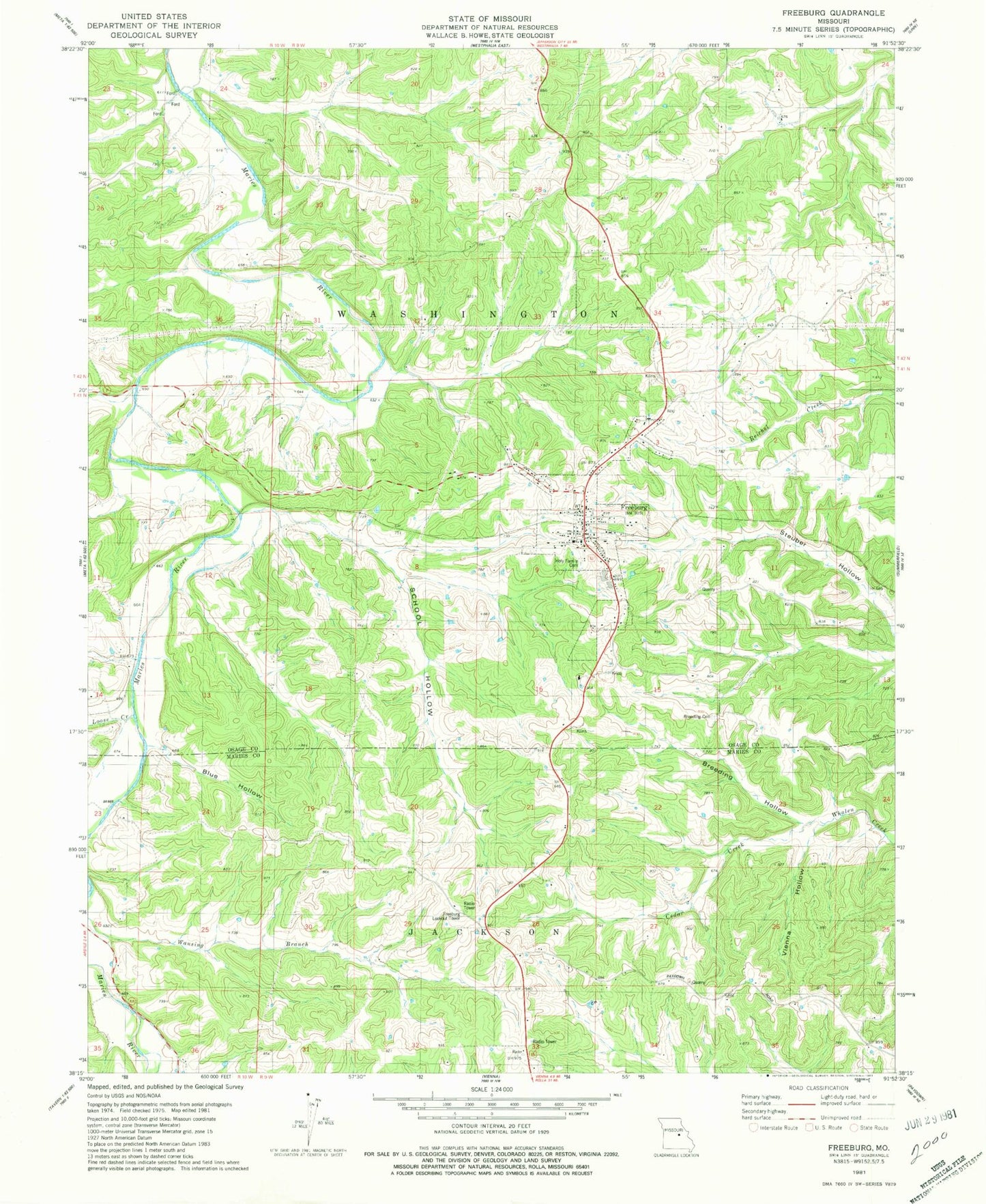
Classic USGS Freeburg Missouri 7.5'x7.5' Topo Map
Couldn't load pickup availability
Historical USGS topographic quad map of Freeburg in the state of Missouri. Map scale may vary for some years, but is generally around 1:24,000. Print size is approximately 24" x 27"
This quadrangle is in the following counties: Maries, Osage.
The map contains contour lines, roads, rivers, towns, and lakes. Printed on high-quality waterproof paper with UV fade-resistant inks, and shipped rolled.
Contains the following named places: Blue Hollow, Breeding Cemetery, Breeding Hollow, Cedar Creek, Church of the Holy Family, Excelsior School, Freeburg, Freeburg Lookout Tower, Freeburg Post Office, Freeburg Volunteer Fire Department Station 1, Holy Family Cemetery, Loehner School, Loose Creek, Renneke School, School Hollow, Vienna Hollow, Village of Freeburg, Wansing Branch, Welschmeyers Dam, Welschmeyers Lake, ZIP Code: 65035