MyTopo
Classic USGS Freedom Mountain Arkansas 7.5'x7.5' Topo Map
Couldn't load pickup availability
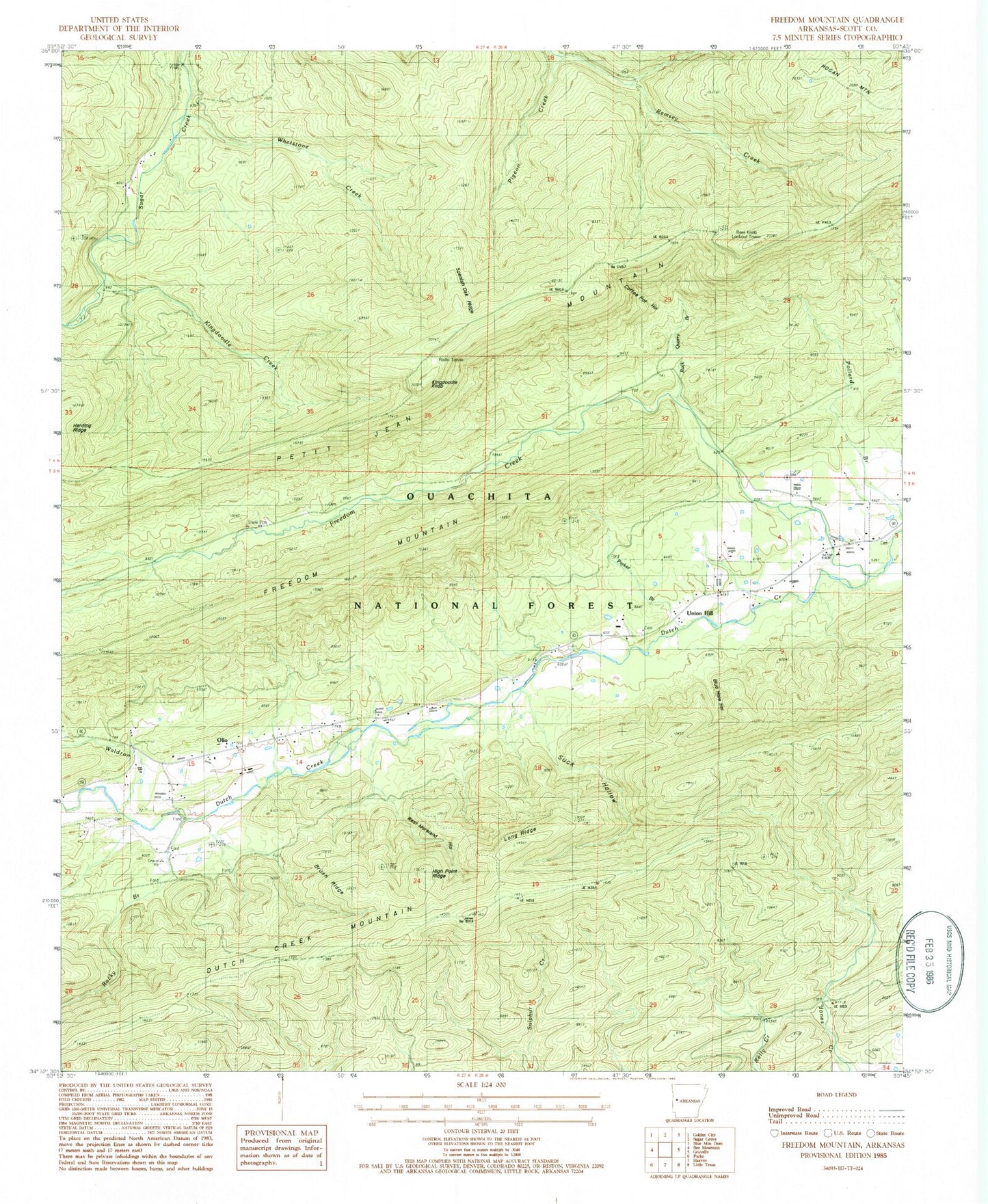
Historical USGS topographic quad map of Freedom Mountain in the state of Arkansas. Map scale may vary for some years, but is generally around 1:24,000. Print size is approximately 24" x 27"
This quadrangle is in the following counties: Scott.
The map contains contour lines, roads, rivers, towns, and lakes. Printed on high-quality waterproof paper with UV fade-resistant inks, and shipped rolled.
Contains the following named places: Bear Knob Lookout Tower, Bear Knob Mountain, Blue Hole Hollow, Brush Ridge, Coffee Pot Hollow, Dutch Creek School, Freedom Creek, Freedom Creek Cemetery, Freedom Mountain, Haletown Volunteer Fire Department, High Point Ridge, Hogan Mountain, Hunt Cemetery, Kingdoodle Creek, Kingdoodle Knob, Long Ridge, Mount Moriah Church, Olio, Parker Branch, Pigeon Creek, Rock Quarry Branch, Rocky Branch, Spanish Oak Ridge, Suck Hollow, Township of Hunt, Township of James, Union Hill, Union Hill Church, Waldron Branch, West Moreland Hollow, Whetstone Creek