MyTopo
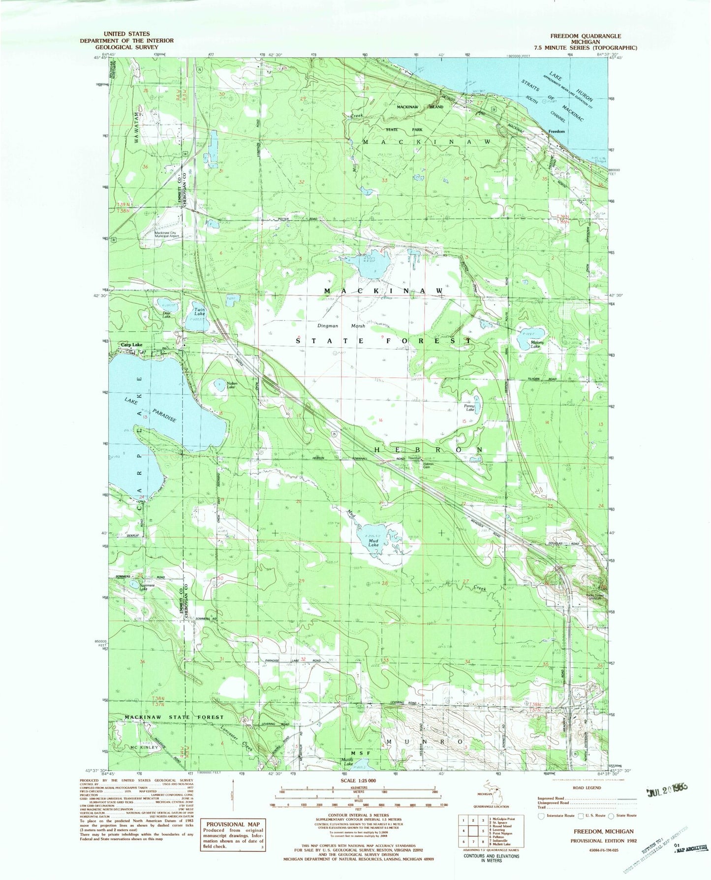
Classic USGS Freedom Michigan 7.5'x7.5' Topo Map
Couldn't load pickup availability
Historical USGS topographic quad map of Freedom in the state of Michigan. Map scale may vary for some years, but is generally around 1:24,000. Print size is approximately 24" x 27"
This quadrangle is in the following counties: Cheboygan, Emmet.
The map contains contour lines, roads, rivers, towns, and lakes. Printed on high-quality waterproof paper with UV fade-resistant inks, and shipped rolled.
Contains the following named places: Agape Lighthouse Church, Dingman Marsh, Dow Lake, Emmet Hebron School, Evangelical Free Church, Freedom, Freedom Post Office, Freedom Station, Hebron Cemetery, Hebron Lookout Tower, Hebron Post Office, Hebron Rest Area, Historic Mill Creek State Park, Lake School, MacKinaw City Municipal Airport, Mackinaw Golf Course, Mackinaw Heights, Malony Lake, Mill Creek, Mud Creek, Mud Lake, Munro Township Fire Station, Nolten Lake, Old Mill Creek Historical Marker, Penny Lake, Sommers Lake, Township of Hebron, Township of Mackinaw, Twin Lake, WWUP Radio Tower (Petoskey)