
MyTopo
Classic USGS Freedom New Hampshire 7.5'x7.5' Topo Map
Couldn't load pickup availability
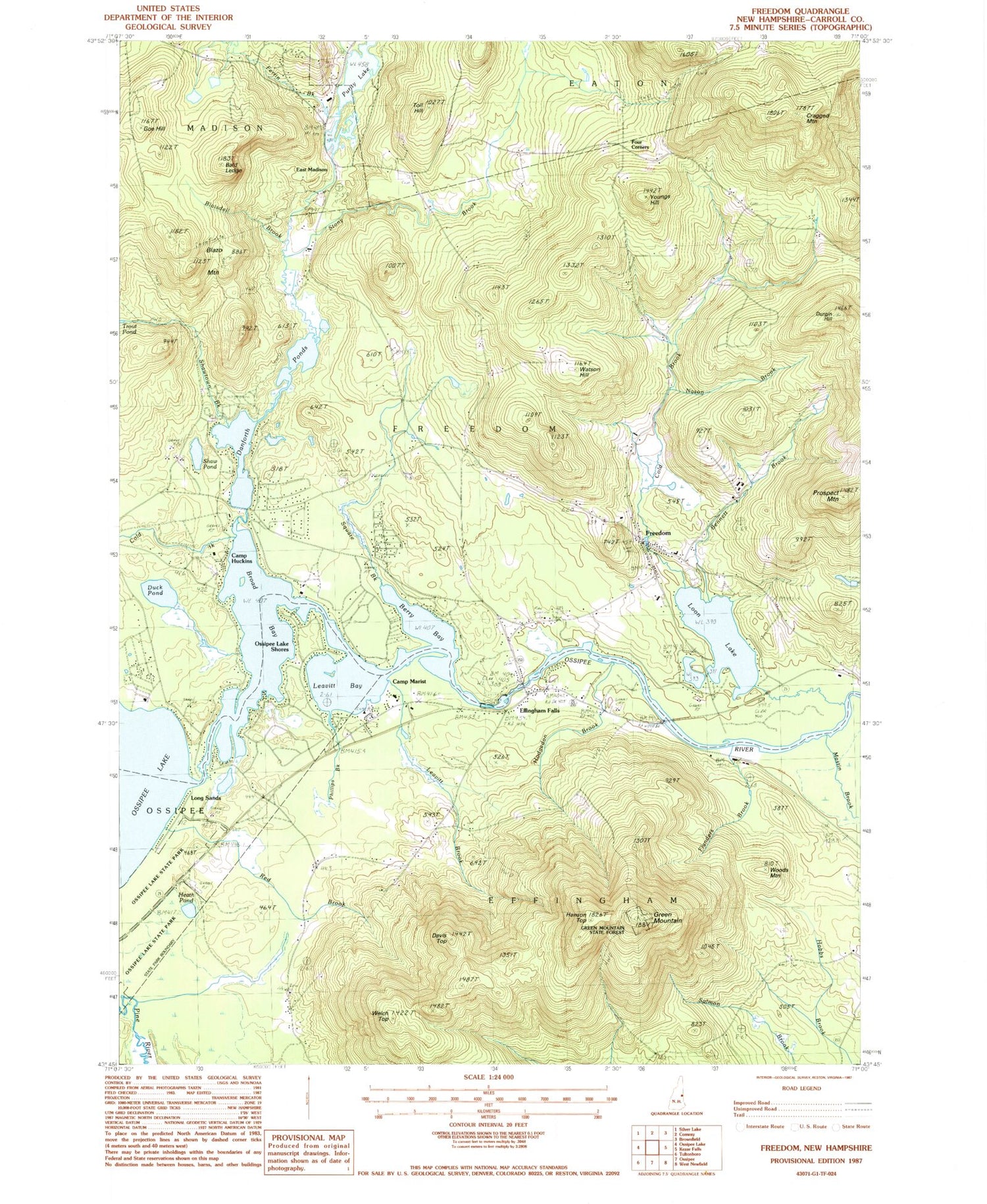
Historical USGS topographic quad map of Freedom in the state of New Hampshire. Typical map scale is 1:24,000, but may vary for certain years, if available. Print size: 24" x 27"
This quadrangle is in the following counties: Carroll.
The map contains contour lines, roads, rivers, towns, and lakes. Printed on high-quality waterproof paper with UV fade-resistant inks, and shipped rolled.
Contains the following named places: Bald Ledge, Bennett Brook, Berry Bay, Blaisdell Brook, Blazo Mountain, Broad Bay, Camp Huckins, Camp Marist, Cold Brook, Cold Brook, Cragged Mountain, Cragged Mountain Farm, Danforth Ponds, Davis Meetinghouse, Davis Top, Duck Pond, Durgin Hill, East Madison, Effingham Falls, Flanders Brook, Four Corners, Freedom, Goe Hill, Green Mountain, Hanson Top, Heath Pond, Hodgedon Brook, Lakeview Cemetery, Leavitt Bay, Leavitt Brook, Long Sands, Loon Lake, Lovering Brook, Mastin Brook, Moulton Brook, Nason Brook, Ossipee Lake Shores, Phillips Brook, Prospect Mountain, Red Brook, Salmon Brook, Shaw Pond, Shawtown Brook, Square Brook, Stony Brook, Toll Hill, Watson Hill, Welch Top, Woods Mountain, Youngs Hill, Ferrin Brook, Purity Lake, Town of Freedom, Purity Lake Dam, Head Works Dam, Berry Bay, Berry Bay Dam, Camp Wampineauk, Effingham Elementary School, First Christian Church, Freedom Elementary School, Freedom Post Office, King Pine Ski Area, Lords Hill (historical), Lords Hill Historic District, Unitarian Universalist Church, Lakeview Learning Center, Freedom Fire Rescue Department, Freedom Police Department, Effingham Police Department


