MyTopo
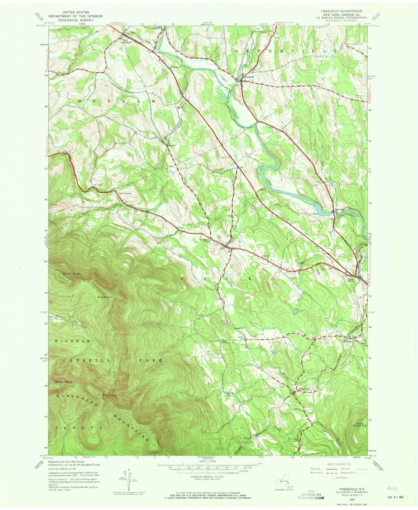
Classic USGS Freehold New York 7.5'x7.5' Topo Map
Couldn't load pickup availability
Historical USGS topographic quad map of Freehold in the state of New York. Typical map scale is 1:24,000, but may vary for certain years, if available. Print size: 24" x 27"
This quadrangle is in the following counties: Greene.
The map contains contour lines, roads, rivers, towns, and lakes. Printed on high-quality waterproof paper with UV fade-resistant inks, and shipped rolled.
Contains the following named places: Acra, Acra Point, Basic Creek, Bowery Creek, Burnt Knob, Catskill State Park, Cornwallville Creek, Countryman Kill, East Durham, Freehold, Glen Falls, Platte Kill, Purling, Round Top, Saint Edmunds Chapel, Saint Marys Church, Snyder Cemetery, South Durham, Sunside, Taylor Cemetery, Thorp Creek, Trout Brook, Winter Clove, Woodstock, Black Dome, Blackhead, Greene County, Freehold Airport, Town of Cairo, Rockefeller Lake, Burroughs Creek, Cairo Census Designated Place, East Durham Cemetery, Freehold Cemetery, Acra Methodist Church (historical), Round Top Methodist Church, Acra Village Cemetery, Cairo Cemetery, Armstrongs Elk Farm, Calvary Episcopal Church, God Grace Assembly, Cairo Post Office, Round Top Post Office, Cairo - Durham Middle School, Cairo - Durham High School, Freehold Volunteer Fire Company, East Durham Volunteer Fire Company, Cairo Ambulance Service, Round Top Volunteer Fire Company, Freehold Post Office, East Durham Post Office, Acra Post Office, East Durham Census Designated Place, Round Top Census Designated Place