MyTopo
Classic USGS Freeman Washington 7.5'x7.5' Topo Map
Couldn't load pickup availability
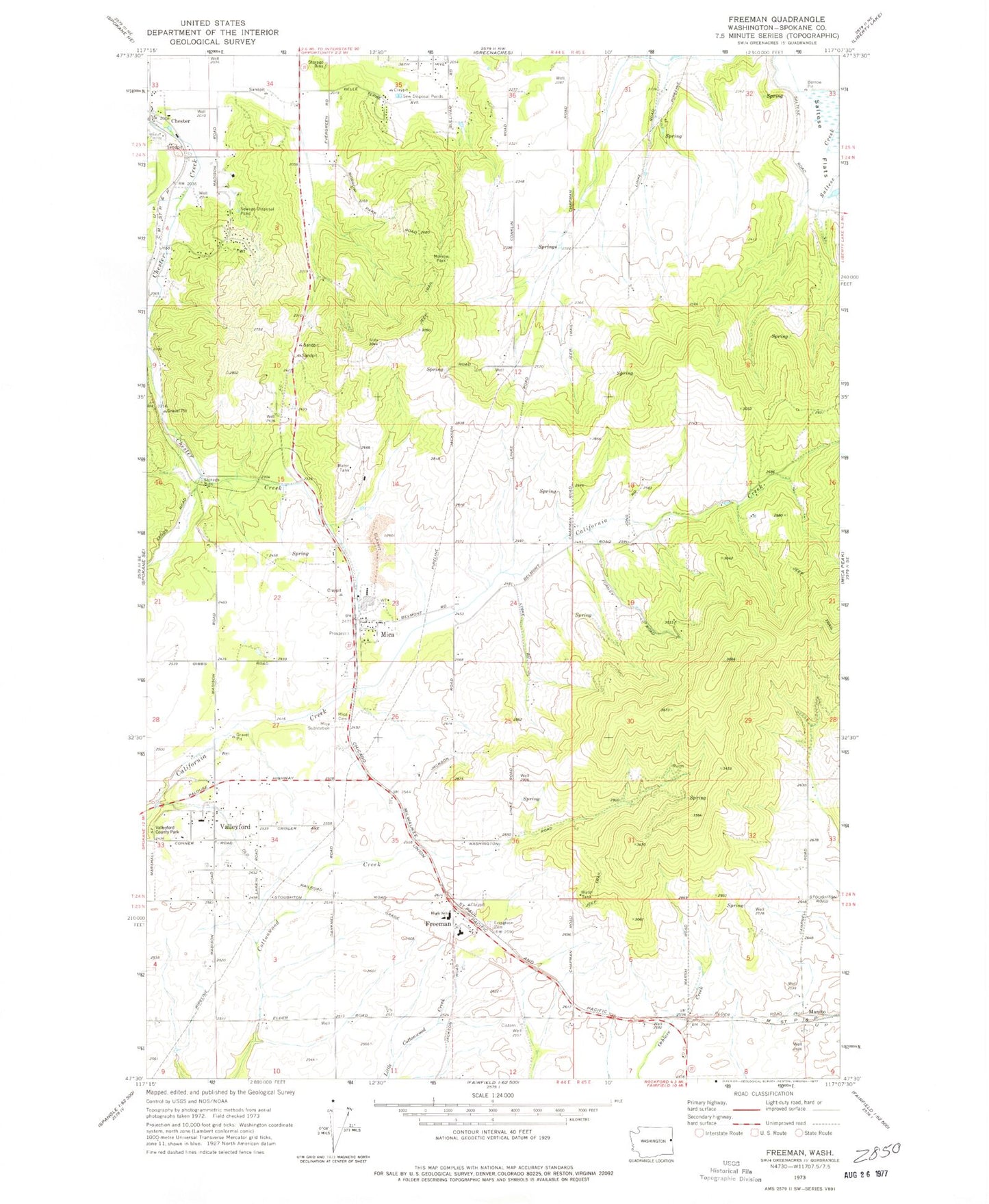
Historical USGS topographic quad map of Freeman in the state of Washington. Map scale may vary for some years, but is generally around 1:24,000. Print size is approximately 24" x 27"
This quadrangle is in the following counties: Spokane.
The map contains contour lines, roads, rivers, towns, and lakes. Printed on high-quality waterproof paper with UV fade-resistant inks, and shipped rolled.
Contains the following named places: Chester Elementary School, Deruwe Dam, Evergreen Cemetery, Freeman, Freeman Elementary School, Freeman High School, Horizon Middle School, KSVY-AM (Opportunity), Lockwood, Manito, Mica, Mica Cemetery, Morrow Park, Sky Meadows Airpark, Spokane County Fire District 8 Station 82, Spokane County Fire District 8 Station 84, Valleyford, Valleyford Division, Vallyford Post Office, ZIP Code: 99023