MyTopo
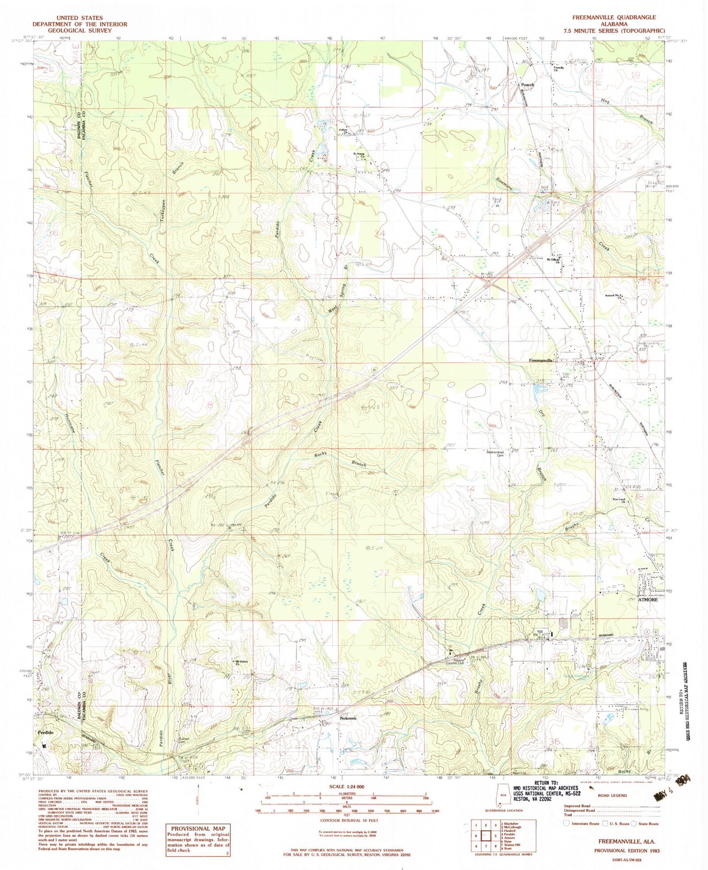
Classic USGS Freemanville Alabama 7.5'x7.5' Topo Map
Couldn't load pickup availability
Historical USGS topographic quad map of Freemanville in the state of Alabama. Map scale may vary for some years, but is generally around 1:24,000. Print size is approximately 24" x 27"
This quadrangle is in the following counties: Baldwin, Escambia.
The map contains contour lines, roads, rivers, towns, and lakes. Printed on high-quality waterproof paper with UV fade-resistant inks, and shipped rolled.
Contains the following named places: Antioch Number 2 Church, Atmore Country Club, Atmore Industrial Park, Atmore Wastewater Treatment Plant, Carney, Dry Branch, Ewing Farms, Fletcher Creek, Freemanville, Freemanville Church, Freemanville Church Cemetery, Freemanville Mennonite Church, Freemanville School, Friendly Church, Hurricane Creek, Judson Church, Judson Indian Cemetery, Kingdom Hall of Jehovahs Witnesses, Marshall Patterson Dam, Morning Dove Church, Mount Gillead Church, Mount Gillis, Mount Shiloh Church, Nokomis, Nokomis Baptist Church, Nokomis Church, Nokomis Church Cemetery, Nokomis Volunteer Fire Department, Oak Drive Church, Patterson Lake, Perdido Church, Perdido Creek, Perdido Hill School, Perdido Oil Field, Perdido School, Pine Level Church, Poarch, Poarch Community Church, Poarch Creek Indian Police Department, Poarch Creek Museum, Poarch Creek Reservation, Poarch Mission Cemetery, Poarch Mission Church, Poarch Volunteer Fire Department, Raley Forest Hill, Rocky Branch, Saint Annas Church, Saint Thomas African Methodist Episcopal Zion Methodist Church, Sturdy Oak Farm Airport, Sullivan Cemetery, Swift Westside Baptist Church, Turkeypen Branch, WASG-AM (Atmore), West End Church, West Spring Branch