
MyTopo
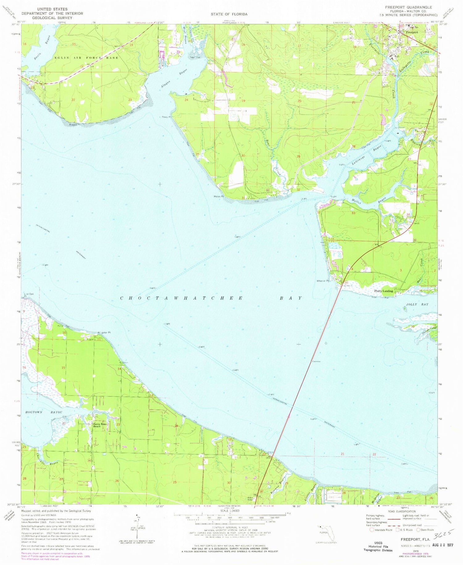
Classic USGS Freeport Florida 7.5'x7.5' Topo Map
Couldn't load pickup availability
Historical USGS topographic quad map of Freeport in the state of Florida. Map scale may vary for some years, but is generally around 1:24,000. Print size is approximately 24" x 27"
This quadrangle is in the following counties: Walton.
The map contains contour lines, roads, rivers, towns, and lakes. Printed on high-quality waterproof paper with UV fade-resistant inks, and shipped rolled.
Contains the following named places: Alaqua Bayou, Alaqua Creek, Alaqua Point, Alligator Point, Basin Bayou, Basin Bayou State Recreation Area, Bay View, Bear Creek, Bowman Bayou, Choctaw Bay Estates, Churchill Bayou, Fluffy Landing, Fourmile Creek, Freeport, Freeport Fire Department, Freeport Plaza, Goodwin Creek, Jolly Bay, La Grange Point, Lafayette Creek, LaGrange Bayou, Lion Park, Littles Bayou, Live Oak Point, Mallet Bayou, McQuage Bayou, Motes Point, Nancys Cutoff, Piney Point, Ramsey Branch, Santa Rosa Beach, South Walton Fire District Headquarters, Walton County Fire Rescue Station 12, Walton County Sheriff's Office Freeport Substation, West Bayou, Wheeler Point


