MyTopo
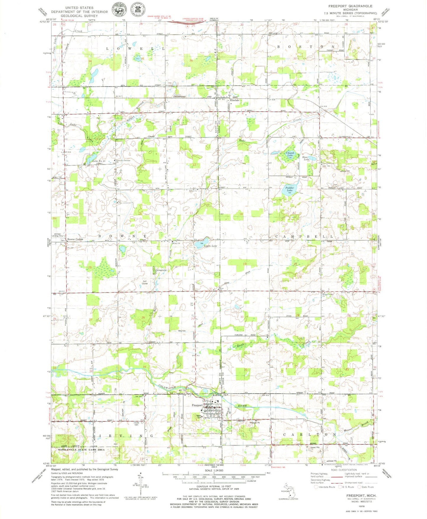
Classic USGS Freeport Michigan 7.5'x7.5' Topo Map
Couldn't load pickup availability
Historical USGS topographic quad map of Freeport in the state of Michigan. Map scale may vary for some years, but is generally around 1:24,000. Print size is approximately 24" x 27"
This quadrangle is in the following counties: Barry, Ionia, Kent.
The map contains contour lines, roads, rivers, towns, and lakes. Printed on high-quality waterproof paper with UV fade-resistant inks, and shipped rolled.
Contains the following named places: Apostolic Christian Church, Bear Creek, Bear Swamp Drain, Bond Drain, Bowne Center, Bowne Center Cemetery, Bowne Center United Methodist Church, Bowne Church, Bowne Post Office, Calvary Church, Church Lake, Duck Creek, Elmdale, Elmdale Church of the Nazarene, Elmdale Post Office, Elmdale Station, Fillmore Post Office, Freeport, Freeport Area Volunteer Fire Department, Freeport Cemetery, Freeport District Library, Freeport Police Department, Freeport Post Office, Freeport United Brethren Church, Freeport United Methodist Church, Freeport Village Hall, Geiger Drain, German Cemetery, Hess Lake, Hope Church, Johnson Airport, Kilgus Branch, Lake Number Ten, Lake School, Logan Lake, Logan Post Office, Lowell Fire Department, Mennonite Cemetery, Messer Brook, Middleville State Game Area, Peddler Lake, Peddler Lake Drain, Pleasant Valley Church, Smelker Drain, Stecklee Drain, Township of Bowne, Township of Campbell, Tyler Creek Golf Club, Village of Freeport, Walton Drain, West Campbell Post Office, ZIP Codes: 48815, 49325