MyTopo
Classic USGS Frees Corners Mississippi 7.5'x7.5' Topo Map
Couldn't load pickup availability
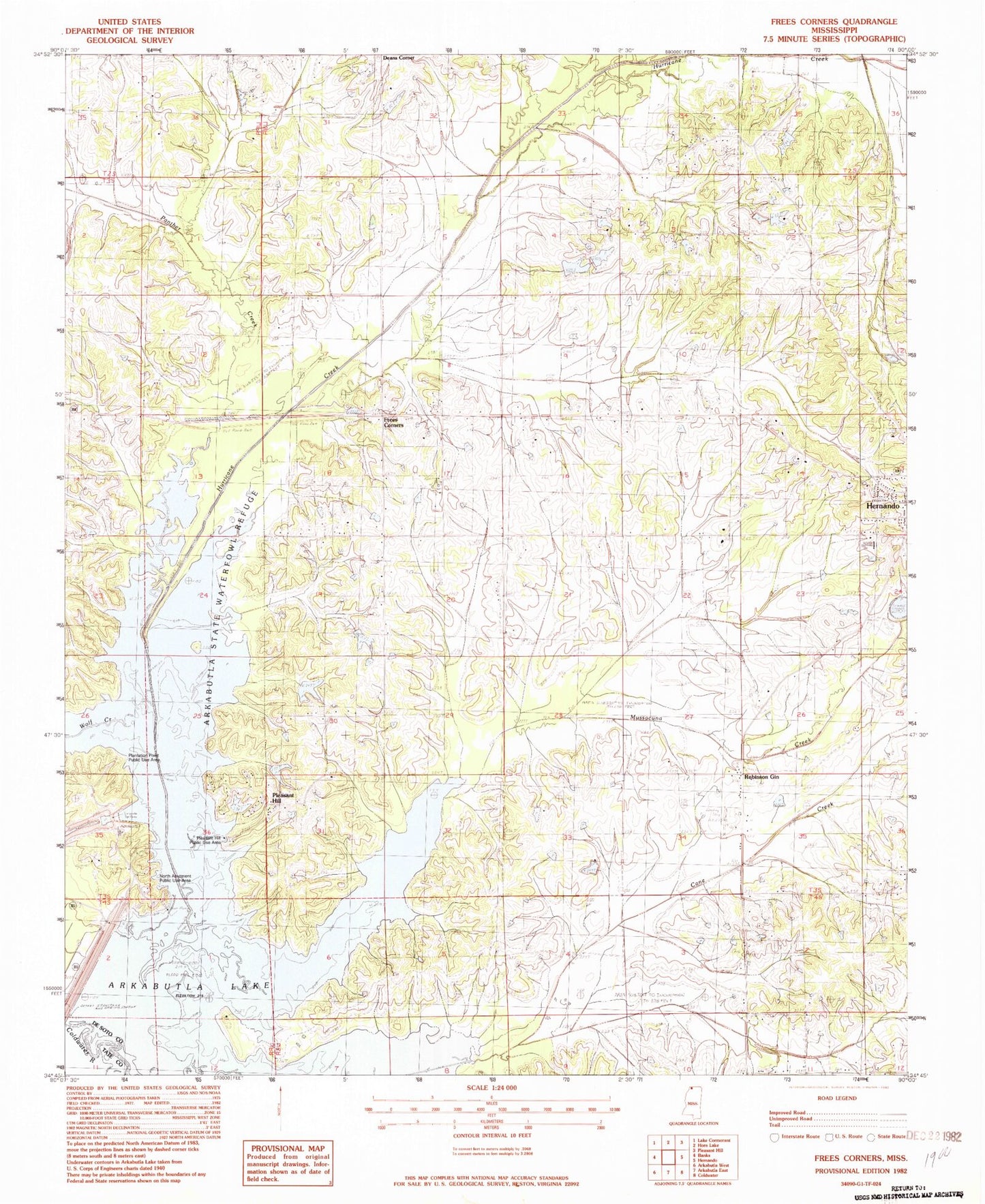
Historical USGS topographic quad map of Frees Corners in the state of Mississippi. Typical map scale is 1:24,000, but may vary for certain years, if available. Print size: 24" x 27"
This quadrangle is in the following counties: DeSoto, Tate.
The map contains contour lines, roads, rivers, towns, and lakes. Printed on high-quality waterproof paper with UV fade-resistant inks, and shipped rolled.
Contains the following named places: Cane Creek, Frees Corners, Hurricane Creek, Mussacuna Creek, Oak Grove Church, Oliver Chapel, Pleasant Hill Church, Robinson Gin, Saint Marys Church, Sunrise School, Wolf Creek, Zion Hill Church, Arkabutla Dam, J F Conger Pond Dam, Tom Clifton Pond Dam, J A Whitten Lake Dam, Hernando Sewage Lagoon Dam, Bill Wallace Lake Dam, R E Selph Pond Dam, R E Selph Pond Dam, Banks Land and Cattle Company Pond Dam, M J Simmons Pond Dam, N B Gray Pond Dam, Arkabutla State Waterfowl Refuge, Oak Grove Central Elementary School, McKays (historical), North Abutment Public Use Area, Panther Creek, Plantation Point Public Use Area, Pleasant Hill, Pleasant Hill Public Use Area, Saint Marys School (historical), Spring Hill Cemetery, Sunrise Church, Zion Hill School (historical), Zion Number 2 Church, Supervisor District 4, Hernando Village Airpark Inc