MyTopo
Classic USGS Fremont Island Utah 7.5'x7.5' Topo Map
Couldn't load pickup availability
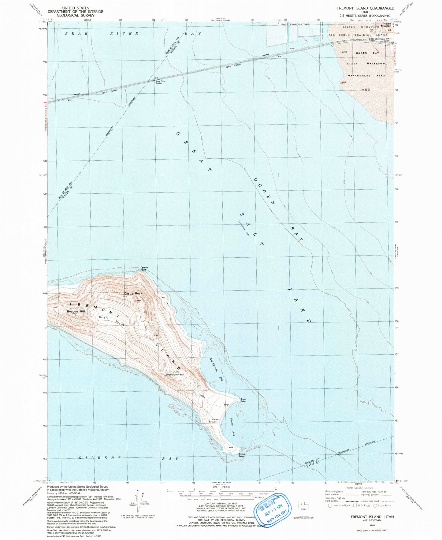
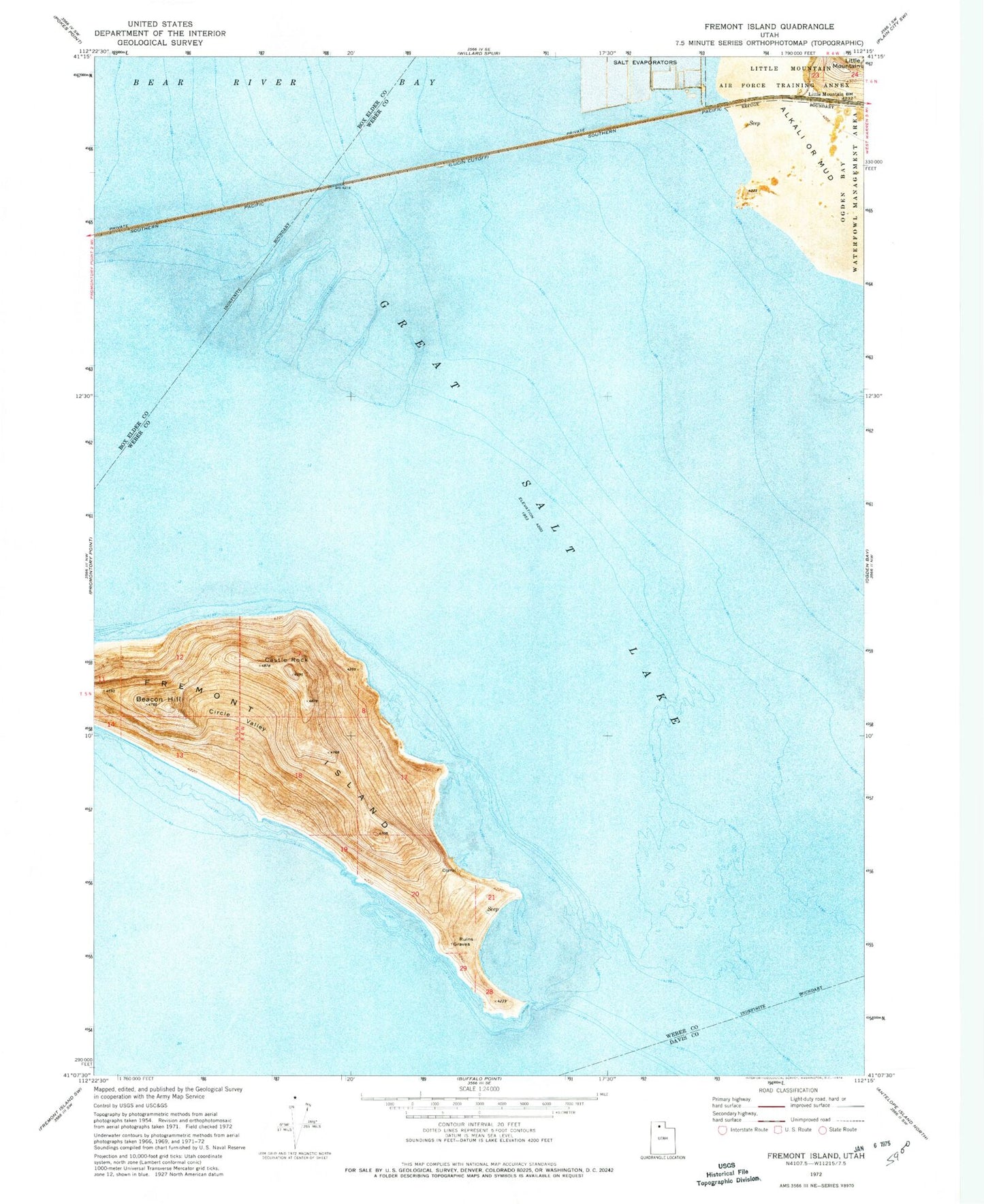
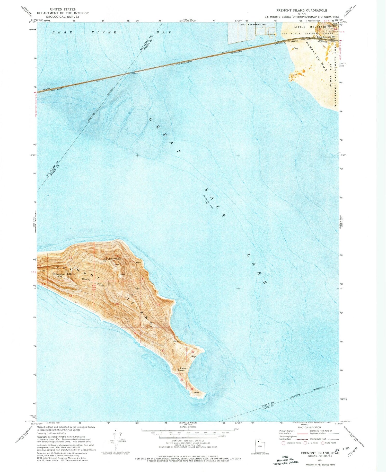
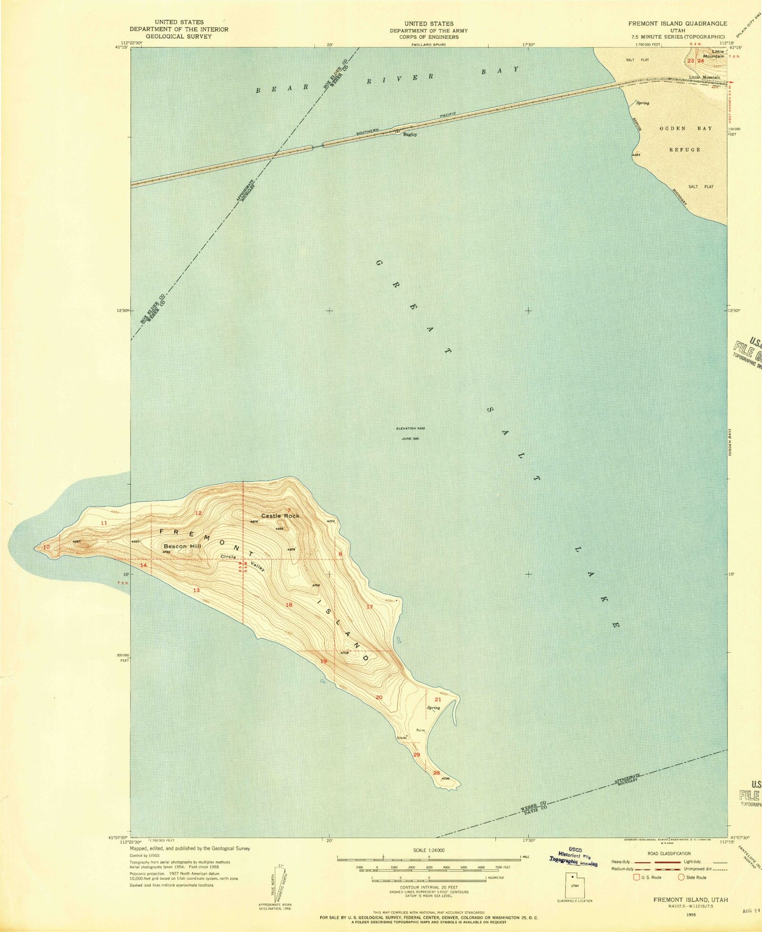
Historical USGS topographic quad map of Fremont Island in the state of Utah. Map scale may vary for some years, but is generally around 1:24,000. Print size is approximately 24" x 27"
This quadrangle is in the following counties: Box Elder, Davis, Weber.
The map contains contour lines, roads, rivers, towns, and lakes. Printed on high-quality waterproof paper with UV fade-resistant inks, and shipped rolled.
Contains the following named places: Argo Point, Beacon Hill, Bear River Bridge, Carson Point, Castle Rock, Circle Valley, City of Hooper, David E Miller Hill, Fremont Bight, Fremont Island, Fremont Island Bar, Jones Beach, Kates Point, Kit Carson Bay, Little Mountain, North Fork Weber River, Ogden Bay, Wenner Bay