MyTopo
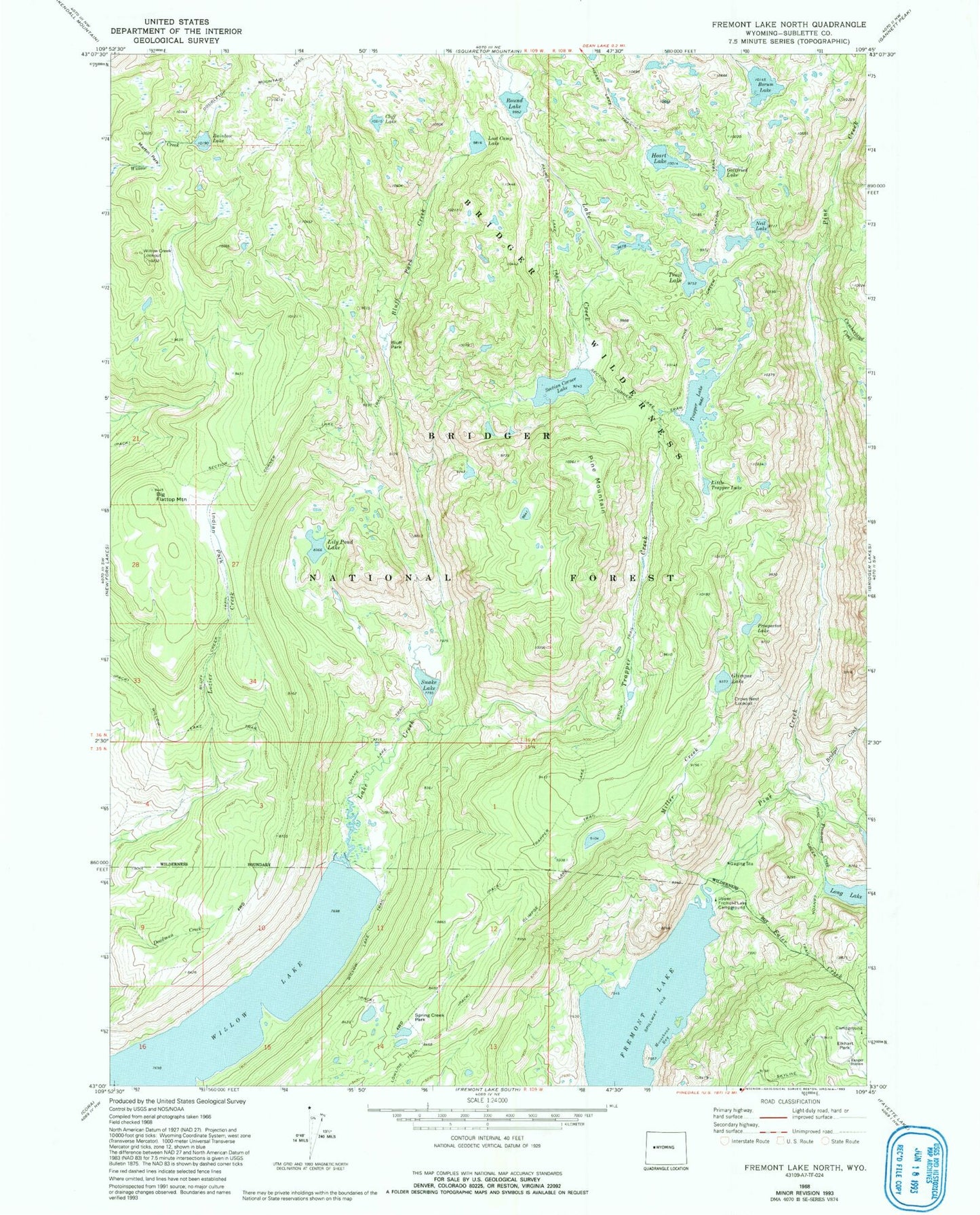
USGS Classic Fremont Lake North Wyoming 7.5'x7.5' Topo Map
Couldn't load pickup availability
Historical USGS topographic quad map of Fremont Lake North in the state of Wyoming. Scale: 1:24000. Print size: 24" x 27"
This quadrangle is in the following counties: Sublette.
The map contains contour lines, roads, rivers, towns, lakes, and grids including latitude / longitude and UTM / MGRS. Printed on high-quality waterproof paper with UV fade-resistant inks.
Contains the following named places: Big Flattop Mountain, Bluff Creek Trail, Bluff Park, Bluff Park Creek, Borum Lake, Bridger Creek, Cliff Lake, Crows Nest Lookout, Cumberland Creek, Elkhart Park, Faler Creek, Fremont Creek, Glimpse Lake, Glimpse Lake Trail, Gottfried Lake, Heart Lake, Indian Park, Lily Pond Lake, Little Trapper Lake, Lost Camp Lake, Martin Park, Miller Creek, Moosehead Bay, Neil Lake, Pine Creek Canyon Trail, Pine Mountain, Prospector Lake, Rainbow Lake, Round Lake, Section Corner Lake, Section Corner Lake Trail, Snake Lake, Snake Lake Trail, Spring Creek Park, Trail Lake, Trapper Creek, Trapper Lake, Trapper Lake Stock Trail, Upper Fremont Lake Campground, Willow Creek Lookout, Willow Lake, Willow Lake Trail, Long Lake Trail, Crows Nest Lookout, Trails End Campground, Big Rock Park