MyTopo
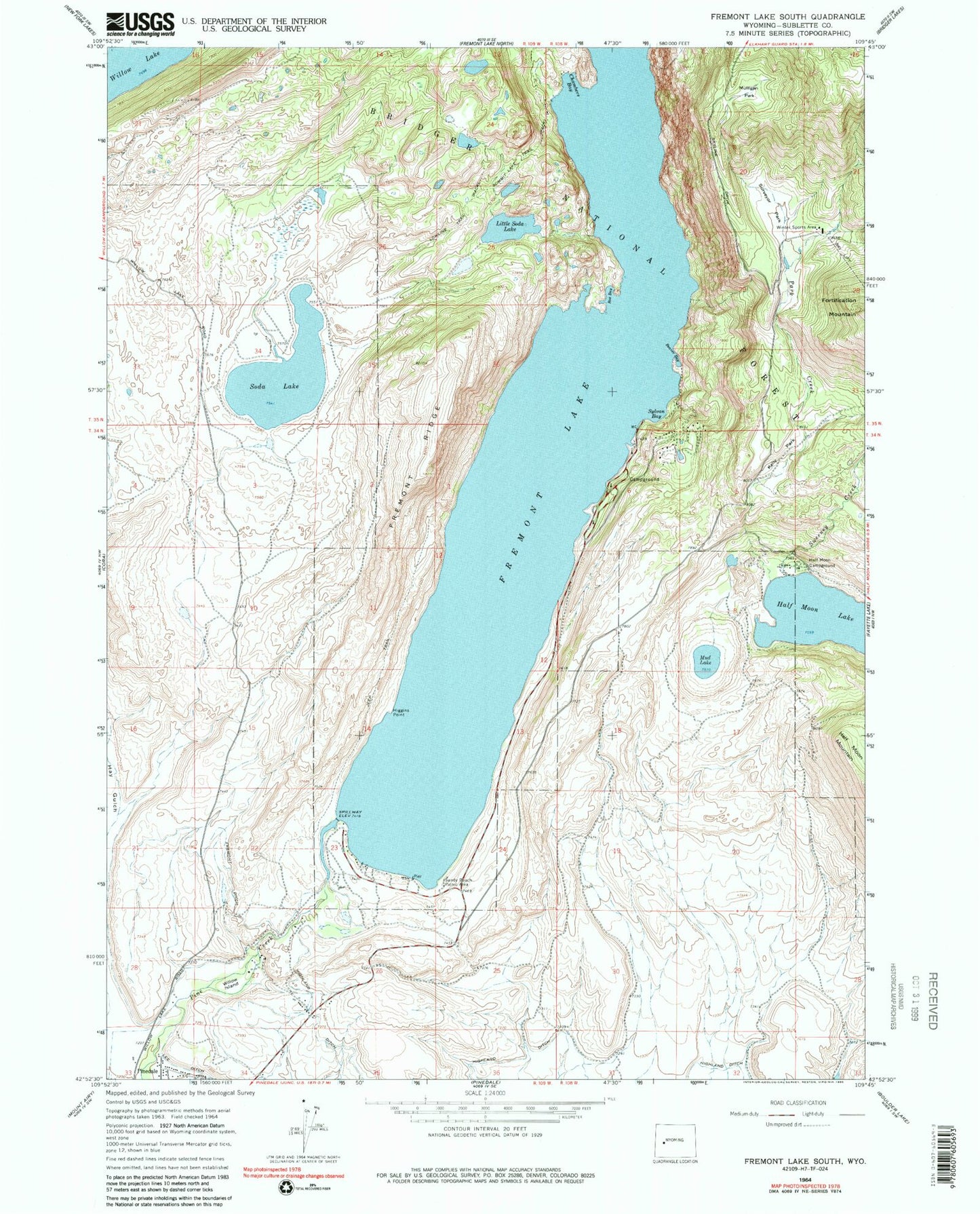
Classic USGS Fremont Lake South Wyoming 7.5'x7.5' Topo Map
Couldn't load pickup availability
Historical USGS topographic quad map of Fremont Lake South in the state of Wyoming. Map scale may vary for some years, but is generally around 1:24,000. Print size is approximately 24" x 27"
This quadrangle is in the following counties: Sublette.
The map contains contour lines, roads, rivers, towns, and lakes. Printed on high-quality waterproof paper with UV fade-resistant inks, and shipped rolled.
Contains the following named places: Beaver Bay, Box Bay, Chambers Bay, Fremont Ditch, Fremont Lake, Fremont Lake Campground, Fremont Ridge, Fremont Ridge Mine, Half Moon Campground, Higgins Point, Highland Ditch, Kelly Park, Lakeside Lodge, Little Soda Lake, Lower Fremont Boat Ramp, Mud Lake, Mulligan Park, Park Loop Ski Trail, Sandy Beach Picnic Area, Soda Lake, Spring Creek, Summit Lake Trail, Surveyor Creek, Surveyor Park, Sweeney Creek, Sylvan Bay, Sylvan Bay Summer Home Area, White Pine Lodge Ski Area, Willow Island