MyTopo
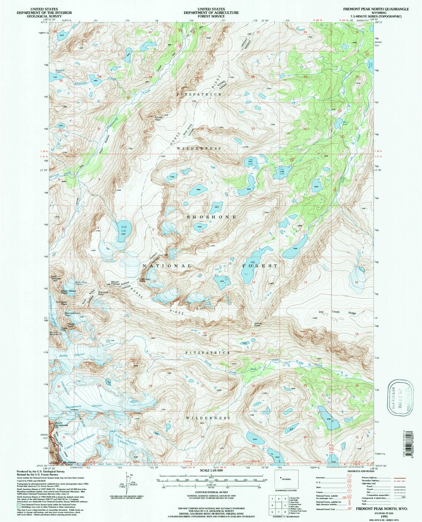
USGS Classic Fremont Peak North Wyoming 7.5'x7.5' Topo Map
Couldn't load pickup availability
Historical USGS topographic quad map of Fremont Peak North in the state of Wyoming. Scale: 1:24000. Print size: 24" x 27"
This quadrangle is in the following counties: Fremont, Sublette.
The map contains contour lines, roads, rivers, towns, lakes, and grids including latitude / longitude and UTM / MGRS. Printed on high-quality waterproof paper with UV fade-resistant inks.
Contains the following named places: Backpackers Pass, Blaurock Pass, Chimney Rock, Cub Lake, Don Lake, Dry Creek Ridge, East Sentinel, Elsie Col, Mount Febbas, Fourts Horn, Gannett Creek, Heap Steep Glacier, Heap Steep Peak, Helen Glacier, Horse Ridge, Indian Pass, Klondike Creek, Noel Lake, Lower Fremont Glacier, Moose Lake, Native Lake, Sacagawea Glacier, Mount Sacagawea, Sunbeam Peak, Turret Peak, Upper Fremont Glacier, Wilson Meadows, Fremont Glaciers