MyTopo
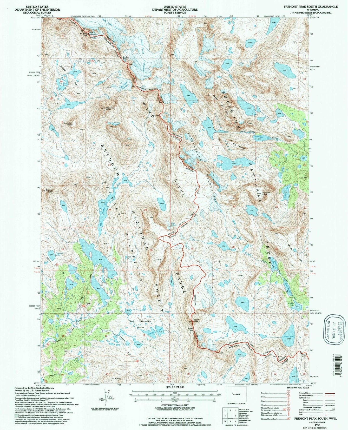
USGS Classic Fremont Peak South Wyoming 7.5'x7.5' Topo Map
Couldn't load pickup availability
Historical USGS topographic quad map of Fremont Peak South in the state of Wyoming. Scale: 1:24000. Print size: 24" x 27"
This quadrangle is in the following counties: Fremont, Sublette.
The map contains contour lines, roads, rivers, towns, lakes, and grids including latitude / longitude and UTM / MGRS. Printed on high-quality waterproof paper with UV fade-resistant inks.
Contains the following named places: Alpine Lakes, Angel Pass, Angel Peak, Bald Mountain Basin, Brown Cliffs, Bull Lake Glacier, Camp Lake, Cook Lakes, Dennis Lake, Douglas Peak, Elephant Head, Fremont Peak, Golden Lake, Hay Pass, Indian Basin, Indian Pass, Jackson Peak, Knife Point Glacier, Knife Point Mountain, Mount Lester, Lake Louise, Mount Quintet, Snowbridge Lake, Spider Lake, The Fortress, Tiny Glacier, Tommy Lake, Upper Golden Lake, Wall Lake, Cook Lake Trail, Harrower Glacier, Harrower Peak