MyTopo
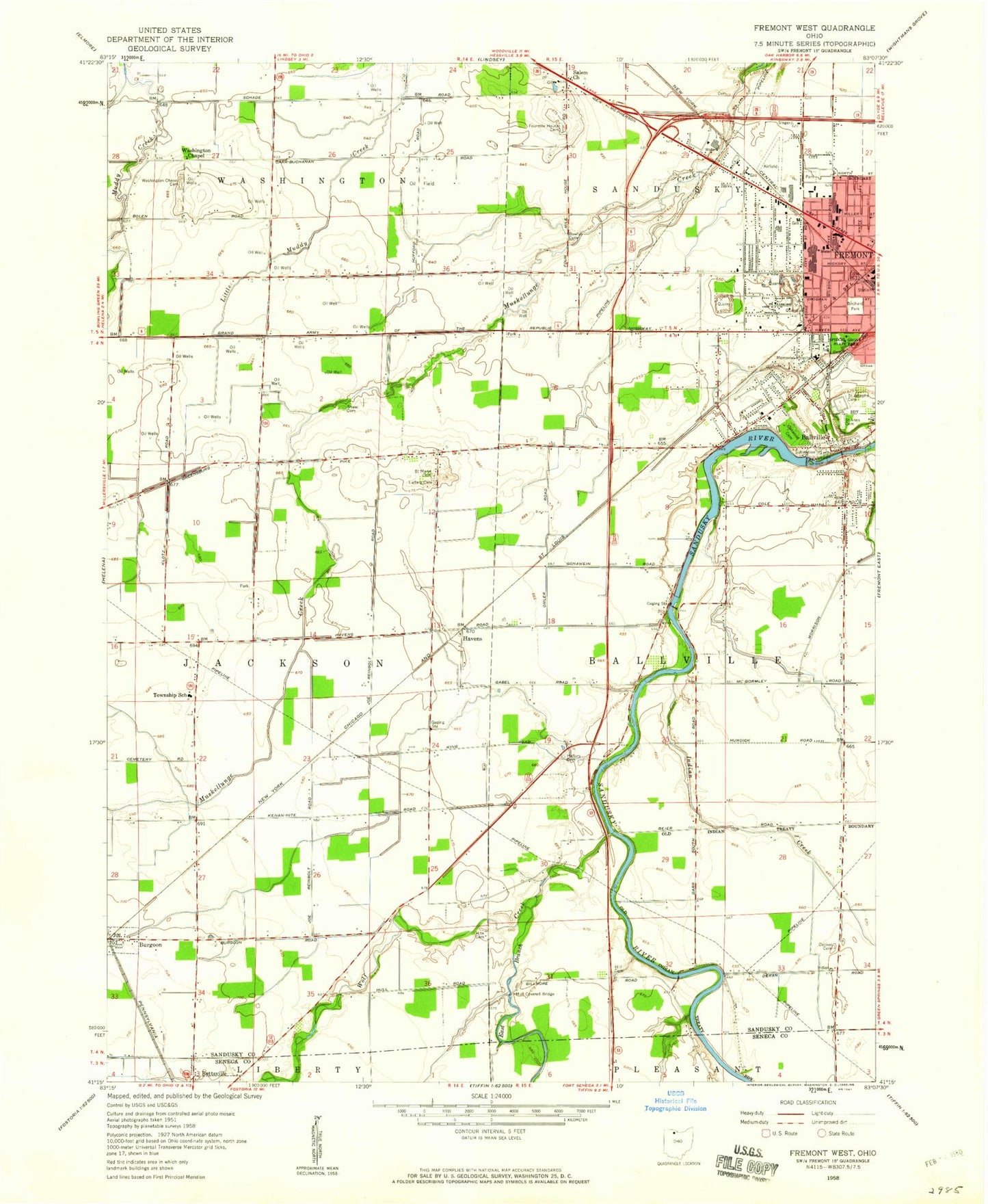
Classic USGS Fremont West Ohio 7.5'x7.5' Topo Map
Couldn't load pickup availability
Historical USGS topographic quad map of Fremont West in the state of Ohio. Map scale may vary for some years, but is generally around 1:24,000. Print size is approximately 24" x 27"
This quadrangle is in the following counties: Sandusky, Seneca.
The map contains contour lines, roads, rivers, towns, and lakes. Printed on high-quality waterproof paper with UV fade-resistant inks, and shipped rolled.
Contains the following named places: Anderson Field, Ballville, Ballville Census Designated Place, Ballville Township House, Ballville Township Volunteer Fire Department, Birchard Park, Bowlus Cemetery, Burgoon Post Office, Church of Christ Apostolic Faith, Church of the Nazarene, Decker Cemetery, East Branch Wolf Creek, Faith Church, First Baptist Church of Fremont, Fourmile House Cemetery, Fourmile House Corner, Fremont Airport, Fremont Baptist Church, Fremont Fire Department Central Station, Gabels Corner, Gillmor Airport, Gilmore Bridge, Golden Gate Estates, Grace Brethren Chapel, Halters Cemetery, Havens, Havens Post Office, Hayes Cemetery, Highland Jersey Farms, Hill Cemetery, Hite Cemetery, Indian Creek, Lakota East Elementary School, Ludwig Cemetery, Lutz Elementary School, Memorial Hospital Heliport, Memorial United Methodist Church, Mill Mobile Home Park, Mount Pleasant Baptist Church, Mull Covered Bridge, Oakwood Cemetery, Ohio State Highway Patrol - Fremont Patrol Post, Otis Elementary School, Our Lady of the Pines School, Portage Trail Park, Potter Village Shopping Center, ProMedica Memorial Hospital, Ruhl Ridge, Rutherford B Hayes Presidential Center Library, Saint Anns Cemetery, Saint Casimir Catholic Church, Saint Casimir School, Saint Josephs Cemetery, Saint Marys Cemetery, Sandusky County, Sandusky Scenic River State Access Area, Shawl Cemetery, Spiegel Grove State Park, Stony Prairie, Stony Prairie Census Designated Place, Sycamore Hills Golf Course, Terra Community College, Township of Ballville, Township of Jackson, Vanguard Vocational and Technical Center, Washington Chapel, Washington Chapel Cemetery, Winters Ditch, Winters Station, Wolf Creek, Wolf Creek Park, Word of Faith Fellowship Church, Young's Colonial Acres, ZIP Code: 43407