MyTopo
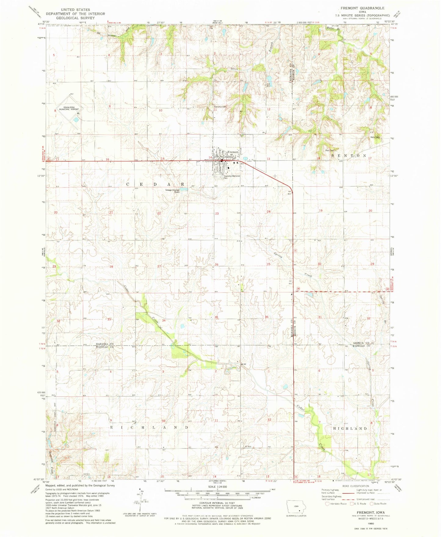
Classic USGS Fremont Iowa 7.5'x7.5' Topo Map
Couldn't load pickup availability
Historical USGS topographic quad map of Fremont in the state of Iowa. Map scale may vary for some years, but is generally around 1:24,000. Print size is approximately 24" x 27"
This quadrangle is in the following counties: Keokuk, Mahaska, Wapello.
The map contains contour lines, roads, rivers, towns, and lakes. Printed on high-quality waterproof paper with UV fade-resistant inks, and shipped rolled.
Contains the following named places: Baptist Church, Cedar Township Cemetery, Cedar Township Memorial Cemetery, Church of the Nazarene, City of Fremont, DeVol Area, Ford Cemetery, Fremont, Fremont City Hall, Fremont Elementary School, Fremont Elevator, Fremont Fire Department, Fremont Middle School, Fremont Post Office, Fremont United Methodist Church, Helm Cemetery, Oskaloosa Municipal Airport, Spring Branch, Thompson Grave, Township of Cedar, Twin Pine Mobile Home Park, ZIP Code: 52561