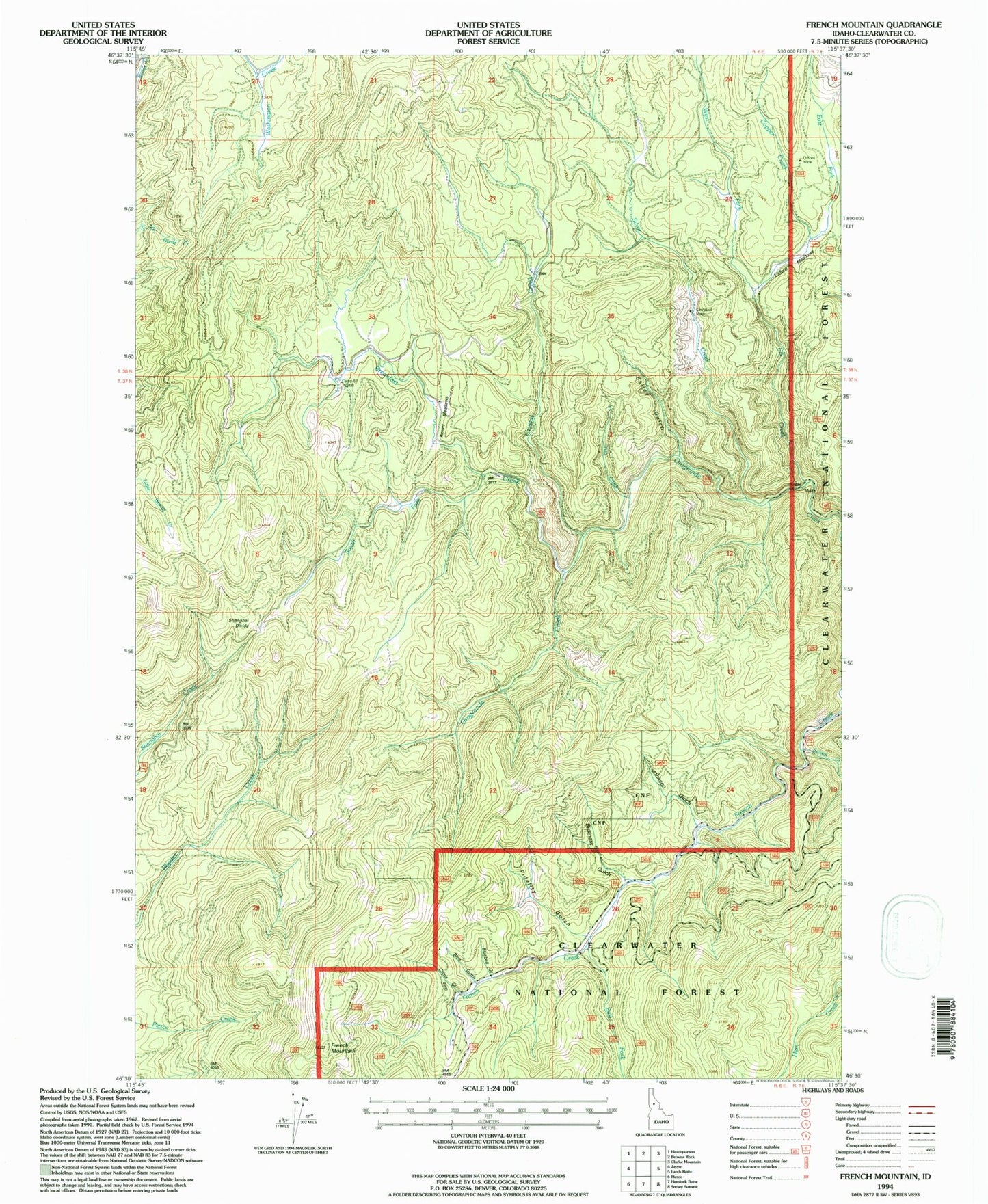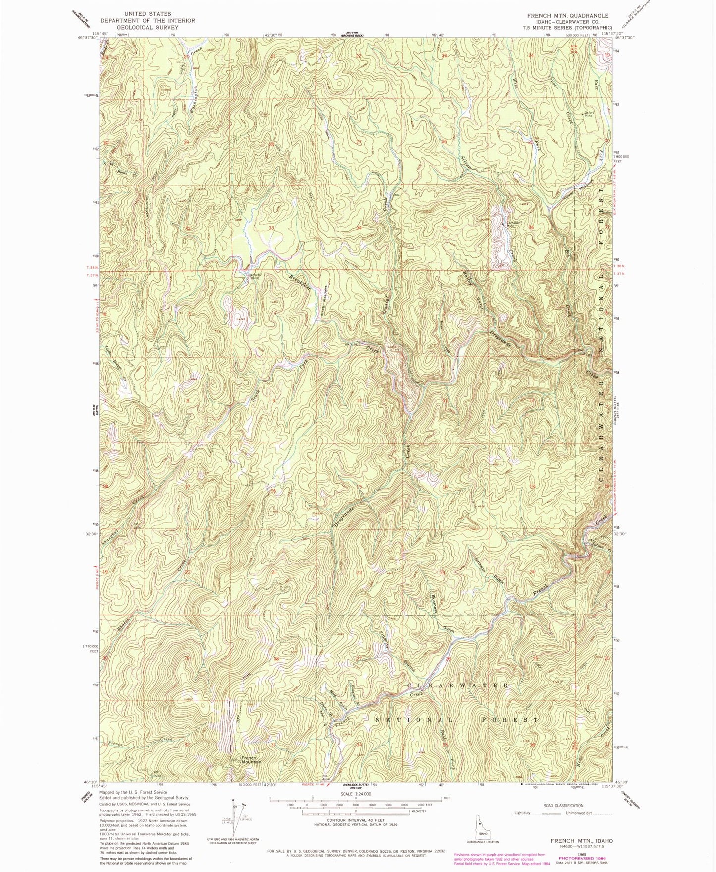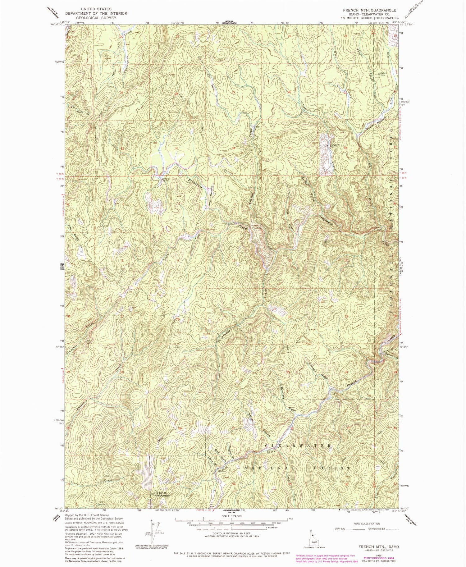
MyTopo
Classic USGS French Mountain Idaho 7.5'x7.5' Topo Map
Couldn't load pickup availability
Historical USGS topographic quad map of French Mountain in the state of Idaho. Map scale may vary for some years, but is generally around 1:24,000. Print size is approximately 24" x 27"
This quadrangle is in the following counties: Clearwater.
The map contains contour lines, roads, rivers, towns, and lakes. Printed on high-quality waterproof paper with UV fade-resistant inks, and shipped rolled.
Contains the following named places: Arnett Meadows, Bailey Gulch, Blue Gulch, Bluebell Gulch, Breakfast Creek, Business Gulch, Camp Fifty-Seven, Campbell Mine, Chas Parker, China Gulch, Copper Creek, Crystal Creek, East Fork Elk Creek, East Fork French Creek, Elk Creek, Fidelity Gulch, Fred Forsman, French Mountain, Irish Creek, Johnson Gulch, Nellie Langam, Oxford Meadows, Oxford Mine, P. T. Langam, Silver Creek, South Fork Breakfast Creek, Sylvan Creek, West Fork Elk Creek