MyTopo
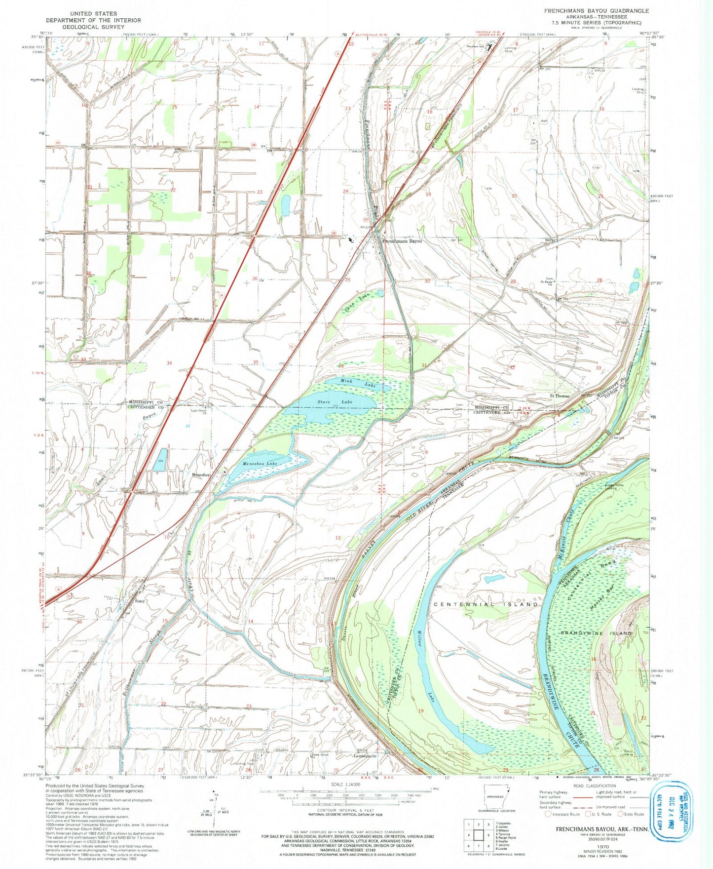
Classic USGS Frenchmans Bayou Arkansas 7.5'x7.5' Topo Map
Couldn't load pickup availability
Historical USGS topographic quad map of Frenchmans Bayou in the states of Arkansas, Tennessee. Map scale may vary for some years, but is generally around 1:24,000. Print size is approximately 24" x 27"
This quadrangle is in the following counties: Crittenden, Mississippi, Tipton.
The map contains contour lines, roads, rivers, towns, and lakes. Printed on high-quality waterproof paper with UV fade-resistant inks, and shipped rolled.
Contains the following named places: Barney Chute, Bellhammer Slough, Brandywine Chute, Brandywine Point, Centennial Bend, Centennial Island, Chapman Switch, Chute 38, Devils Elbow, Ditch Number 1, Ditch Number 11, Ditch Number 14, Ditch Number 15, Ditch Number 2, Ditch Number 3, Ditch Number 4, Frenchmans Bayou, Frenchmans Bayou Post Office, Happy Valley Landing, Happy Valley Revetment, KPYR-FM (Osceola), Lake Grove Church, Lambethville, Massey Bar, McKenzie Chute, Meneshea, Meneshea Lake, Meneshea School, Mink Lake, Mount Zion Church, Peach Bayou, Rasts Landing, Rupe Cemetery, Saint Francis Levee, Saint Pauls Church, Saint Thomas, Saint Thomas Church, Sam Barr Lake, Shawnee Elementary School, Sims, Stacy, Stave Lake, Swan Lake, Township of Fogleman, Township of McGavock, Township of Old River, Turrell Flying Service Airport, Union Grove Church, Willow Lake, ZIP Codes: 72338, 72350, 72384