
MyTopo
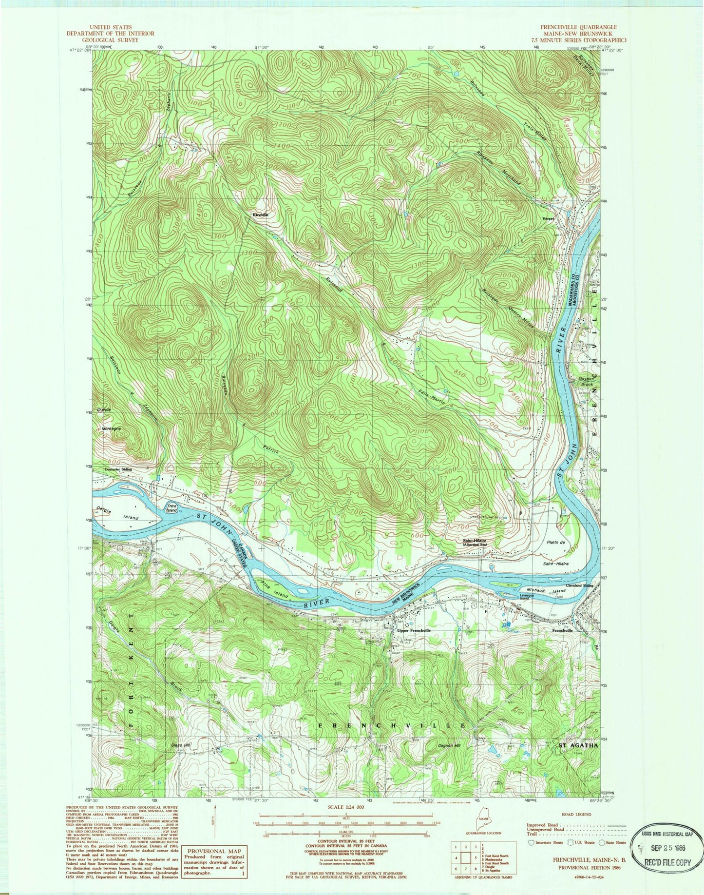
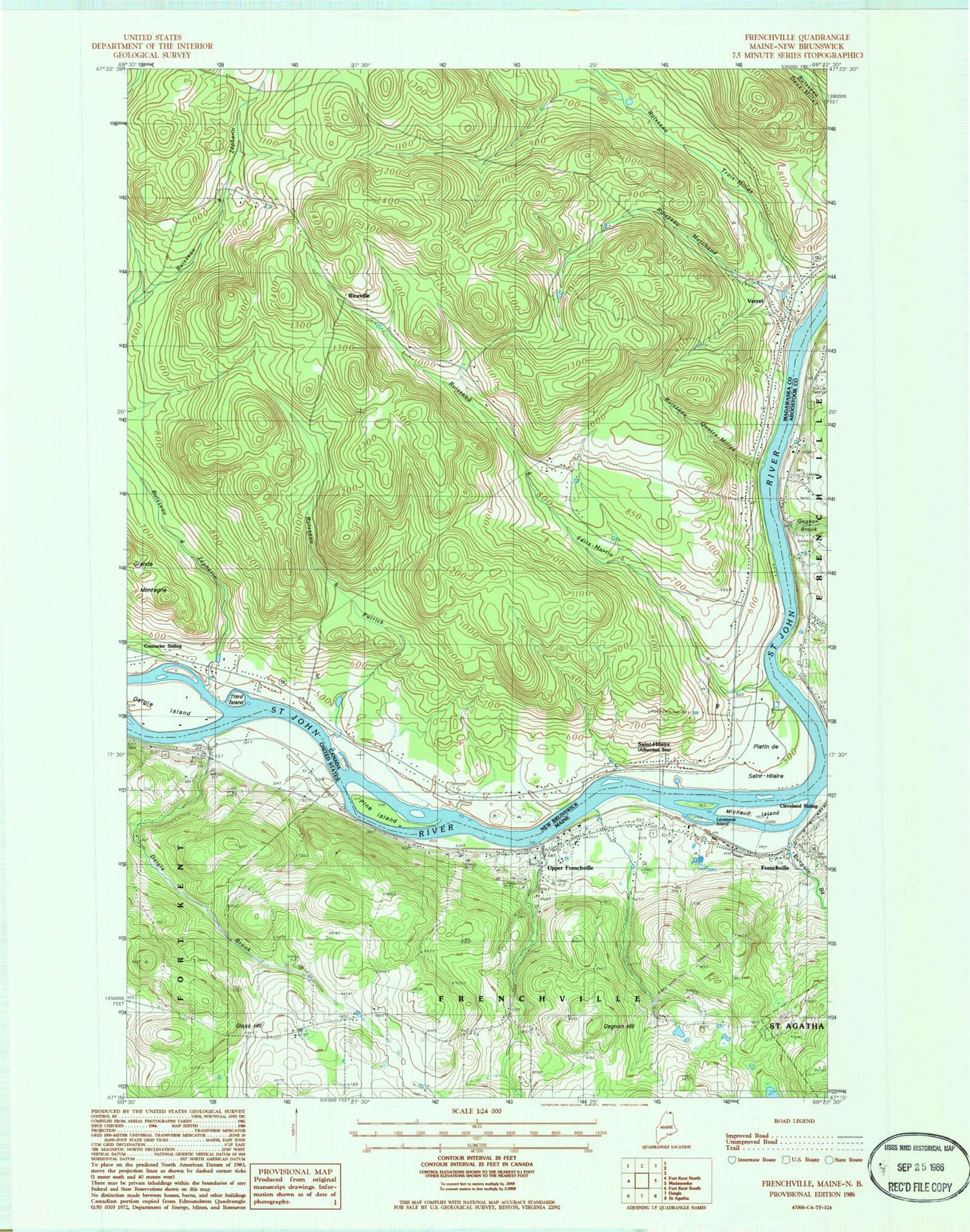
Classic USGS Frenchville Maine 7.5'x7.5' Topo Map
Couldn't load pickup availability
Historical USGS topographic quad map of Frenchville in the state of Maine. Map scale may vary for some years, but is generally around 1:24,000. Print size is approximately 24" x 27"
This quadrangle is in the following counties: Aroostook.
The map contains contour lines, roads, rivers, towns, and lakes. Printed on high-quality waterproof paper with UV fade-resistant inks, and shipped rolled.
Contains the following named places: Burgoin Brook, Daigle Brook, Dickey Brook, Doctor Levesque Elementary School, Frenchville, Frenchville Fire Department, Frenchville Post Office, Frenchville Snowmobile Club, Gagnon Brook, Gagnon Hill, Gilman Siding, Glass Hill, Grant School, Green Water Tank Historical Museum and Caboose, Jefferson School, Levesque Island, Lincoln School, Michaud Island, Saint John Valley Technology Center School, Saint Luce Cemetery, Saint Luce Church, Saint Luce Station, Town of Frenchville, Upper Frenchville, Upper Frenchville Post Office, Valley Emergency Medical Services, Washington School, ZIP Code: 04745