
MyTopo
Classic USGS Friars Point NW Mississippi 7.5'x7.5' Topo Map
Couldn't load pickup availability
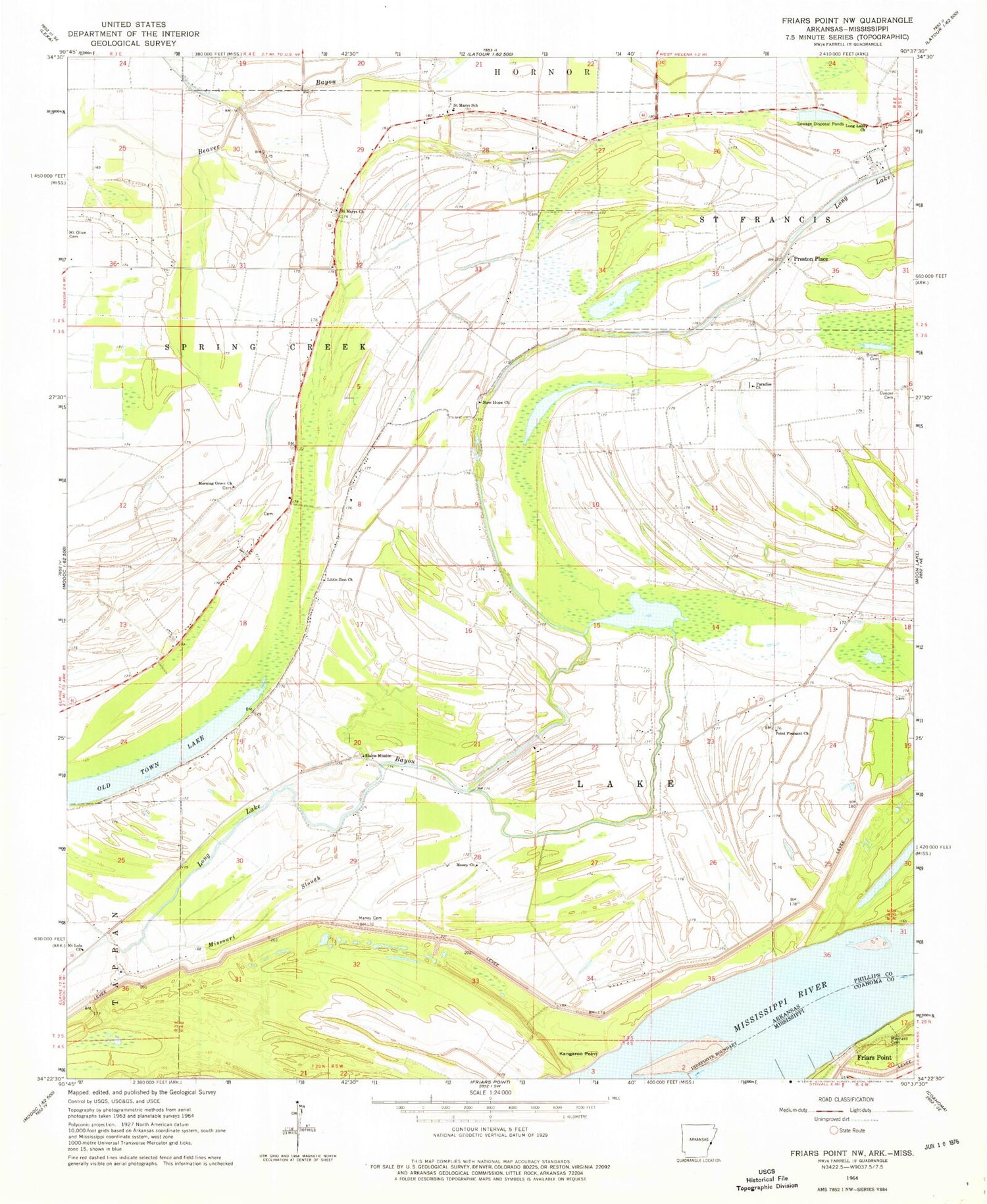
Historical USGS topographic quad map of Friars Point NW in the states of Mississippi, Arkansas. Map scale may vary for some years, but is generally around 1:24,000. Print size is approximately 24" x 27"
This quadrangle is in the following counties: Coahoma, Phillips.
The map contains contour lines, roads, rivers, towns, and lakes. Printed on high-quality waterproof paper with UV fade-resistant inks, and shipped rolled.
Contains the following named places: Beaver Bayou Ditch, Bee Tree Church, Brown Cemetery, Brown Chapel, Cooper Cemetery, District 44 School, Elaine Mission, Fitzhugh School, Kangaroo Point, Kangaroo Point Landing, Kangaroo Point Upper Bar, Little Zion Church, Little Zion School, Llewellyn Church, Llewellyn School, Long Lake, Long Lake Church, Long Lake School, Maney Cemetery, Maney Church, Maynard Cemetery, Missouri Slough, Morning Grove Cemetery, Morning Grove Church, Mount Lula Church, New Hope Church, Paradise Church, Paradise School, Point Pleasant Church, Preston Place, Saint Marys Cemetery, Saint Marys Church, Saint Marys School, Saint Stephens School, Township of Lake, Union School, United States National River Academy, Westover, Westover Bayou, Westover Landing, Westover Revetment, ZIP Code: 72342


