MyTopo
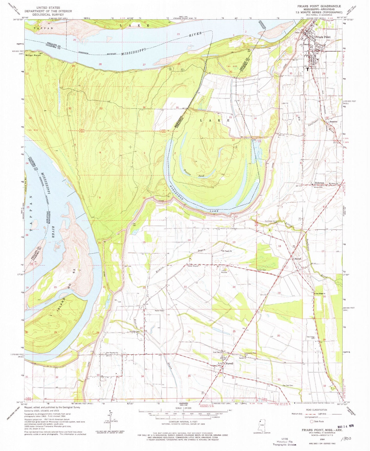
Classic USGS Friars Point Mississippi 7.5'x7.5' Topo Map
Couldn't load pickup availability
Historical USGS topographic quad map of Friars Point in the states of Mississippi, Arkansas. Map scale may vary for some years, but is generally around 1:24,000. Print size is approximately 24" x 27"
This quadrangle is in the following counties: Coahoma, Phillips.
The map contains contour lines, roads, rivers, towns, and lakes. Printed on high-quality waterproof paper with UV fade-resistant inks, and shipped rolled.
Contains the following named places: Bend of Island Number Sixty Three, Carson Cemetery, Coahoma County Volunteer Fire Department Friars Point, Dickerson, Dustin Pond, Elk Horn Plantation, Farrell, Farrell Census Designated Place, Farrell Church, Fitzhugh Landing, Friars Point, Friars Point Cemetery, Friars Point Elementary School, Friars Point Police Department, Friars Point Post Office, Horseshoe Bend, Horseshoe Cutoff, Horseshoe Lake, Horseshoe Revetment, Houston Landing, Humber, Humber Cemetery, Island Number 61, Island Number Sixty three Dikes, Island Number Sixtythree, John Gilbert Pond Dam, Kangaroo Point Dikes, Ledbetter Landing, Lone Oak Cemetery, Lone Oak Church, Lonesome Pine Cemetery, McCloud Landing, McCloud School, McLemore School, McWilliams Landing, Miller Point, Moten Cemetery, Mount Aaron Cemetery, Mount Aaron Church, Mount Aaron School, Mount Pisgah Church, Mud Lake, Oak Ridge Cemetery, Oak Ridge Church, Oak Ridge School, Pee Dee Cemetery, Pleasant Valley Cemetery, Pleasant Valley Church, Sessions, Stokely, Stovall, Supervisor District 2, Sycamore Grove Cemetery, Sycamore Grove Church, Town of Friars Point, West End School, Zion Traveler Cemetery, Zion Traveler Church, ZIP Code: 38630