
MyTopo
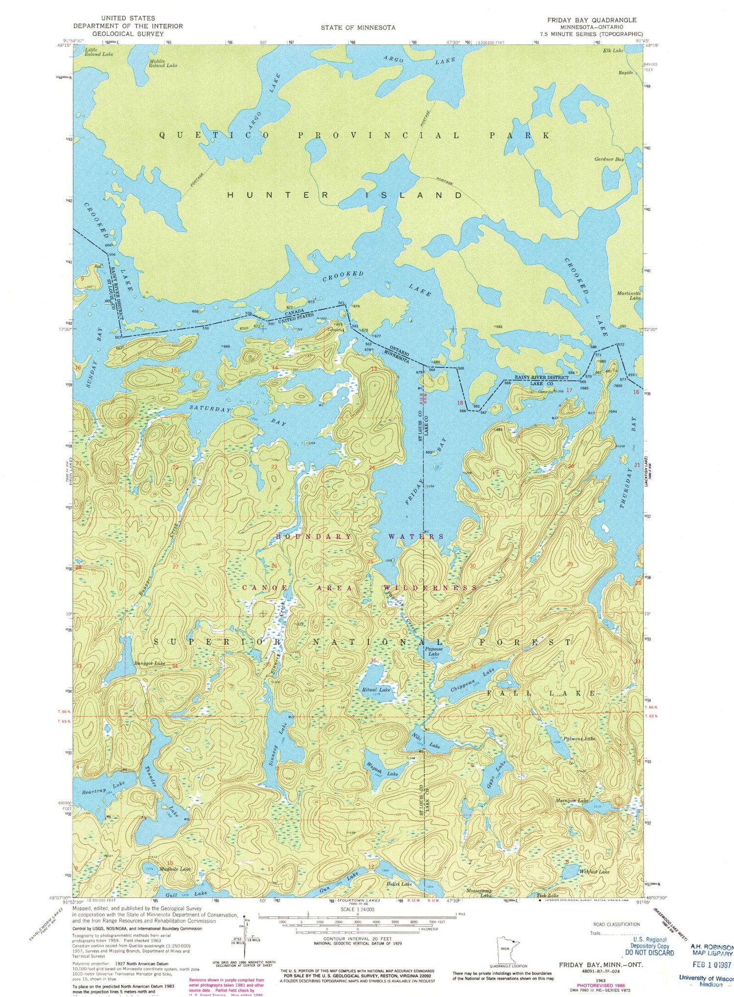
Classic USGS Friday Bay Minnesota 7.5'x7.5' Topo Map
Couldn't load pickup availability
Historical USGS topographic quad map of Friday Bay in the state of Minnesota. Typical map scale is 1:24,000, but may vary for certain years, if available. Print size: 24" x 27"
This quadrangle is in the following counties: Lake, St. Louis.
The map contains contour lines, roads, rivers, towns, and lakes. Printed on high-quality waterproof paper with UV fade-resistant inks, and shipped rolled.
Contains the following named places: Chippewa Lake, Gypo Lake, Maingan Lake, Pakwene Lake, Thursday Bay, Webfoot Lake, Beartrap Lake, Bullet Lake, Bunggee Creek, Bunggee Lake, Crooked Lake, Friday Bay, Home Creek, Mudhole Lake, Niki Lake, Papoose Creek, Papoose Lake, Ritual Lake, Saturday Bay, Sinneeg Creek, Sinneeg Lake, Sunday Bay, Thunder Lake, Wagosh Lake, Unorganized Territory of Sunday Lake (historical)


