MyTopo
Classic USGS Fridley Peak Montana 7.5'x7.5' Topo Map
Couldn't load pickup availability
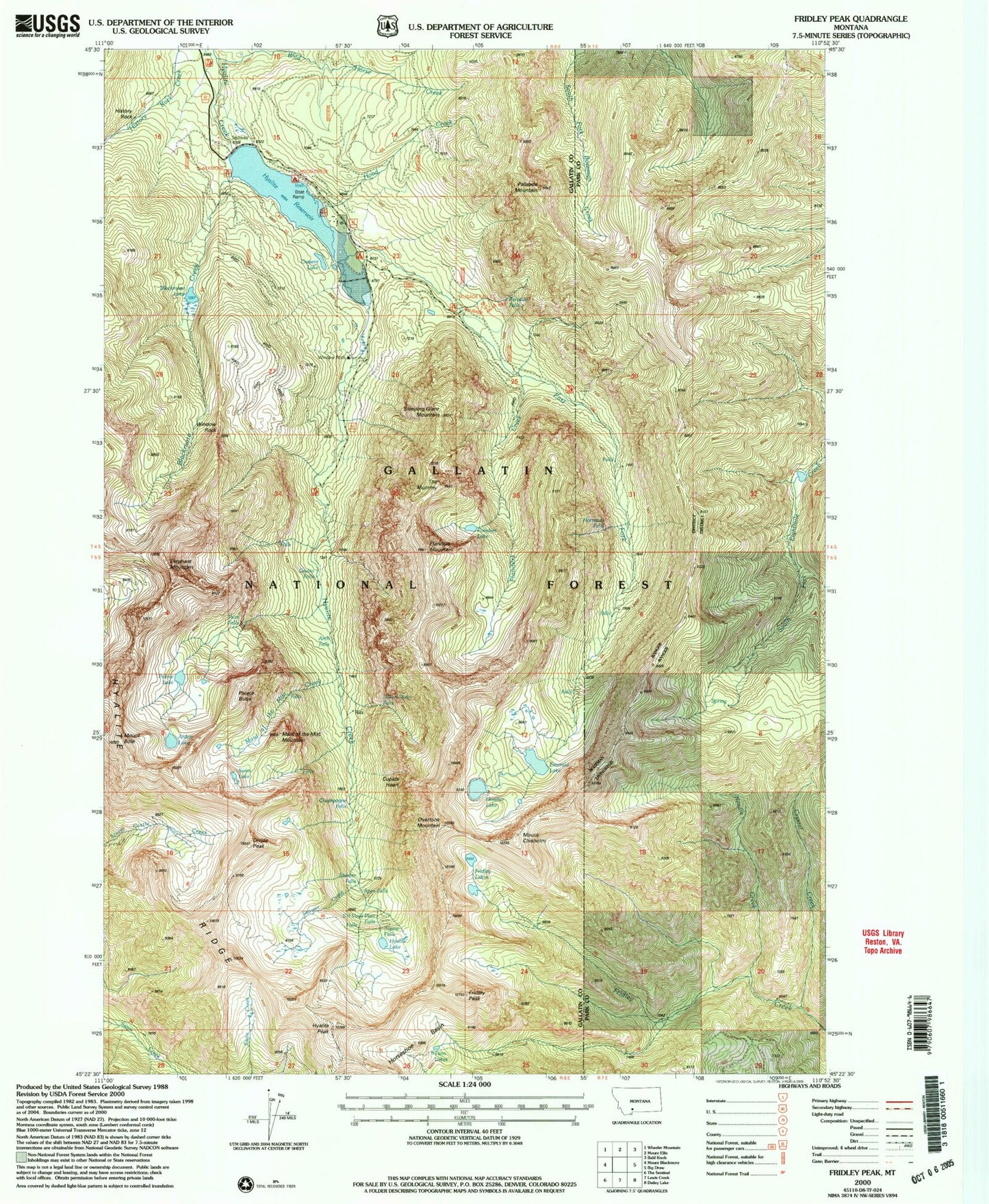
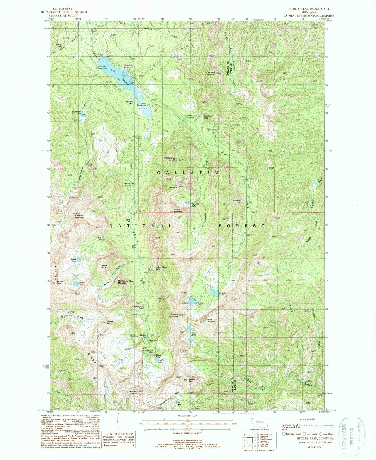
Historical USGS topographic quad map of Fridley Peak in the state of Montana. Typical map scale is 1:24,000, but may vary for certain years, if available. Print size: 24" x 27"
This quadrangle is in the following counties: Gallatin, Park.
The map contains contour lines, roads, rivers, towns, and lakes. Printed on high-quality waterproof paper with UV fade-resistant inks, and shipped rolled.
Contains the following named places: Crescent Lake, Alpine Falls, Apex Falls, Arch Falls, Blackmore Creek, Blackmore Lake, Champagne Falls, Chisholm Cabin, Crystal Creek, Cupids Heart, Divide Peak, East Fork Hyalite Creek, Emerald Lake, Flanders Creek, Flanders Lake, Flanders Mountain, Fridley Lakes, Fridley Peak, Grotto Falls, Heather Lake, History Rock Creek, Hood Creek, Horseshoe Basin, Horsetail Falls, Hyalite Lake, Hyalite Peak, Hyalite Ridge, Junior Hyalite Camp, Maid of the Mist Creek, Maid of the Mist Mountain, Middle Creek Dam, Needle Creek, Overlook Mountain, Palace Butte, Palace Lake, Palisade Mountain, Palisades Falls, Shower Creek, Shower Falls, Silken Skein Falls, Sleeping Giant Mountain, The Mummy, Twin Falls, Twin Lakes, Wild Horse Creek, Window Rock, Window Rock Station, History Rock, Palisade Falls, Hyalite Reservoir, Arden Lake, Blackmore Campground, Chisholm Campground, Elephant Mountain, Mount Bole, Mount Chisholm, Palisade Falls Picnic Area, Palace Butte Campground, Hood Creek Campground, S'il Vous Plait Falls, Arch Falls Natural Bridge, Swim Lake