MyTopo
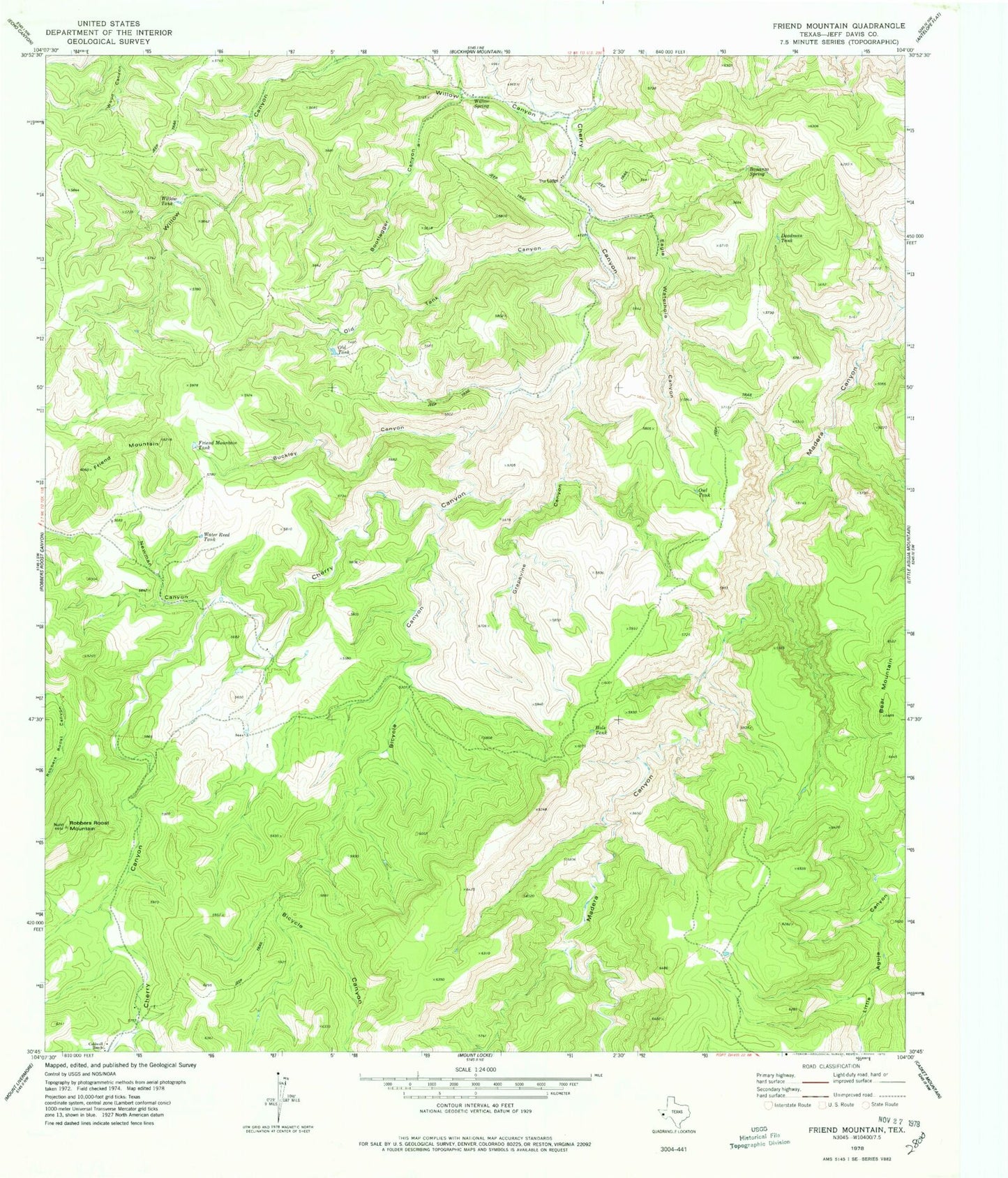
Classic USGS Friend Mountain Texas 7.5'x7.5' Topo Map
Couldn't load pickup availability
Historical USGS topographic quad map of Friend Mountain in the state of Texas. Map scale may vary for some years, but is generally around 1:24,000. Print size is approximately 24" x 27"
This quadrangle is in the following counties: Jeff Davis.
The map contains contour lines, roads, rivers, towns, and lakes. Printed on high-quality waterproof paper with UV fade-resistant inks, and shipped rolled.
Contains the following named places: Bicycle Canyon, Bonanza Spring, Bootlegger Canyon, Buckley Canyon, Caldwell Ranch, Davis Mountains, Deadman Tank, Eagle Waterhole Canyon, Friend Mountain, Friend Mountain Tank, Grapevine Canyon, Hole Tank, Lost Spring Canyon, Newman Canyon, Old Tank, Old Tank Canyon, Owl Tank, Robbers Roost Mountain, The Lodge, Water Reed Tank, Willow Canyon, Willow Spring, Willow Tank