
MyTopo
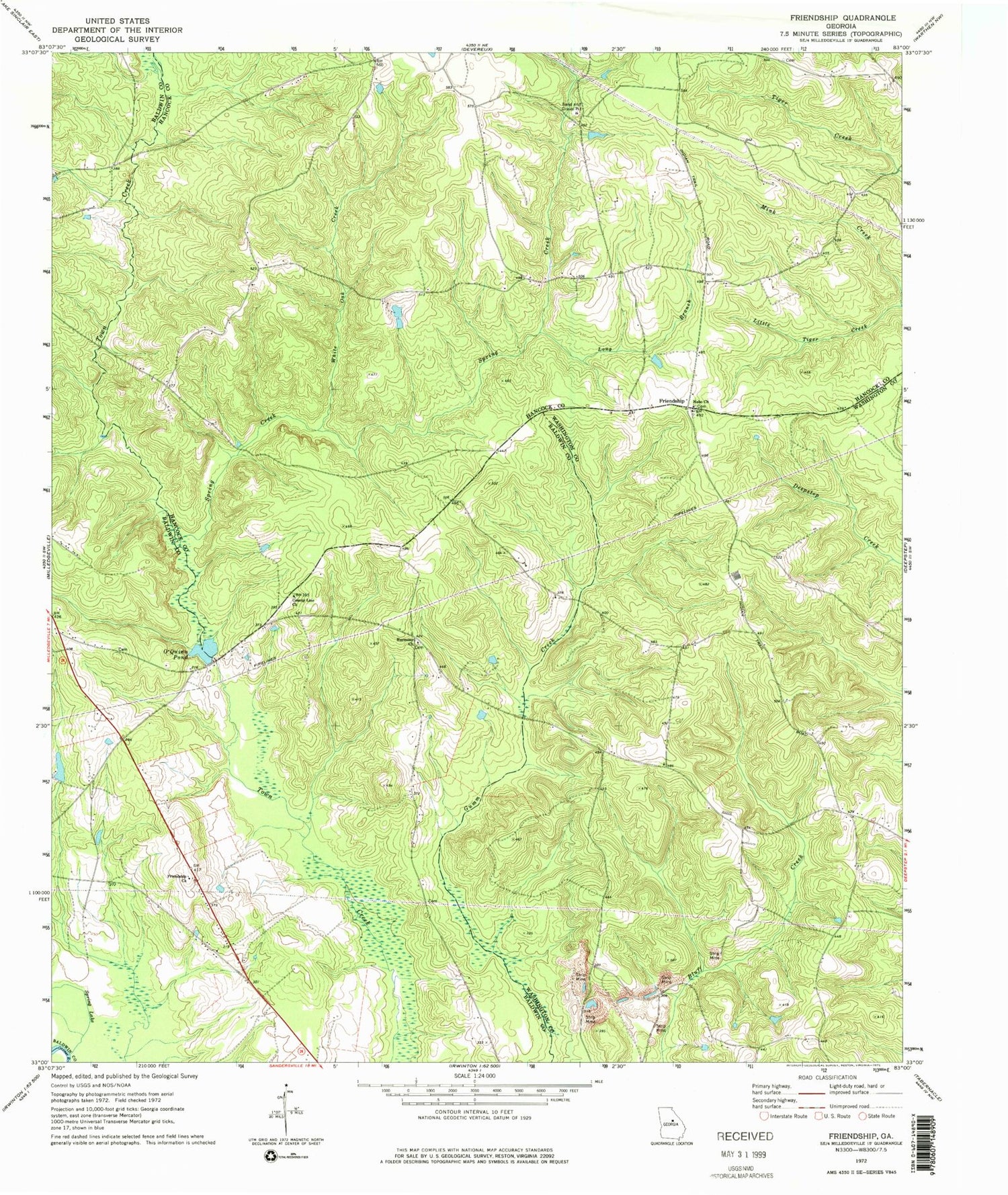
Classic USGS Friendship Georgia 7.5'x7.5' Topo Map
Couldn't load pickup availability
Historical USGS topographic quad map of Friendship in the state of Georgia. Map scale may vary for some years, but is generally around 1:24,000. Print size is approximately 24" x 27"
This quadrangle is in the following counties: Baldwin, Hancock, Washington, Wilkinson.
The map contains contour lines, roads, rivers, towns, and lakes. Printed on high-quality waterproof paper with UV fade-resistant inks, and shipped rolled.
Contains the following named places: Allen Mill, Body of Christ Church, County Line Church, Friendship, Friendship Baptist Church, Friendship Church, Garner Family Cemetery, Gin Branch, Griffin Academy, Harmony Church, Harmony Church Cemetery, John Thomas Family Cemetery, Leverett - Sparks Cemetery, Long Branch, Minor School, Mount Nebo Church Cemetery, Nebo Church, O'Quinn Pond, O'Quinn Pond Dam, Peavy Lake, Peavy Lake Dam, Pleasant Grove School, Prosser Fields Cemetery, Roberson Chapel Church, Rogers Cemetery, Second Darien Church Cemetery, Simmons Cemetery, Spring Creek, Spring Lake, Trawick Family Cemetery Number 1, Underwood - Harrison Family Cemetery, White Oak Creek


