MyTopo
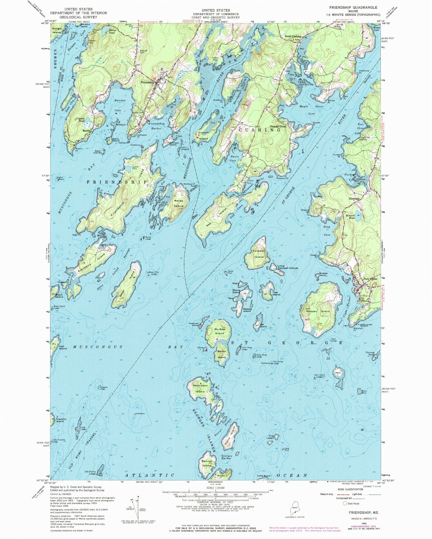
Classic USGS Friendship Maine 7.5'x7.5' Topo Map
Couldn't load pickup availability
Historical USGS topographic quad map of Friendship in the state of Maine. Typical map scale is 1:24,000, but may vary for certain years, if available. Print size: 24" x 27"
This quadrangle is in the following counties: Knox, Lincoln.
The map contains contour lines, roads, rivers, towns, and lakes. Printed on high-quality waterproof paper with UV fade-resistant inks, and shipped rolled.
Contains the following named places: Allen Ledge, Floods Cove, Back River, Bar Island, Barter Island, Benner Island, Beyer Ship Ledge, Bird Point, Black Island, Black Island Ledge, Black Rock, Blubber Island, Bradford Point, Burton Point, Caldwell Island, Carey Rock, Cedar Island, Cranberry Island, Crotch Island, Crotch Island Ledges, Crystal Pond, Davis Cove, Davis Island, Davis Strait, Deep Cove, Delano Cove, Eagle Island, Forest Pond, Franklin Island, Friendship, Friendship Harbor, Gangway Ledge, Garrison Island, Gay Cove, Gay Island, Georges Harbor, Goose Rock, Gull Rock, Hall Island, Harbor Cemetery, Hart Island, Hart Island Ledges, Hatchet Cove, Hathorne Point, Hornbarn Cove, Howard Point, Howard Pond, Hungry Island, Inner Shag Ledge, Jameson Point, Little Caldwell Islands, Lobster Gut, Long Ledge, Maple Juice Cove, Marshall Point, Martin, Martin Point, McGee Island, Meduncook River, Minister Gut, Morse Island, Morse Ledge, Neds Point, Northeast Point Reef, Nubbins, Old Horse Ledge, Old Hump Channel, Old Hump Ledge, Otter Island, Otter Island Passage, Outer Shag Ledge, Pleasant Point, Pleasant Point, Pleasant Point Gut, Port Clyde, Port Clyde Harbor, Ram Island, Ram Island, Saint George River, Sand Island, Seavey Island, Shag Ledges, Stone Island, Stones Point, Teel Cove, Teel Island, Thompson Island, Toms Island, Turkey Cove, Turkey Point, Twobush Island, Roadside Cemetery, Wiley Cove, Glenmere, South Cushing, Friendship Long Island, Hupper Island, Hupper Point, The Sisters, Gay Cove Ledge, Channel Rock, Davis Shoal, Gig Rock, Goose Rock Ledge, Griffin Ledge, Henderson Ledge, Jenks Ledge, Kelp Ledges, Marshall Ledge, Murray Ledge, Old Cilley Ledge, Otter Island Ledge, Thompson Rock, The Kegs, Town of Friendship, Forest Pond Dam, Crystal Pond Dam, Friendship Museum, Friendship Village School, Marshall Point Light Station, Marshall Point Lighthouse Museum, Olson House, Port Clyde Post Office, Friendship Volunteer Fire Department, Old Village Cemetery, Hathorn Cemetery, Pleasant View Cemetery, Friendship Public Library, Franklin Island National Wildlife Refuge, Cushing Post Office, Friendship Post Office