MyTopo
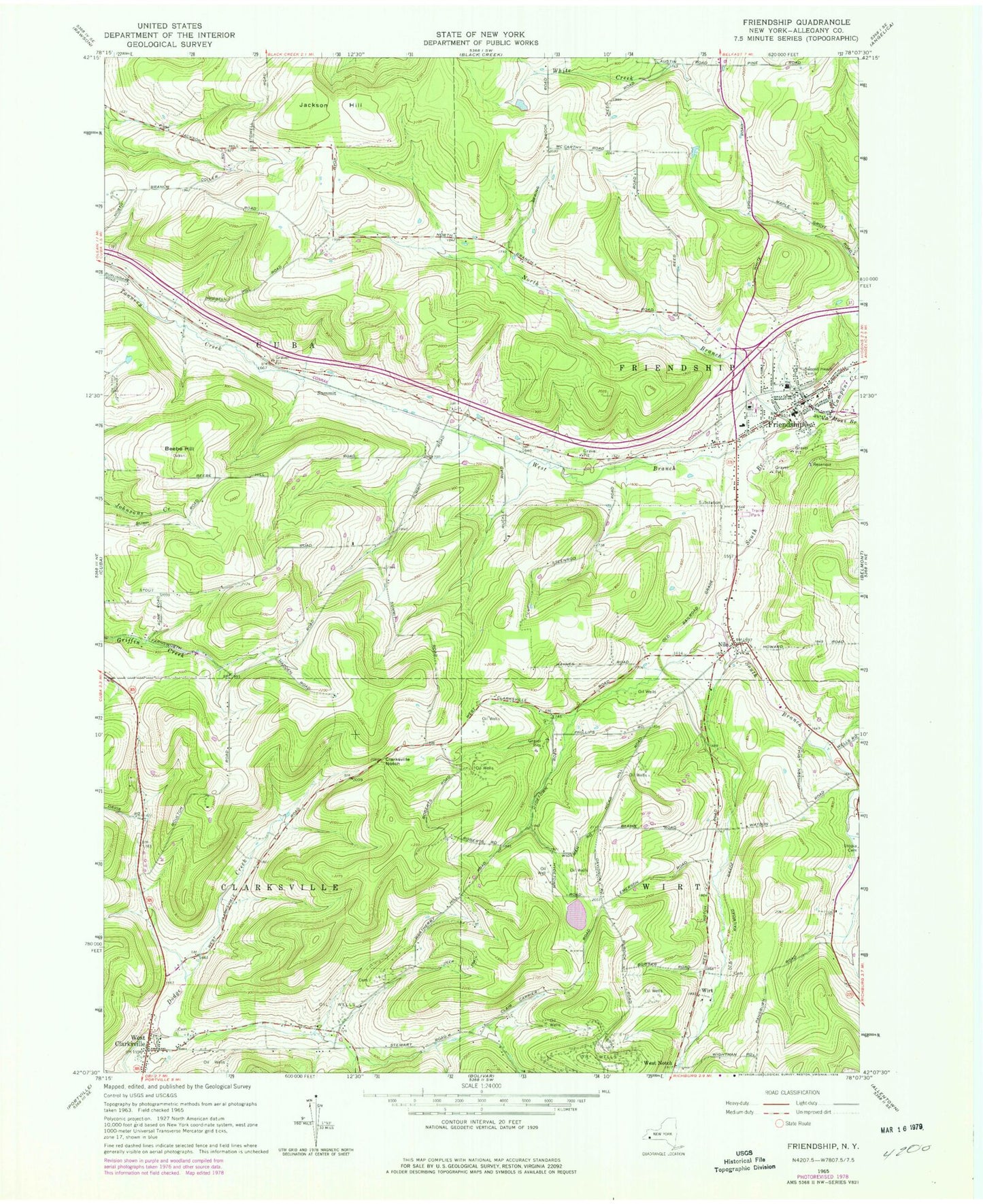
Classic USGS Friendship New York 7.5'x7.5' Topo Map
Couldn't load pickup availability
Historical USGS topographic quad map of Friendship in the state of New York. Map scale may vary for some years, but is generally around 1:24,000. Print size is approximately 24" x 27"
This quadrangle is in the following counties: Allegany.
The map contains contour lines, roads, rivers, towns, and lakes. Printed on high-quality waterproof paper with UV fade-resistant inks, and shipped rolled.
Contains the following named places: Beebe Hill, Clarksville Ambulance Service, Clarksville Cemetery, Clarksville Notch, Dew Airpark, First United Methodist Church, Friendship, Friendship Ambulance Squad, Friendship Bible Baptist Church, Friendship Census Designated Place, Friendship Central School, Friendship Church of God, Friendship Fire Department, Friendship Free Library, Friendship Post Office, Jackson Hill, Moulton School, Nile, Nile Cemetery, Nile Community Church, North Branch Van Campen Creek, Pink School, Rocking R Farm, Sacred Heart Cemetery, Sawyer Trailer Court, School Number 3, School Number 4, School Number 5, Smalley School, South Branch Van Campen Creek, Summit, Town of Clarksville, Town of Cuba, Town of Friendship, Town of Wirt, United Church of Friendship, Val Dale Farms, West Branch Van Campen Creek, West Clarksville, West Clarksville Post Office, West Notch, Wheeler Cemetery, Wirt, Wirt Center School, ZIP Code: 14739