MyTopo
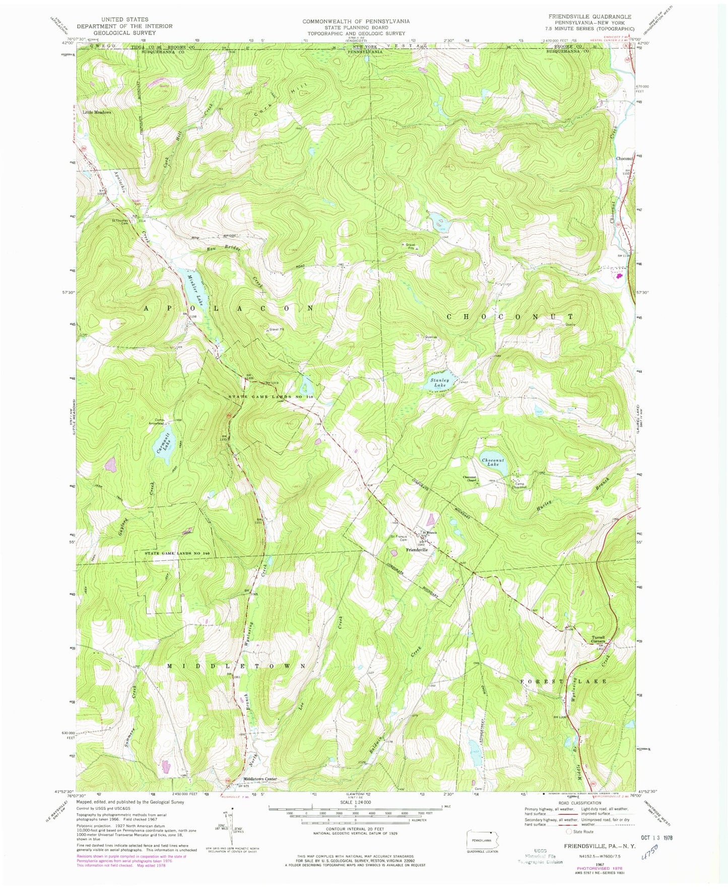
Classic USGS Friendsville Pennsylvania 7.5'x7.5' Topo Map
Couldn't load pickup availability
Historical USGS topographic quad map of Friendsville in the states of Pennsylvania, New York. Map scale may vary for some years, but is generally around 1:24,000. Print size is approximately 24" x 27"
This quadrangle is in the following counties: Broome, Susquehanna, Tioga.
The map contains contour lines, roads, rivers, towns, and lakes. Printed on high-quality waterproof paper with UV fade-resistant inks, and shipped rolled.
Contains the following named places: Baldwin Creek, Borough of Friendsville, Bow Bridge Creek, Camp Arrowhead, Camp Choconut, Carmault Lake, Choconut Chapel, Choconut Lake, Cork Hill, Cork Hill Creek, Courtland Birchard Pond, Friendsville, Friendsville Post Office, Lee Creek, Middletown Center, Minkler Lake, Minkler Lake Dam, Rush Volunteer Fire Department Station 2, Saint Francis Cemetery, Saint Francis Church, Saint Thomas the Apostle Cemetery, Stanley Lake, Stanley Lake Dam, State Game Lands Number 140, Stone Lake Dam, Stonestreet Cemetery, Township of Apolacon, Township of Choconut, Turrell Corners, ZIP Codes: 18818, 18830