MyTopo
Classic USGS Frog Lake Wisconsin 7.5'x7.5' Topo Map
Couldn't load pickup availability
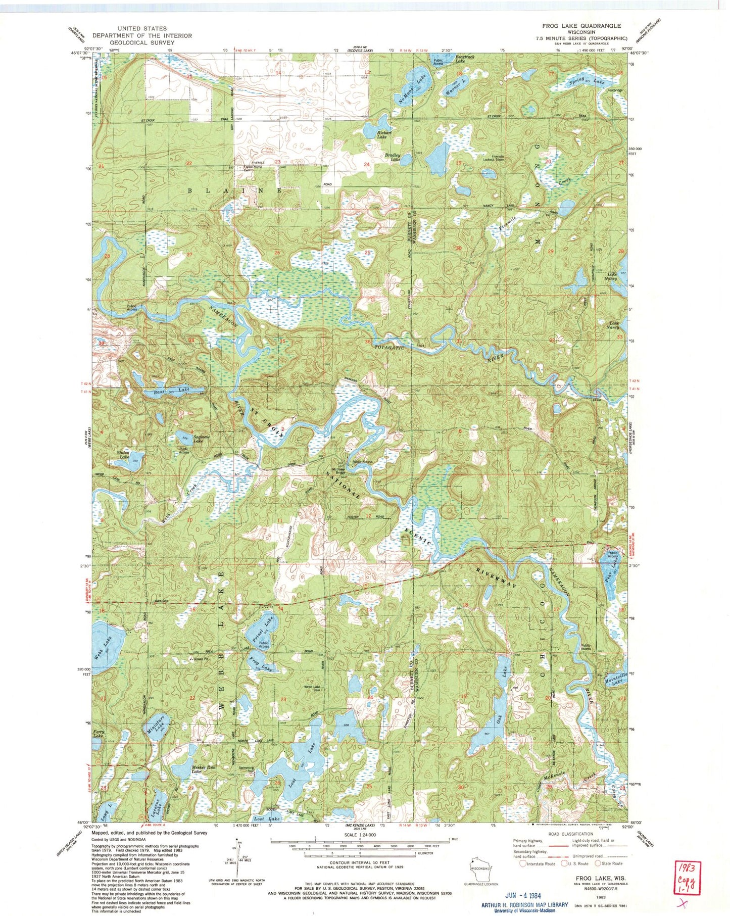
Historical USGS topographic quad map of Frog Lake in the state of Wisconsin. Typical map scale is 1:24,000, but may vary for certain years, if available. Print size: 24" x 27"
This quadrangle is in the following counties: Burnett, Washburn.
The map contains contour lines, roads, rivers, towns, and lakes. Printed on high-quality waterproof paper with UV fade-resistant inks, and shipped rolled.
Contains the following named places: Bass Lake, Bradley Lake, Casey Creek, Fivemile Creek, Frog Lake, Lost Lake, Lucerne Lake, McDowel Bridge, McKenzie Creek, Meeker Run Lake, Miniature Lake, No Mans Lake, Oak Lake, Pear Lake, Richart Lake, Saginaw Lake, Stulen Lake, Warner Lake, Webb Creek, Webb Lake School, Prinel Lake, Totagatic River, Fivemile Lookout Tower, Town of Webb Lake, Webb Lake 2WP466 Dam, Webb Lake 18, Lower Lost Lake 2WP936 Dam, Forest Home Cemetery, Webb Lake Cemetery, Spring Lake, Webb Lake Police Department