MyTopo
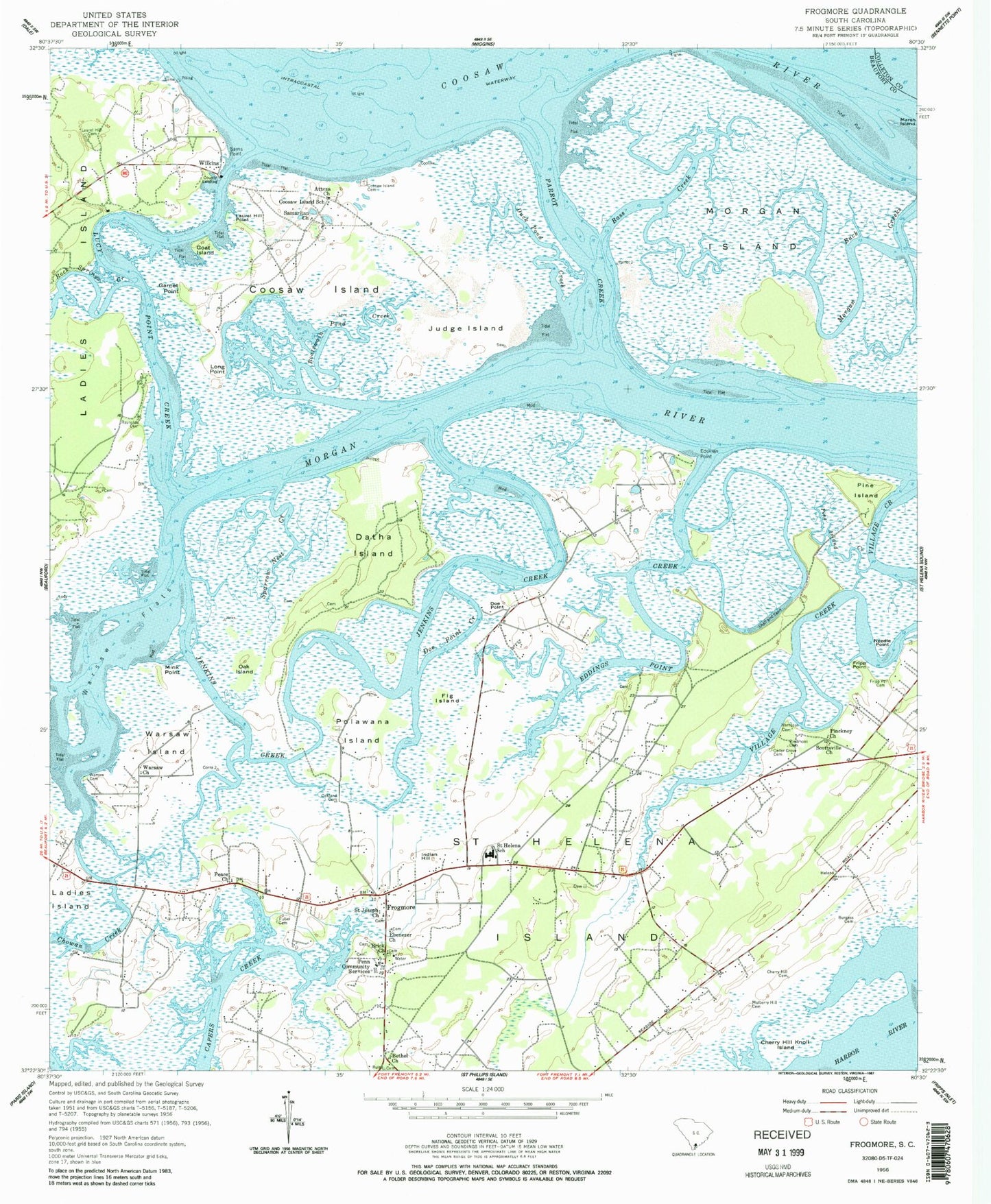
Classic USGS Frogmore South Carolina 7.5'x7.5' Topo Map
Couldn't load pickup availability
Historical USGS topographic quad map of Frogmore in the state of South Carolina. Typical map scale is 1:24,000, but may vary for certain years, if available. Print size: 24" x 27"
This quadrangle is in the following counties: Beaufort, Colleton.
The map contains contour lines, roads, rivers, towns, and lakes. Printed on high-quality waterproof paper with UV fade-resistant inks, and shipped rolled.
Contains the following named places: Marsh Island, Atteza Church, Bass Creek, Bethel Church, Boatswain Pond Creek, Burgess Cemetery, Cedar Grove Cemetery, Cherry Hill Cemetery, Cherry Hill Knoll Island, Coosaw Island Cemetery, Coosaw Island School, Doe Point, Doe Point Creek, Duck Pond Creek, Ebenezer Church, Fig Island, Fripp Point, Fripp Point Cemetery, Fuller Cemetery, Garnet Point, Goat Island, Hampton Cemetery, Jenkins Creek, Judge Island, Laurel Hill Cemetery, Laurel Hill Point, Long Point, Mink Point, Mulberry Hill Cemetery, Needle Point, Oak Island, Oakland Cemetery, Peace Church, Piedmont Cemetery, Pine Island, Pine Island Creek, Reynolds Cemetery, Rock Springs Creek, Saint Joseph Church, Samaritan Church, Sams Point, Sparrow Nest Creek, Village Creek, Warsaw Cemetery, Warsaw Church, Warsaw Flats, Edding Creek, Morgan Back Creek, Point Creek, Frogmore, Indian Hill, Wilkins, Ashdale, Big Dataw Point, Coosaw School (historical), Edding Point School (historical), Elding School (historical), Gleasons Landing, Hill Field Lake, Oak School (historical), Pine Landing, Saint Helena Parish Chapel of Ease Ruins, Sams Point School (historical), Spring Well Pond, Wassa School (historical), Morgan Island, Brick Church, Coosaw Island, Datha Island, Edding Point, Parrot Creek, Penn Community Services, Pinckney Church, Polawana Island, Saint Helena Island, Saint Helena Elementary School, Scottsville Church, Warsaw Island, Marsh Point Airport, Laurel Hill Plantation Airport (historical), Lady's Island Saint Helena Fire District Station 22, Lady's Island - St. Helena Fire District Station 24, Dataw Island, Saint Helena Island Post Office, Beaufort County Library Saint Helena Branch, Dataw Island Marina, Little Gem Tree Farm