MyTopo
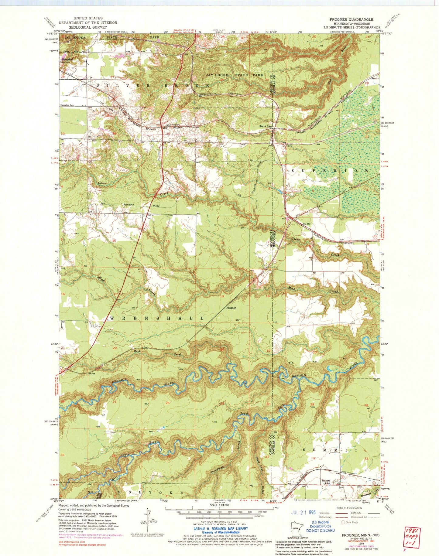
Classic USGS Frogner Minnesota 7.5'x7.5' Topo Map
Regular price
$16.95
Regular price
Sale price
$16.95
Unit price
per
Couldn't load pickup availability
Historical USGS topographic quad map of Frogner in the states of Minnesota, Wisconsin. Map scale may vary for some years, but is generally around 1:24,000. Print size is approximately 24" x 27"
This quadrangle is in the following counties: Carlton, Douglas.
The map contains contour lines, roads, rivers, towns, and lakes. Printed on high-quality waterproof paper with UV fade-resistant inks, and shipped rolled.
Contains the following named places: Barker, Barker Post Office, Deer Creek, Foxboro School, Frogner, Little Net River, Net River, Rock Creek, Section Thirty-six Creek, South Fork Nemadji River, State Line, State Line Creek, Township of Silver Brook, Township of Wrenshall, ZIP Code: 55797