
MyTopo
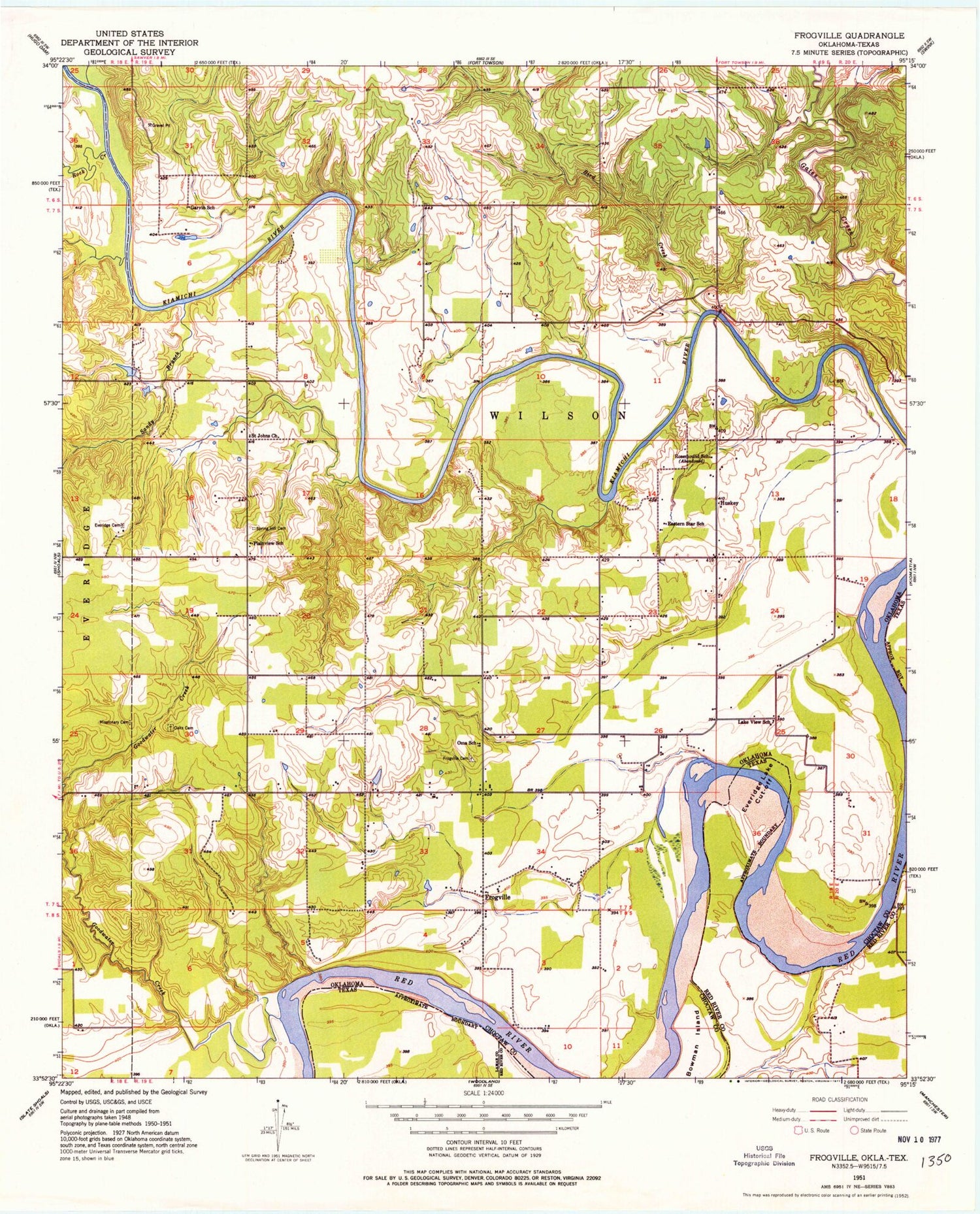
Classic USGS Frogville Oklahoma 7.5'x7.5' Topo Map
Couldn't load pickup availability
Historical USGS topographic quad map of Frogville in the states of Oklahoma, Texas. Map scale may vary for some years, but is generally around 1:24,000. Print size is approximately 24" x 27"
This quadrangle is in the following counties: Choctaw, Lamar, Red River.
The map contains contour lines, roads, rivers, towns, and lakes. Printed on high-quality waterproof paper with UV fade-resistant inks, and shipped rolled.
Contains the following named places: Bird Creek, Bowman Island, Cedar Creek, Eastern Star School, Everidge Cemetery, Everidge Lake Cut-off, Frogville, Frogville Cemetery, Frogville Creek Site 1 Dam, Frogville Creek Site 1 Reservoir, Frogville Creek Site 2 Dam, Frogville Creek Site 2 Reservoir, Garvin School, Goodwater Creek, Huskey, Lake Raymond Gary, Lake Raymond Gary Dam, Lake View School, Missionary Cemetery, North Sandy Branch, Oakes Cemetery, Oma School, Plainview School, Raymond Gary State Park, Rock Creek, Rosemound School, Saint Johns Church, Sandy Branch, South Sandy Branch, Spring Hill Cemetery


