MyTopo
Classic USGS Frolona Georgia 7.5'x7.5' Topo Map
Couldn't load pickup availability
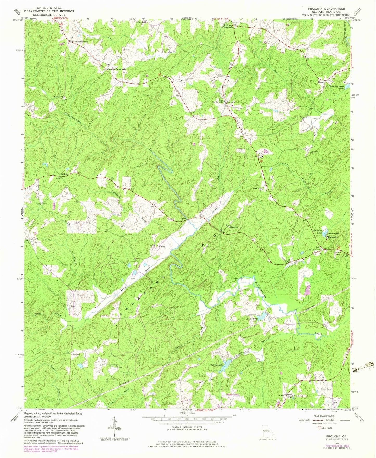
Historical USGS topographic quad map of Frolona in the state of Georgia. Map scale may vary for some years, but is generally around 1:24,000. Print size is approximately 24" x 27"
This quadrangle is in the following counties: Heard.
The map contains contour lines, roads, rivers, towns, and lakes. Printed on high-quality waterproof paper with UV fade-resistant inks, and shipped rolled.
Contains the following named places: Adamson, Allens Lake, Allens Lake Dam, Almon Cemetery, Answered Prayer Airport, Awbreys Lake, Awbreys Lake Dam, Backbone Ridge, Barkers Crossroads, Camp Ground School, Cedar Creek, Centralia Lake, Centralia Lake Dam, Copeland Creek, Crews Creek, Elery, Flat Rock Campground, Flat Rock Campgrounds Church, Frolona, Frolona Fire Department Station 7, Heard County, Heard County Quarry, Hearn Cemetery, Hyatt, Lancaster Cemetery, Lashley Cemetery, Little Creek, Macedonia Cemetery, Macedonia Missionary Baptist Church, Maedonia Church, Mahailey Crossroads, Merrill - Roop Cemetery, Miller Cemetery, Mount Olive Cemetery, Mount Olive Missionary Baptist Church, Mount Salem School, New Hope Cemetery, New Hope Missionary Baptist Church, New Spring Congregational Methodist Church, New Springs Cemetery, Noles Cemetery, Notnomis Acres Lake, Old New Hope Church, Olive Branch Cemetery, Olive Branch Missionary Baptist Church, Ridgeway, Ridgeway Cemetery, Ridgeway Methodist Church, Ridgeway School, Ridley, Ridley - Davis Cemetery, Rockridge, Rooks - Lewis Cemetery, Salem Cemetery, Salem United Methodist Church, Shellnut, Simpson, Simpson School, Skinner Chapel, Stone Mill Mountain, Tolieson Branch, Viola, Walnut Hill Baptist Church, Walnut Hill School, Watkins Bridge, Wood Cemetery, Yates Crossroads, ZIP Code: 30217