MyTopo
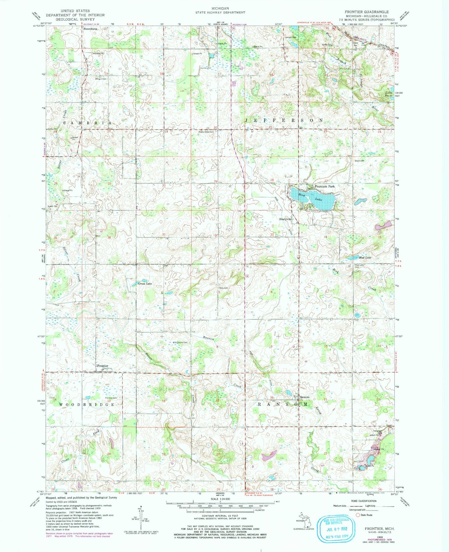
Classic USGS Frontier Michigan 7.5'x7.5' Topo Map
Couldn't load pickup availability
Historical USGS topographic quad map of Frontier in the state of Michigan. Map scale may vary for some years, but is generally around 1:24,000. Print size is approximately 24" x 27"
This quadrangle is in the following counties: Hillsdale.
The map contains contour lines, roads, rivers, towns, and lakes. Printed on high-quality waterproof paper with UV fade-resistant inks, and shipped rolled.
Contains the following named places: Bird Lake, Bird Lake Bible School, Bird Lake Wesleyan Missionary Church, Black Cemetery, Doty Cemetery, Evergreen Cemetery, Fountain Park, Frontier, Frontier Cemetery, Frontier Post Office, Frontier United Methodist Church, Gateway Park Church, Grass Lake, Jefferson Post Office, Lake Lesage Cemetery, Leonard Cemetery, Maple Grove Cemetery, Morgan Cemetery, Mud Lake, Mud Lake Cemetery, Nile Ditch, Otto Drain, Ransom, Ransom Ditch, Ransom Post Office, Shadyside, Shadyside Post Office, Township of Jefferson, Township of Ransom, Wild Cherry Cemetery, Woodbridge Township Fire and Rescue, ZIP Code: 49266