MyTopo
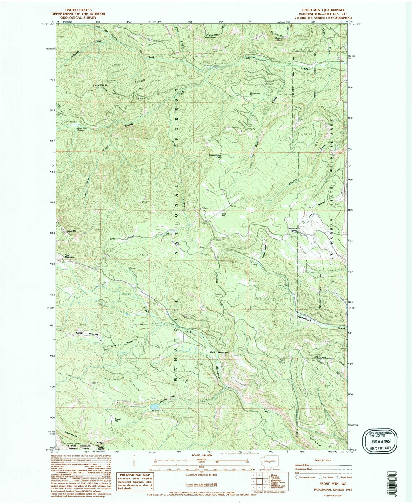
Classic USGS Frost Mountain Washington 7.5'x7.5' Topo Map
Couldn't load pickup availability
Historical USGS topographic quad map of Frost Mountain in the state of Washington. Typical map scale is 1:24,000, but may vary for certain years, if available. Print size: 24" x 27"
This quadrangle is in the following counties: Kittitas.
The map contains contour lines, roads, rivers, towns, and lakes. Printed on high-quality waterproof paper with UV fade-resistant inks, and shipped rolled.
Contains the following named places: Buck Meadows, Case Knife Creek, Cedar Creek, First Creek, Frost Creek, Frost Mountain, Grasshopper Flat, Gnat Flat Trail, Gooseberry Flat, Keenan Meadows, Lodgepole Creek, Lost Lake, Manastash Cow Camp, North Fork Taneum Creek, North Fork Trail, Osborn Point, South Fork Meadow, South Fork Taneum Creek, Tamarack Spring, Tripod Flat, Walter Spring, Willow Gulch, Gnat Flat, Keenan Meadows Trail, Manastash Lake Trail, South Fork Meadow Trailhead, Tamarack Spring Campground, Ice Water Creek, Manastash Ridge Division, Buck Meadows, Case Knife Creek, Cedar Creek, First Creek, Frost Creek, Frost Mountain, Grasshopper Flat, Gnat Flat Trail, Gooseberry Flat, Keenan Meadows, Lodgepole Creek, Lost Lake, Manastash Cow Camp, North Fork Taneum Creek, North Fork Trail, Osborn Point, South Fork Meadow, South Fork Taneum Creek, Tamarack Spring, Tripod Flat, Walter Spring, Willow Gulch, Gnat Flat, Keenan Meadows Trail, Manastash Lake Trail, South Fork Meadow Trailhead, Tamarack Spring Campground, Ice Water Creek, Manastash Ridge Division