MyTopo
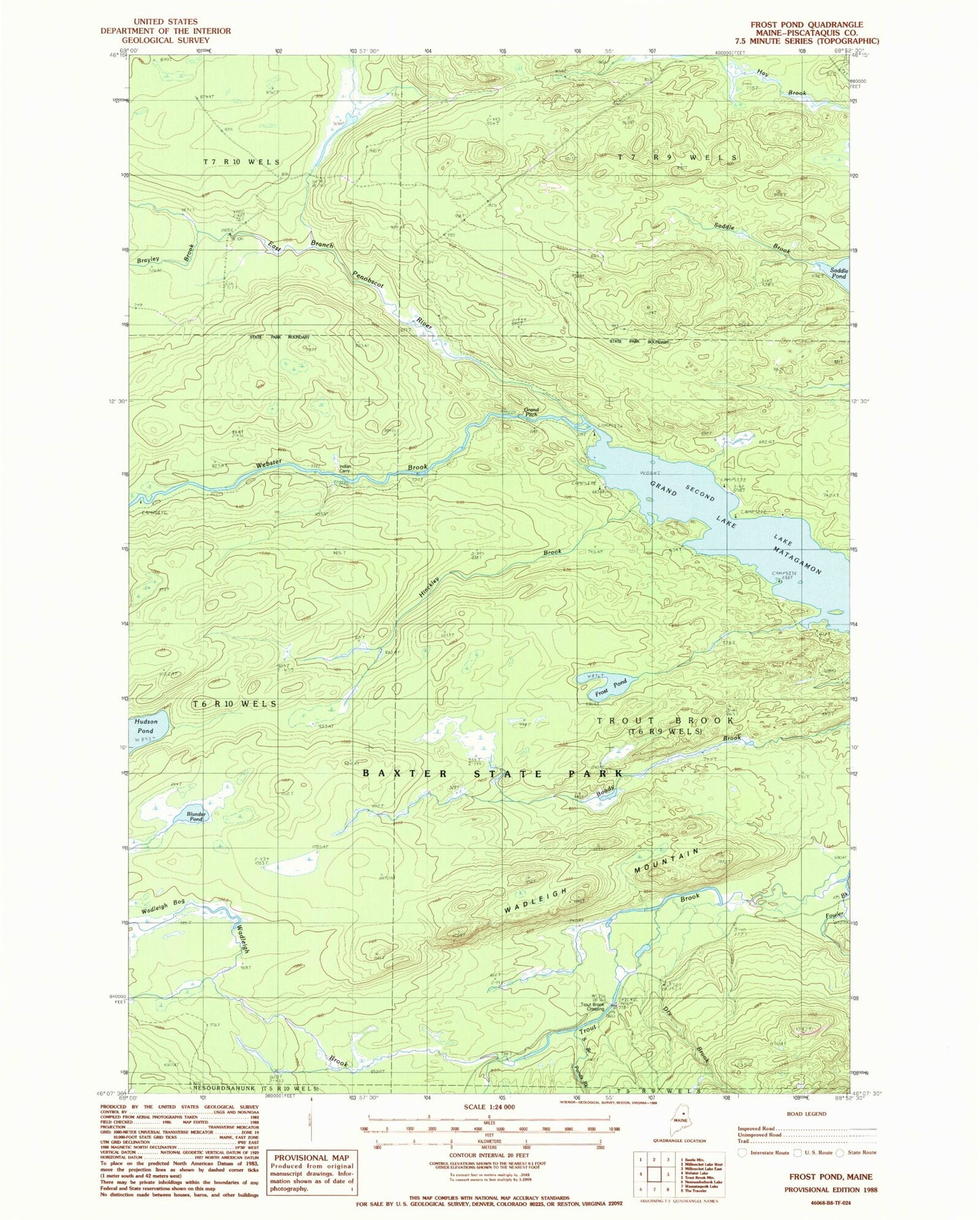
Classic USGS Frost Pond Maine 7.5'x7.5' Topo Map
Regular price
$16.95
Regular price
Sale price
$16.95
Unit price
per
Couldn't load pickup availability
Historical USGS topographic quad map of Frost Pond in the state of Maine. Typical map scale is 1:24,000, but may vary for certain years, if available. Print size: 24" x 27"
This quadrangle is in the following counties: Piscataquis.
The map contains contour lines, roads, rivers, towns, and lakes. Printed on high-quality waterproof paper with UV fade-resistant inks, and shipped rolled.
Contains the following named places: Blunder Pond, Brayley Brook, Dry Brook, Eagle Lake Tote Road, Fowler Brook, Fowler Green, Freezeout Road, Frost Pond, Grand Pitch, Hinckley Brook, Indian Carry, Saddle Brook, South Branch Ponds Brook, Wadleigh Brook, Wadleigh Mountain, Webster Brook, The Crossing, Trout Brook Township