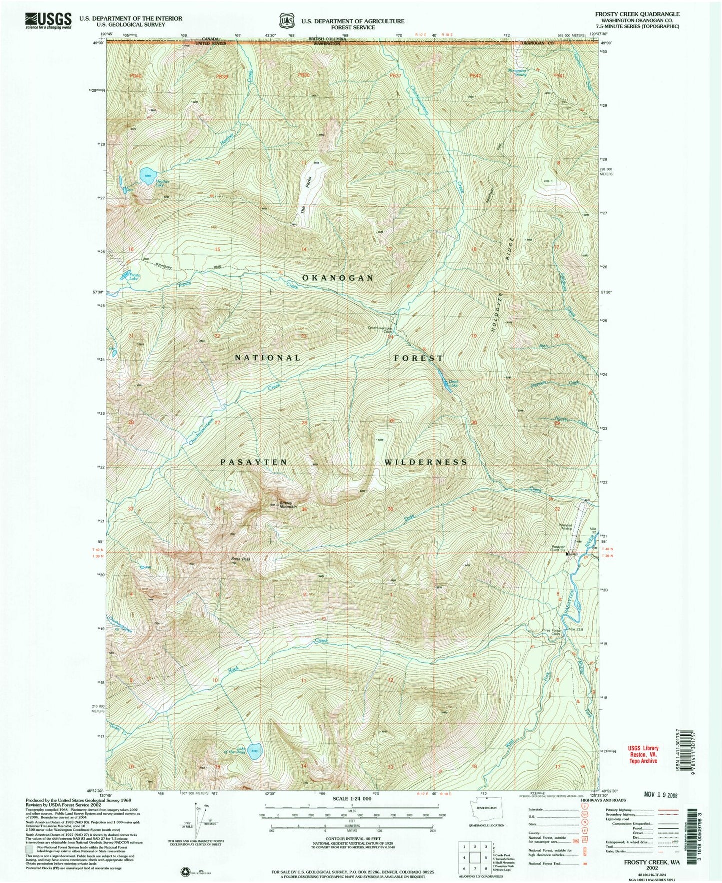
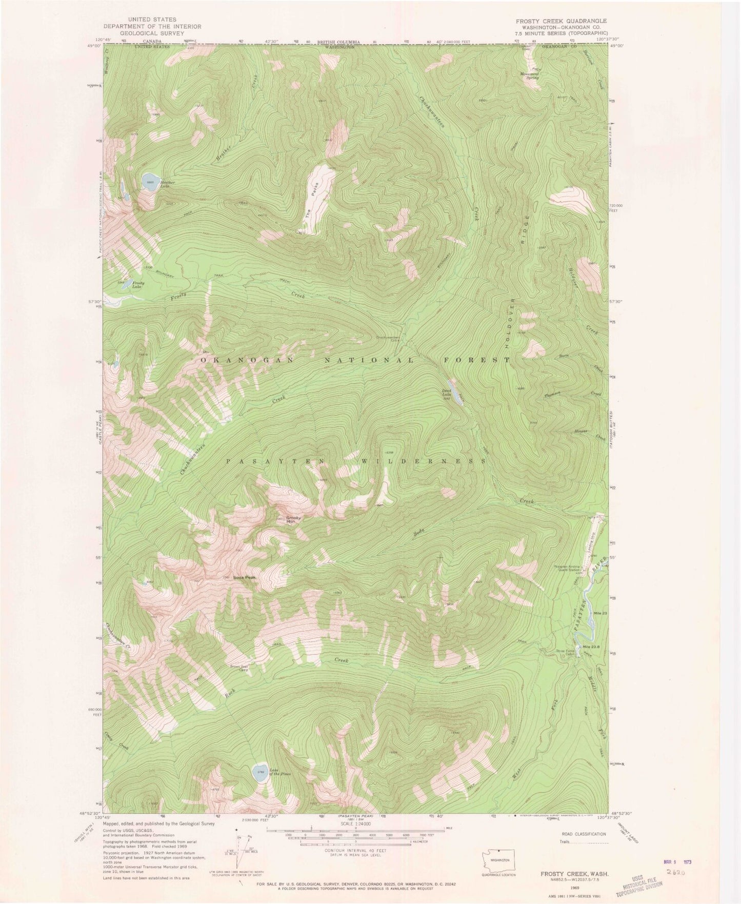
MyTopo
Classic USGS Frosty Creek Washington 7.5'x7.5' Topo Map
Couldn't load pickup availability
Historical USGS topographic quad map of Frosty Creek in the state of Washington. Map scale may vary for some years, but is generally around 1:24,000. Print size is approximately 24" x 27"
This quadrangle is in the following counties: Okanogan.
The map contains contour lines, roads, rivers, towns, and lakes. Printed on high-quality waterproof paper with UV fade-resistant inks, and shipped rolled.
Contains the following named places: Brown Bear Camp, Chuchuwanteen Cabin, Coney Creek, Dead Lake, Frosty Creek, Frosty Lake, Heather Lake, Holdover Ridge, Lake of the Pines, Lease Creek, Middle Fork Pasayten River, Monument Spring, Pasayten Airstrip Guard Station, Pasayten-US Forest Service Airfield, Rock Creek, Smoky Mountain, Snehumption Creek, Soda Peak, The Parks, Three Forks Cabin, West Fork Pasayten River