
MyTopo
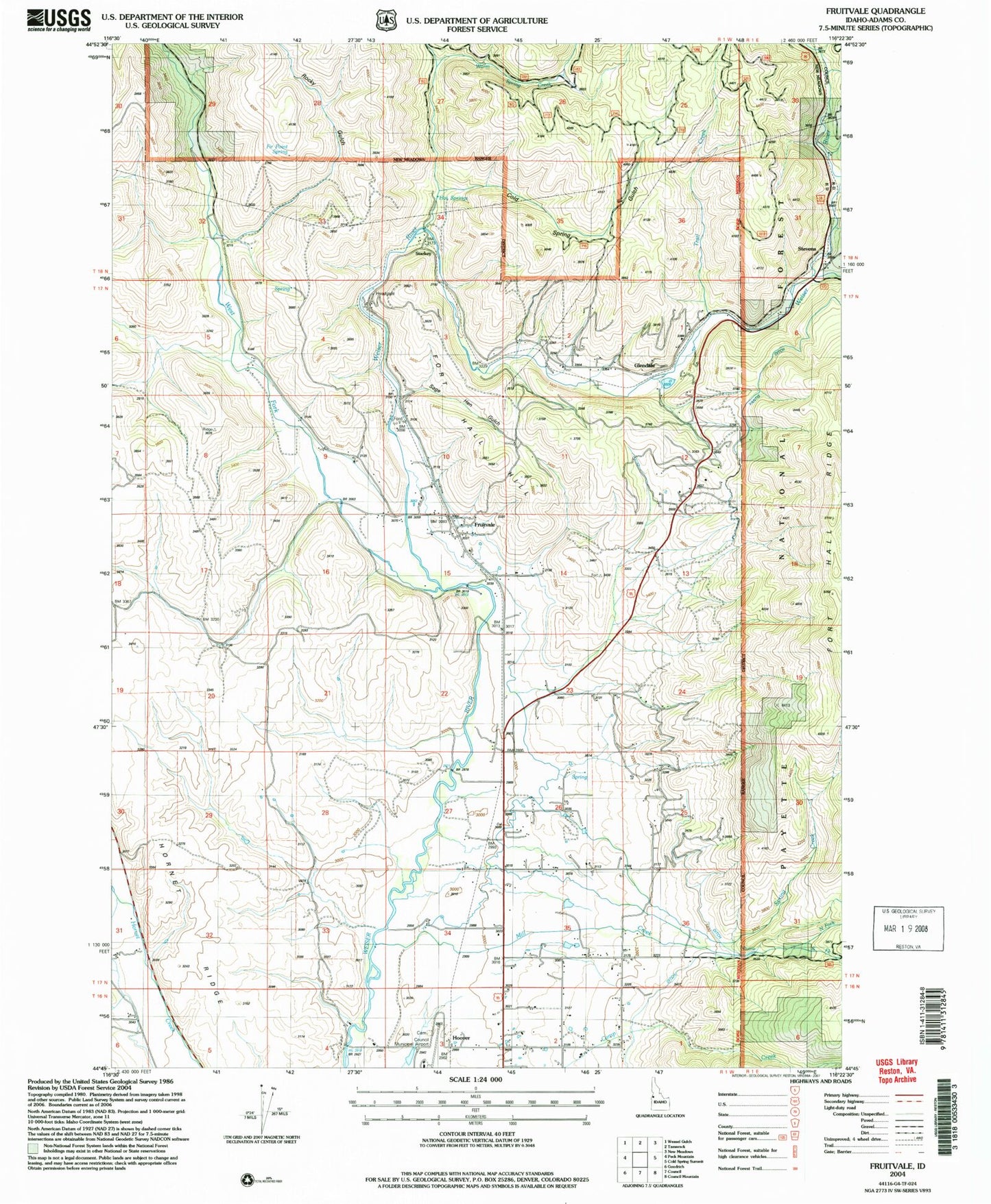
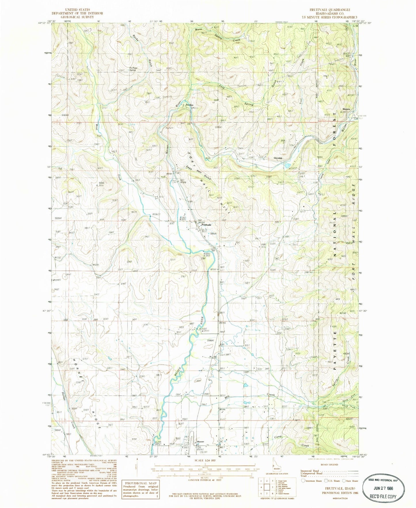
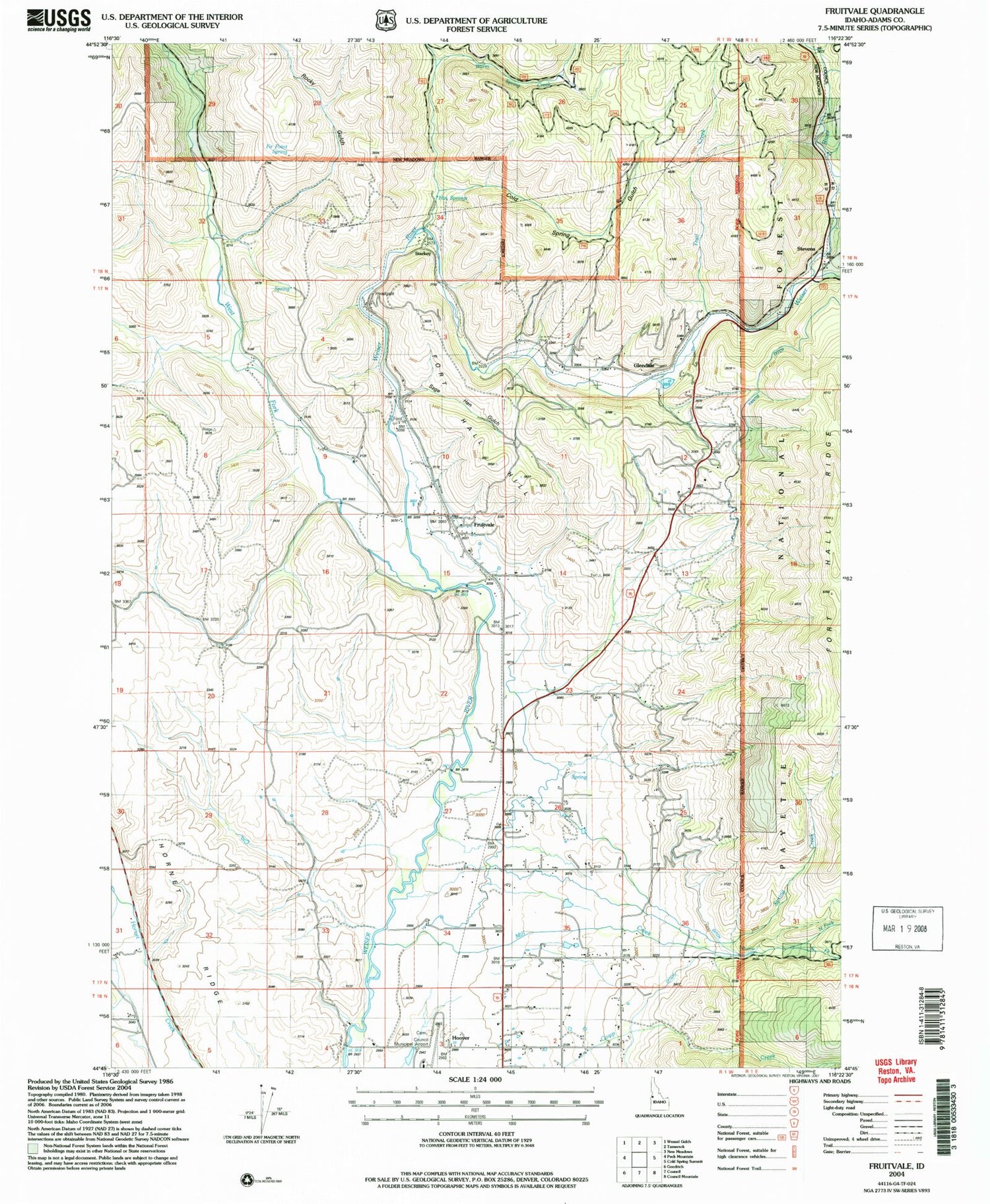
Classic USGS Fruitvale Idaho 7.5'x7.5' Topo Map
Couldn't load pickup availability
Historical USGS topographic quad map of Fruitvale in the state of Idaho. Map scale may vary for some years, but is generally around 1:24,000. Print size is approximately 24" x 27"
This quadrangle is in the following counties: Adams.
The map contains contour lines, roads, rivers, towns, and lakes. Printed on high-quality waterproof paper with UV fade-resistant inks, and shipped rolled.
Contains the following named places: Camp Creek, Cold Spring Gulch, Council Municipal Airport, Dale, East Fork Weiser River, Fir Point Spring, Fort Hall Hill, Fort Hall Ridge, Fruitvale, Gaylord Creek, Glendale, Hoover, Hoover Station, Hornet Ridge, Mill Creek, North Fork Mill Creek, Pin Creek, Rocky Gulch, South Fork Mill Creek, Spring Creek, Starkey, Starkey Hot Springs, Starkey Post Office, Stevens, Trail Creek, Trestle Creek, Warm Spring Creek, Warm Spring Gulch, West Fork Weiser River, White School, Winkler Cemetery