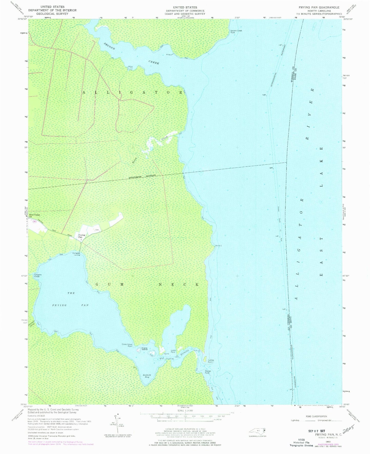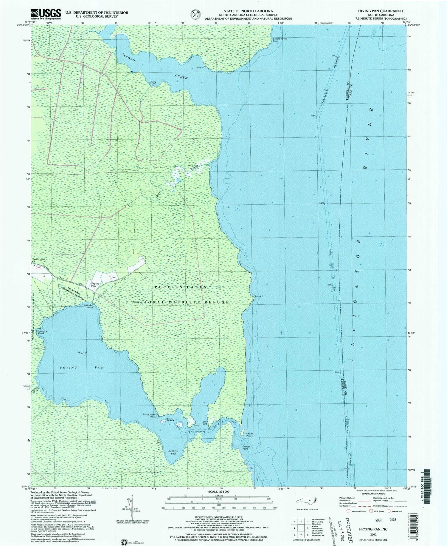
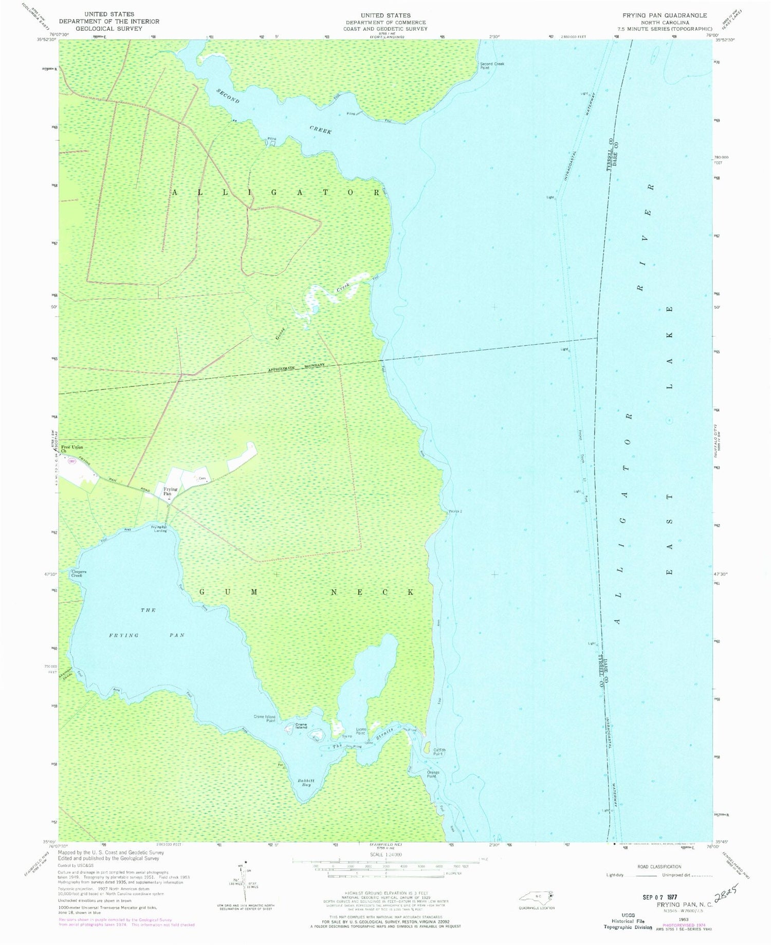
MyTopo
Classic USGS Frying Pan North Carolina 7.5'x7.5' Topo Map
Regular price
$16.95
Regular price
Sale price
$16.95
Unit price
per
Couldn't load pickup availability
Historical USGS topographic quad map of Frying Pan in the state of North Carolina. Map scale may vary for some years, but is generally around 1:24,000. Print size is approximately 24" x 27"
This quadrangle is in the following counties: Dare, Tyrrell.
The map contains contour lines, roads, rivers, towns, and lakes. Printed on high-quality waterproof paper with UV fade-resistant inks, and shipped rolled.
Contains the following named places: Babbitt Bay, Catfish Point, Coopers Creek, Crane Island, Crane Island Point, Free Union Church, Frying Pan, Frying Pan Landing, Goose Creek, Lyons Point, Orange Point, Second Creek, Second Creek Point, The Frying Pan, The Straits