MyTopo
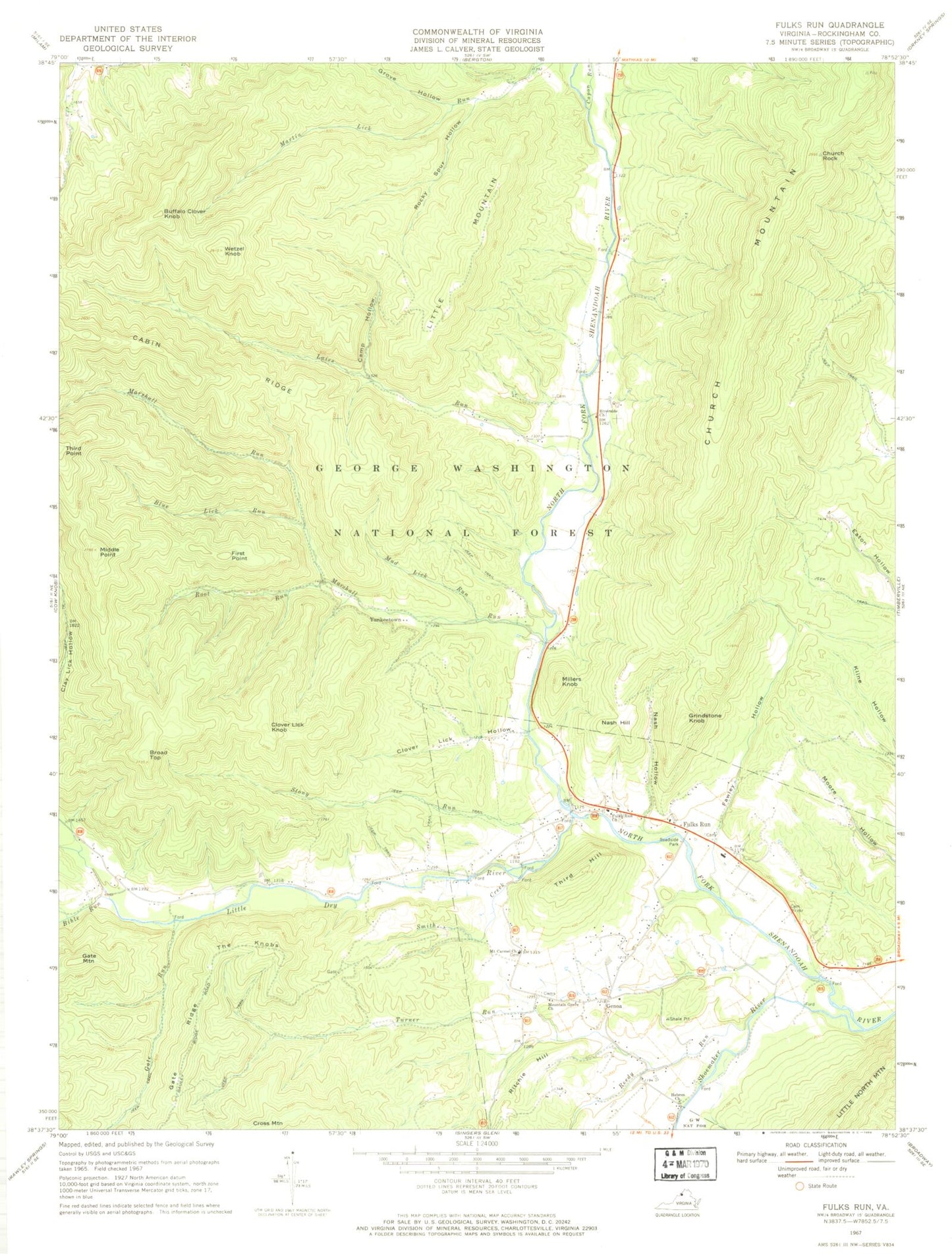
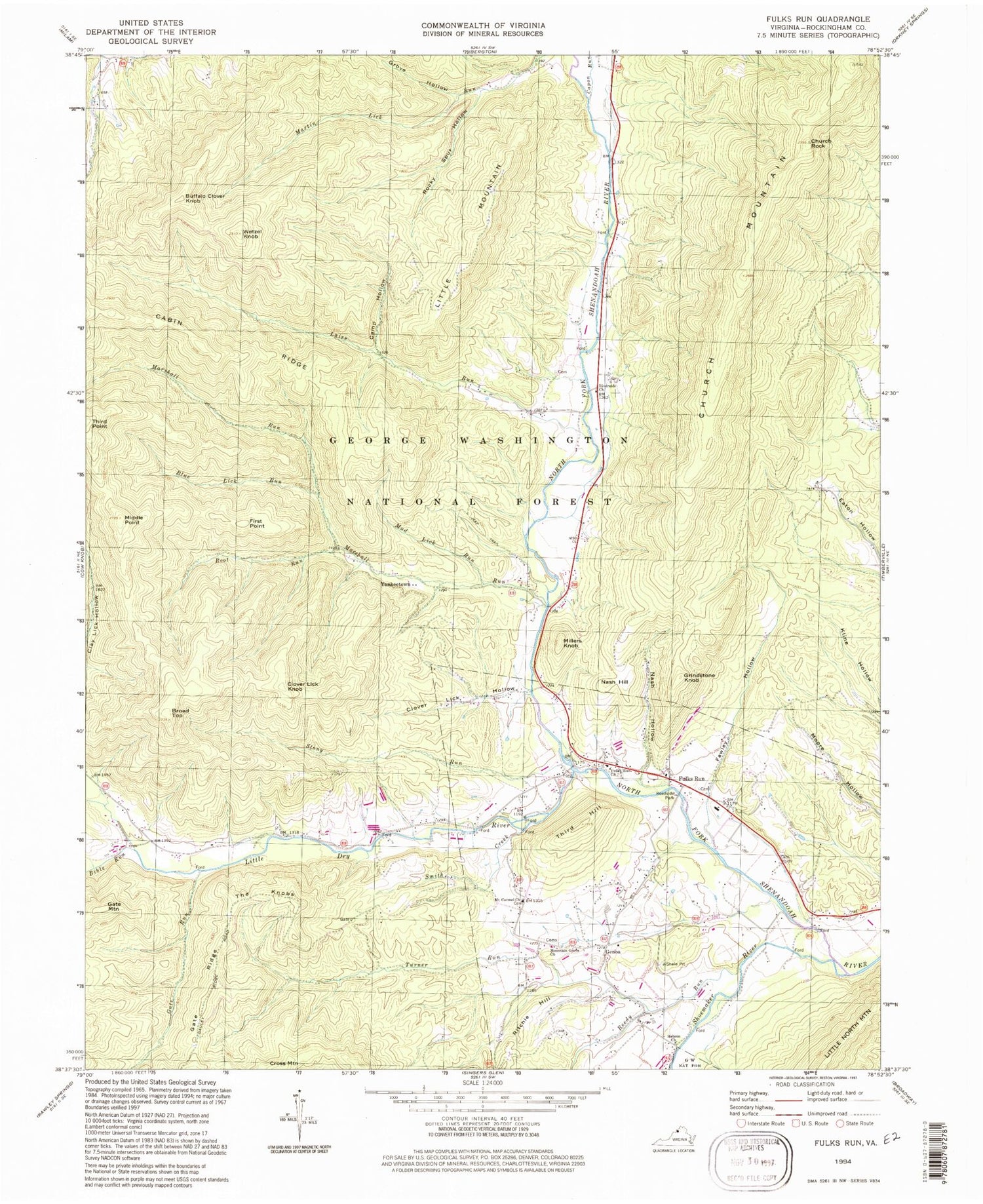
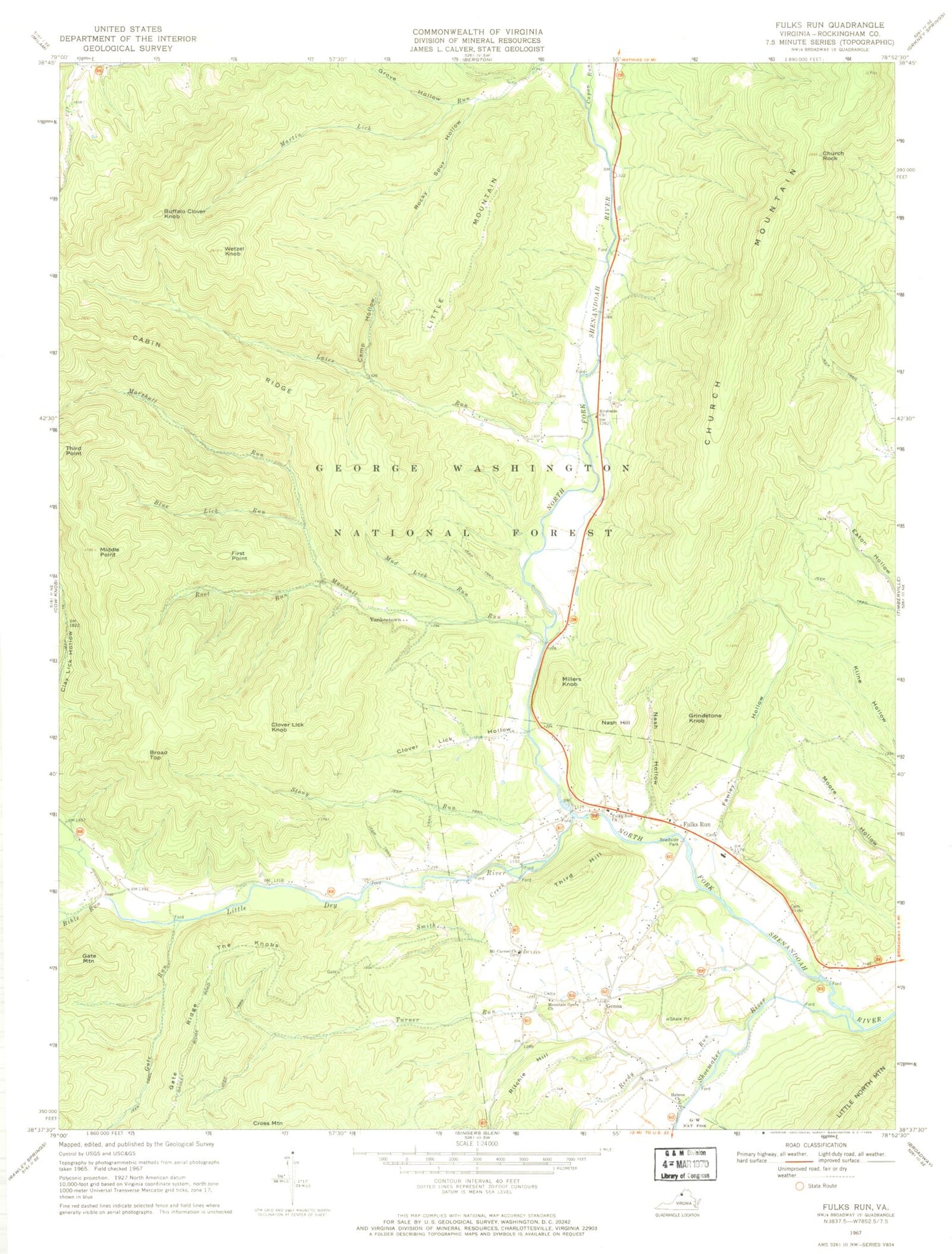
Classic USGS Fulks Run Virginia 7.5'x7.5' Topo Map
Couldn't load pickup availability
Historical USGS topographic quad map of Fulks Run in the states of Virginia, West Virginia. Typical map scale is 1:24,000, but may vary for certain years, if available. Print size: 24" x 27"
This quadrangle is in the following counties: Rockingham.
The map contains contour lines, roads, rivers, towns, and lakes. Printed on high-quality waterproof paper with UV fade-resistant inks, and shipped rolled.
Contains the following named places: Bible Run, Blue Lick Run, Broad Top, Cabin Ridge, Camp Hollow, Capon Run, Church Rock, Clover Lick Hollow, Fawley Hollow, First Point, Fulks Run Church, Gate Run, Grove Hollow, Lairs Run, Little Dry River, Marshall Run, Middle Point, Mount Carmel Church, Mountain Grove Church, Mud Lick Run, Nash Hollow, Reedy Run, Ritchie Hill, Riverside Church, Rocky Sprur Hollow, Root Run, Shoemaker River, Smith Creek, Stony Run, The Knobs, Third Hill, Turner Run, Wetzel Knob, Hebron Church, Claycomb Dam, Buffalo Clover Knob, Clover Lick Knob, Fulks Run, Genoa, Grindstone Knob, Little Mountain, Millers Knob, Nash Hill, Yankeetown, Fulks Run Elementary School, Trumbo Cemetery, Fulks Run School (historical), Genoa School (historical), Mount Pleasant School (historical), Pentacostal Church, Cabin Ridge Dairy, Fulks Run Post Office, Capon Run