MyTopo
Classic USGS Fullers Crossroads Alabama 7.5'x7.5' Topo Map
Couldn't load pickup availability
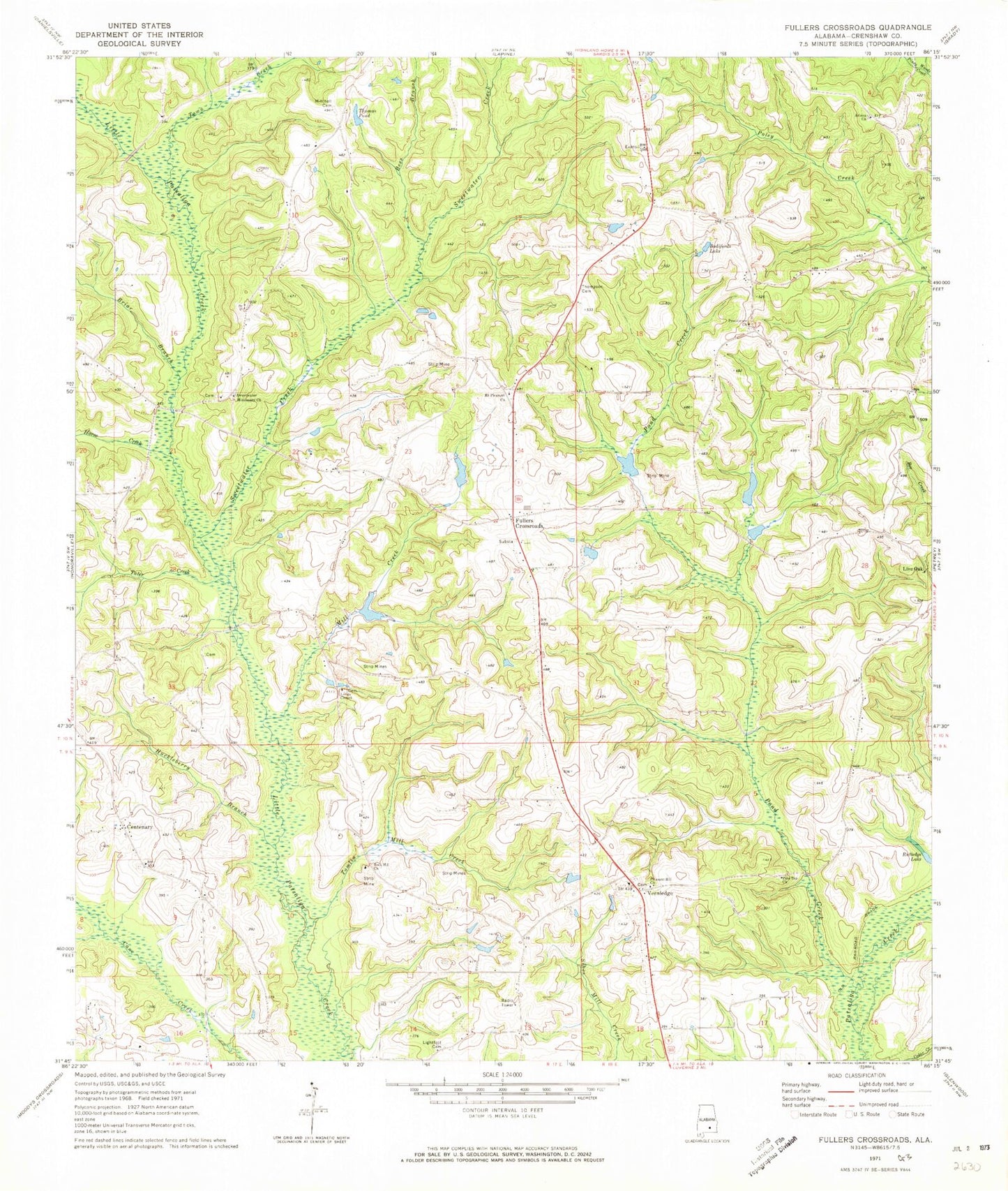
Historical USGS topographic quad map of Fullers Crossroads in the state of Alabama. Map scale may vary for some years, but is generally around 1:24,000. Print size is approximately 24" x 27"
This quadrangle is in the following counties: Crenshaw.
The map contains contour lines, roads, rivers, towns, and lakes. Printed on high-quality waterproof paper with UV fade-resistant inks, and shipped rolled.
Contains the following named places: Arlena Church, Bells Gin, Bess Branch, Bodifords Lake, Briar Branch, Centenary, Centenary Church, Fuller School, Fullers Crossroads, Fullers Crossroads Fire Department, Horse Creek, Huckleberry Branch, Joiners Store, Lightfoot Cemetery, Live Oak Church, Longs Chapel, Mill Creek, Mitchell Cemetery, Mount Pleasant Cemetery, Mount Pleasant Church of Christ, Pine Top Church, Pleasant Grove School, Pleasant Hill Church, Pleasant Hill School, Pond Creek, Providence Church, R D Beasley Dam, R D Beasley Fish Pond, Rock Hill Church of Christ, Rutledge Lake, Sal Soda, Saville Church, Sweetwater Creek, Sweetwater Missionary Church, Sweetwater School, Tater Creek, Thomas Pond, Thompson Cemetery, Tomlin Mill Creek, Town Creek, Vernledge, Vernledge Baptist Church, Vernledge Cemetery, ZIP Code: 36049