MyTopo
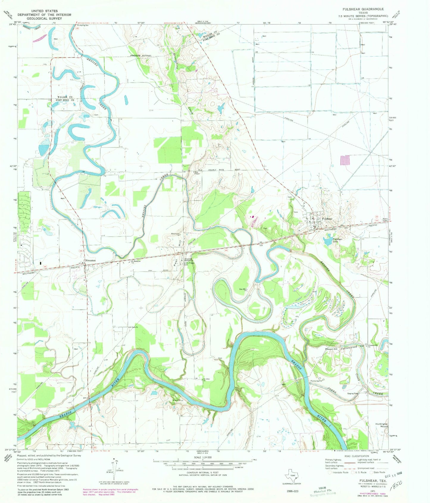
Classic USGS Fulshear Texas 7.5'x7.5' Topo Map
Couldn't load pickup availability
Historical USGS topographic quad map of Fulshear in the state of Texas. Map scale may vary for some years, but is generally around 1:24,000. Print size is approximately 24" x 27"
This quadrangle is in the following counties: Fort Bend, Waller.
The map contains contour lines, roads, rivers, towns, and lakes. Printed on high-quality waterproof paper with UV fade-resistant inks, and shipped rolled.
Contains the following named places: Baytown Medical Center Heliport, Bessies Creek, Bob Lutts Fulshear/Simonton Branch Library, Brookshire Creek, City of Simonton, City of Weston Lakes, Cottonwood Creek, Fendley Airport, Fulshear, Fulshear City Hall, Fulshear Lake, Fulshear Police Department, Fulshear Post Office, Fulshear Simonton Fire Department Station 1, Jerusalem Starlight Church, Little Prayer Cemetery, Pittsville, Pleasant Hill, Pleasant Hill Church, Pool Hill, Saint Johns Church, Saint Mathews Church, Saint Pauls Church, Simonton, Simonton Fire Station, Simonton Post Office, Weston Lakes, Weston Lakes Country Club, White Wing Ranch Airport, Zion Chapel, ZIP Codes: 77441, 77476