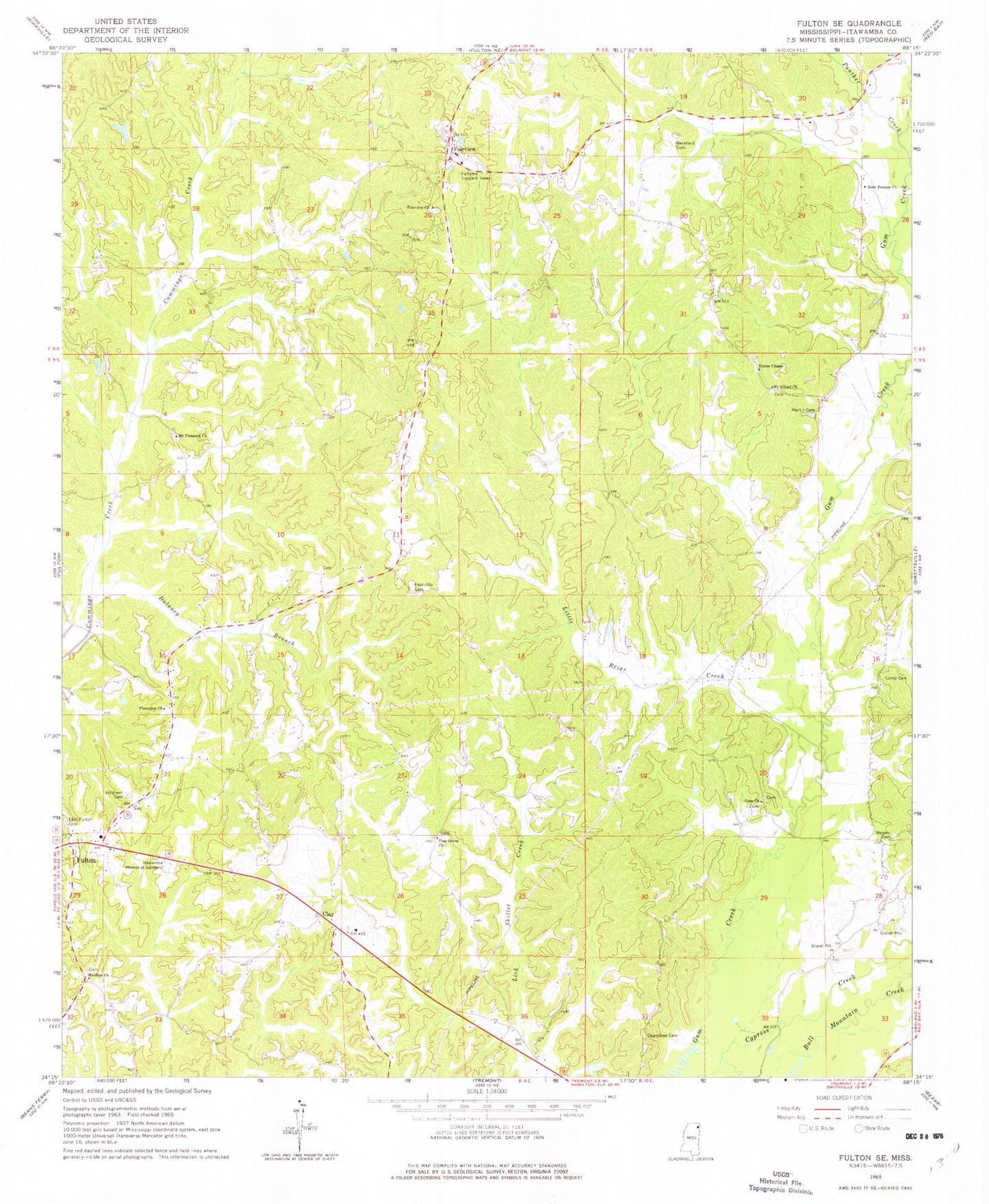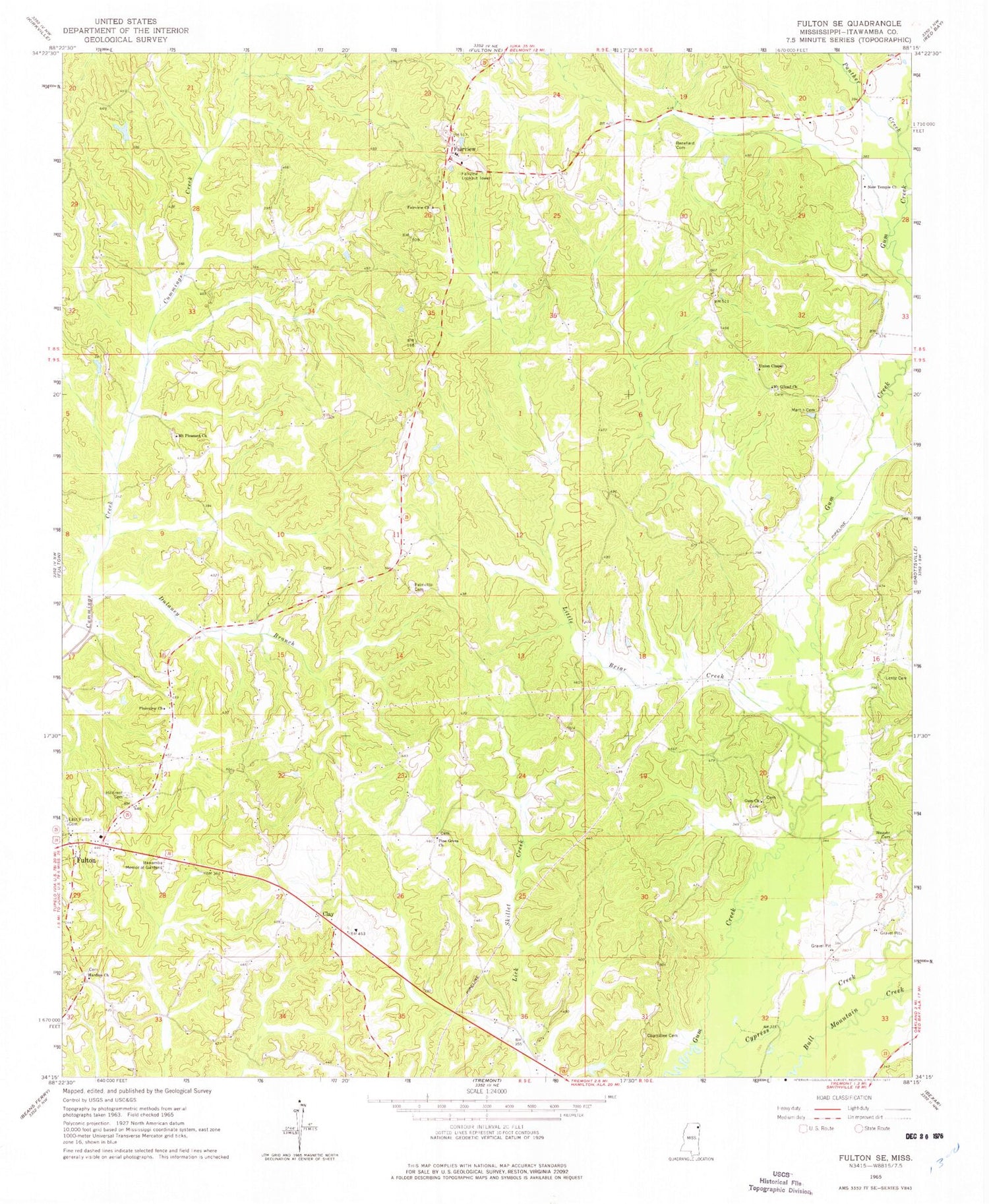
MyTopo
Classic USGS Fulton SE Mississippi 7.5'x7.5' Topo Map
Couldn't load pickup availability
Historical USGS topographic quad map of Fulton SE in the state of Mississippi. Map scale may vary for some years, but is generally around 1:24,000. Print size is approximately 24" x 27"
This quadrangle is in the following counties: Itawamba.
The map contains contour lines, roads, rivers, towns, and lakes. Printed on high-quality waterproof paper with UV fade-resistant inks, and shipped rolled.
Contains the following named places: A E Young Lake Dam, Benefield Cemetery, Chaffin Branch, Chamblee Cemetery, Clay, Dulaney Branch, East Fulton Baptist Church, East Fulton Cemetery, Fairview, Fairview Cemetery, Fairview Church, Fairview Junior High School, Fairview Lookout Tower, Gum Church, Gun Creek Cemetery, Hardin Chapel Cemetery, Hardins Church, Hillcrest Cemetery, Ingraham, Itawamba County, Itawamba Memorial Gardens, Lentz Cemetery, Little Briar Creek, Martin Cemetery, Mount Gilead Cemetery, Mount Gilead Church, Mount Pleasant Cemetery, Mount Pleasant Church, New Temple Church, Northeast Itawamba Volunteer Fire Department Station 851, Palmetto Cemetery, Panther Creek, Pine Grove Church, Plainview Church, Pleasanton, R K Houston Lake Dam, Supervisor District 5, Union Chapel, Weaver Cemetery