
MyTopo
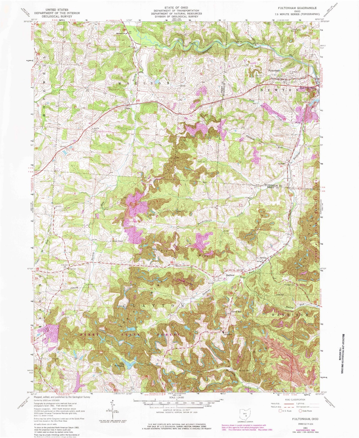
Classic USGS Fultonham Ohio 7.5'x7.5' Topo Map
Couldn't load pickup availability
Historical USGS topographic quad map of Fultonham in the state of Ohio. Typical map scale is 1:24,000, but may vary for certain years, if available. Print size: 24" x 27"
This quadrangle is in the following counties: Muskingum, Perry.
The map contains contour lines, roads, rivers, towns, and lakes. Printed on high-quality waterproof paper with UV fade-resistant inks, and shipped rolled.
Contains the following named places: Bush Creek, Clayton School, Fultonham Cemetery, Madison School, McLuney Cemetery, Mount Horeb Cemetery, Roberts Cemetery, Uniontown Cemetery, Unity Presbyterian Cemetery, Wesley Chapel, Redfield, Locust Grove School (historical), Perrydale School (historical), Olive School (historical), Curren School (historical), Lick School (historical), Zion Cemetery, Pike School (historical), Wesley School (historical), Unity Church (historical), Porter School (historical), Clover Hill, Cannon, Fultonham, Saltillo, Sego, Butcherknife Creek, Turkey Run, Twomile Run, Wesley, New Lexington Water Supply Reservoir, Essington Lake Dam, Essington Lake, Perry Reclaim Dam Three, Perry Reclaim Dam Three Impoundment, Perry Reclaim Dam One, Perry Reclaim Reservoir One, Perry Reclaim Dam Two, Perry Reclaim Reservoir Two, Perry Fish and Game Association Pond Dam, Perry Fish and Game Association Pond, Zion Methodist Church, Avondale State Wildlife Area, Perry State Forest, WWJM-FM (New Lexington), Township of Clayton, Township of Madison, Bethel Cemetery, Green Lawn Memory Cemetery, Wesley Chapel Cemetery, Fultonham Post Office, Redfield Post Office (historical), Sego Post Office (historical), Wesley Post Office (historical), Saltillo Post Office (historical), Village of Fultonham