MyTopo
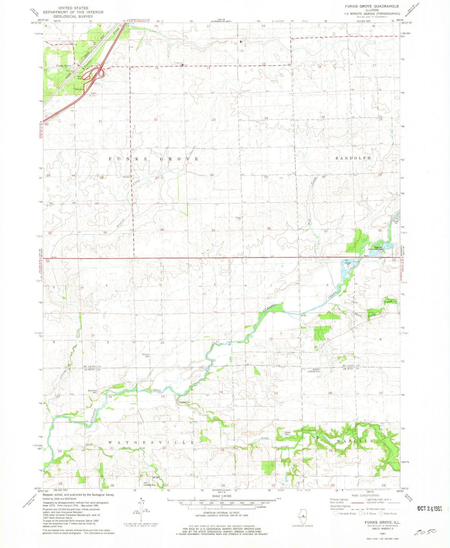
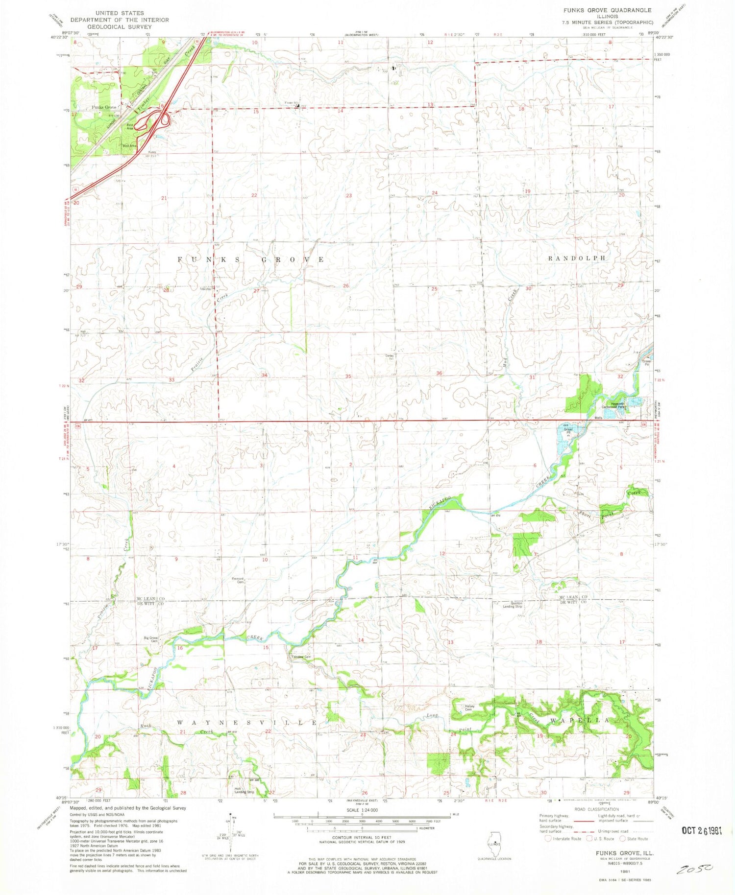
Classic USGS Funks Grove Illinois 7.5'x7.5' Topo Map
Couldn't load pickup availability
Historical USGS topographic quad map of Funks Grove in the state of Illinois. Map scale may vary for some years, but is generally around 1:24,000. Print size is approximately 24" x 27"
This quadrangle is in the following counties: De Witt, McLean.
The map contains contour lines, roads, rivers, towns, and lakes. Printed on high-quality waterproof paper with UV fade-resistant inks, and shipped rolled.
Contains the following named places: Alexander School, Big Grove Cemetery, Burr Oak School, Campbells Hump Church, Columbia School, Fairview Cemetery, Fremont Cemetery, Funks Grove, Funks Grove Nature Preserve, Funks Grove Townhall, Funks School, Halsey Cemetery, Heyworth Centennial Park, Holland Field, Holt Landing Strip, Long Point Creek, Mud Creek, Prairie Creek, Rock Creek, Short Point Creek, Short Point School, Stubblefield Woodlots Nature Preserve, Township of Funks Grove, Township of Waynesville, WM Quinton RLA Airport