MyTopo
Classic USGS Furman South Carolina 7.5'x7.5' Topo Map
Couldn't load pickup availability
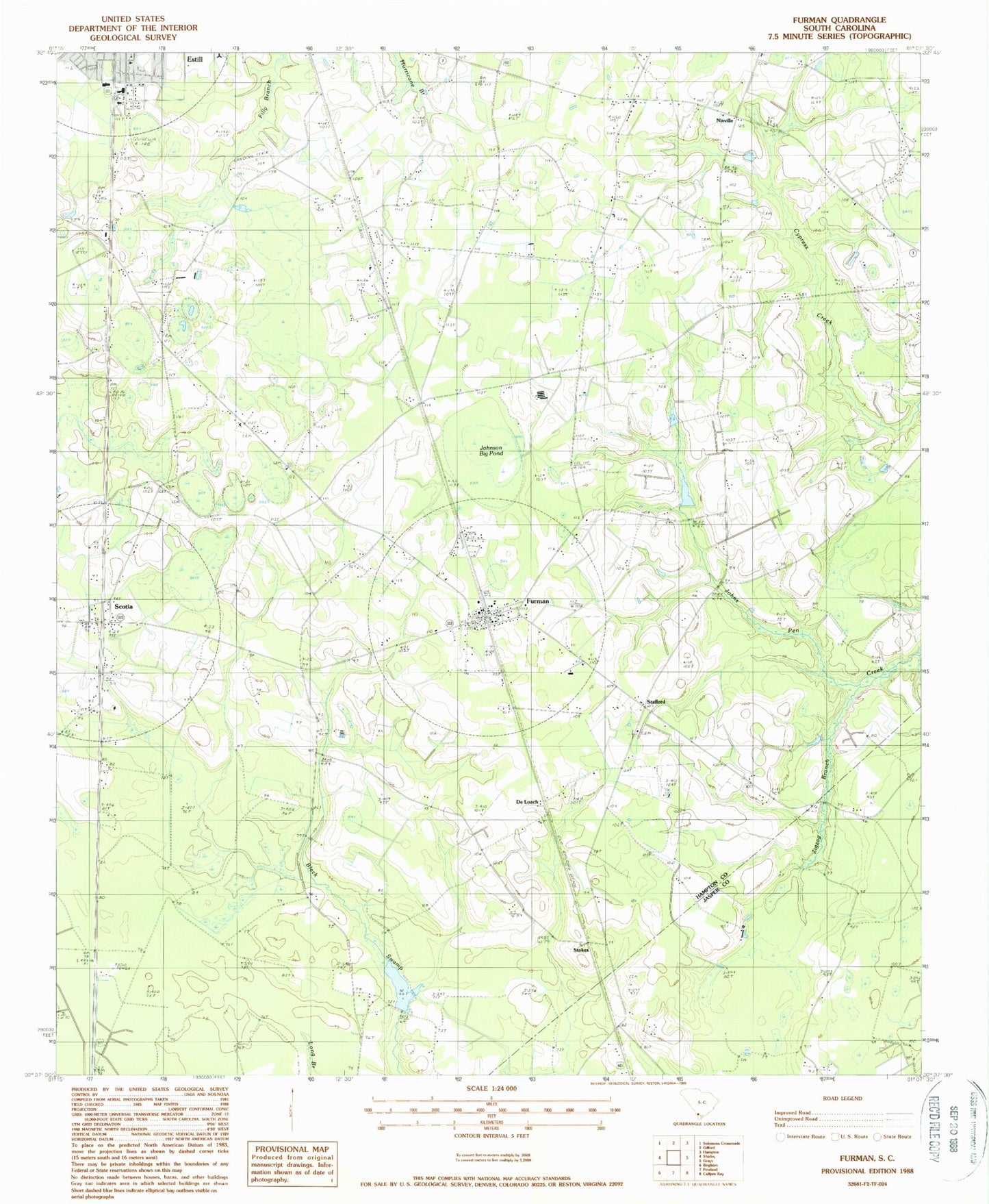
Historical USGS topographic quad map of Furman in the state of South Carolina. Map scale may vary for some years, but is generally around 1:24,000. Print size is approximately 24" x 27"
This quadrangle is in the following counties: Hampton, Jasper.
The map contains contour lines, roads, rivers, towns, and lakes. Printed on high-quality waterproof paper with UV fade-resistant inks, and shipped rolled.
Contains the following named places: Bishop Grace Church, Buckner School, Crapsedale School, De Loach, Dixon Elementary School, First Estill Baptist Church, Furman, Furman Fire Department Station 30, Furman Post Office, Good Hope Church, Hampton Fire Department Station 80, Horse Pond School, Johnson Big Pond, Jones Pond, Lebanon Church, Nixville, Nixville Church, Nixville School, Pine Savannah School, Russel School, Sanctified Church, Sandy Drain Church, Sandy Drain School, Scotia, Scotia School, Smith Store, South Carolina Noname 25011 D-2604 Dam, South Carolina Noname 25013 D-2612 Dam, Stafford, Stafford Church, Steep Bottom, Steep Bottom Church, Steep Bottom Pond, Stokes, Thankful Church, Town of Furman, Town of Scotia, Zigzag Branch, ZIP Codes: 29918, 29921, 29939