MyTopo
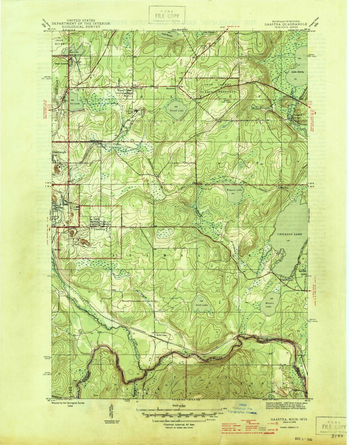
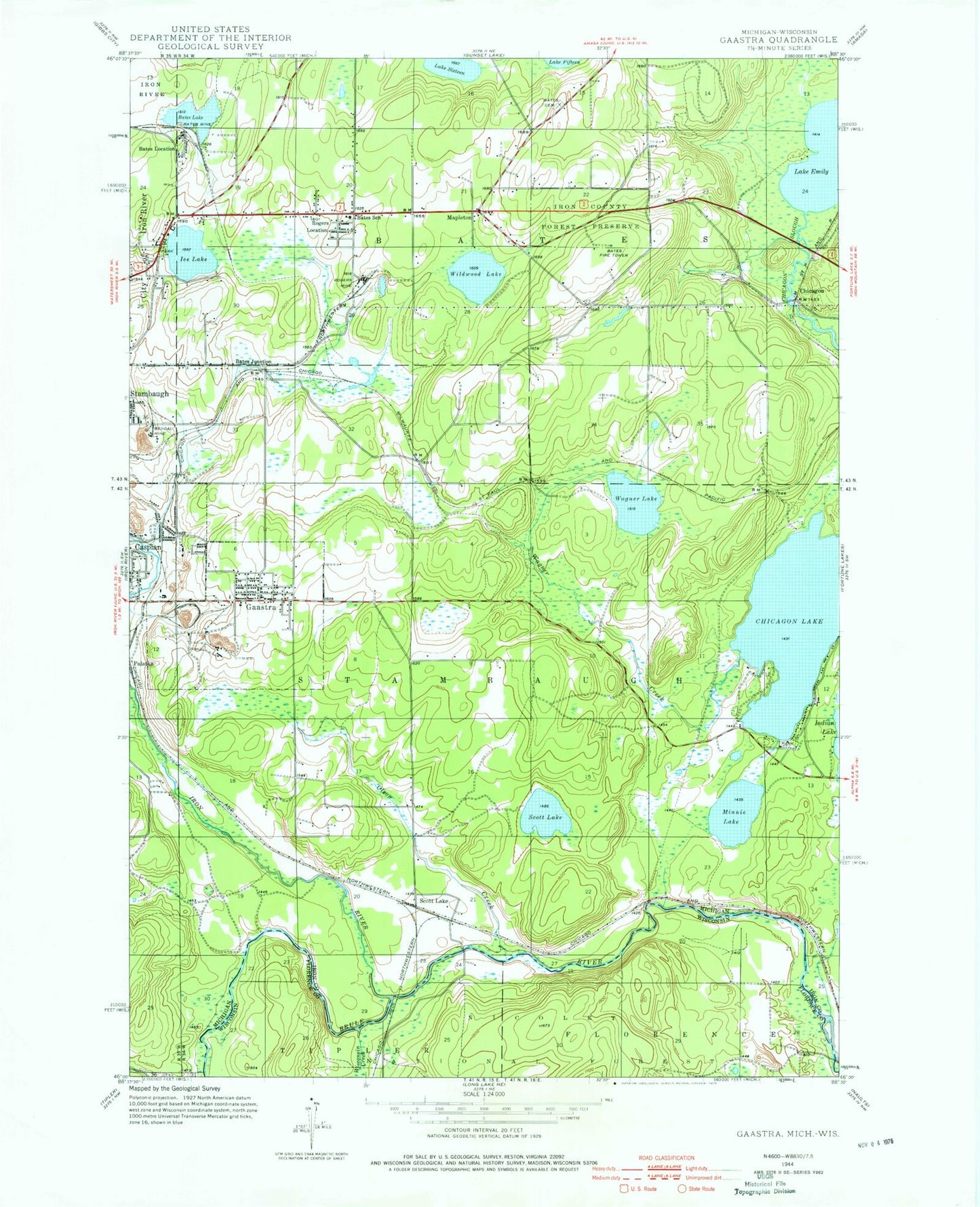
Classic USGS Gaastra Michigan 7.5'x7.5' Topo Map
Couldn't load pickup availability
Historical USGS topographic quad map of Gaastra in the states of Michigan, Wisconsin. Typical map scale is 1:24,000, but may vary for certain years, if available. Print size: 24" x 27"
This quadrangle is in the following counties: Florence, Iron.
The map contains contour lines, roads, rivers, towns, and lakes. Printed on high-quality waterproof paper with UV fade-resistant inks, and shipped rolled.
Contains the following named places: Bates Lake, Bates Mine, Bengal Mine, Chicagon Lake, Lake Emily, Gaastra, Olson Creek, Rogers Location, Lake Sixteen, Wagner Creek, Wildwood Lake, Mapleton, Scott Lake, Bates Cemetery, Bates Junction, Bates Location, Bates School, Chicagon, Ice Lake, Iron River, Minnie Lake, Palatka, Rogers Mine, Scott Lake, Wagner Lake, Pentoga Park, Bates Fire Tower, WIKB-FM (Iron River), City of Gaastra, Iron River Bible Church, Iron River Jehovah's Witnesses, Lakeland Baptist Church, Iron County Community School, Aspirus Iron River Hospital, Marquette Medical Clinic, Bates Township Hall, Saunders Post Office (historical), Scott Lake Station (historical), Mapleton Post Office (historical), Ice Lake Park, Gaastra Post Office, Gaastra Police Station, Indian Burial Ground, George Young Golf Course, Indian Village Historical Marker, First Roadside Park Historical Marker, Wisconsin Creek, Edison School (historical), Brule River Cliffs State Natural Area