MyTopo
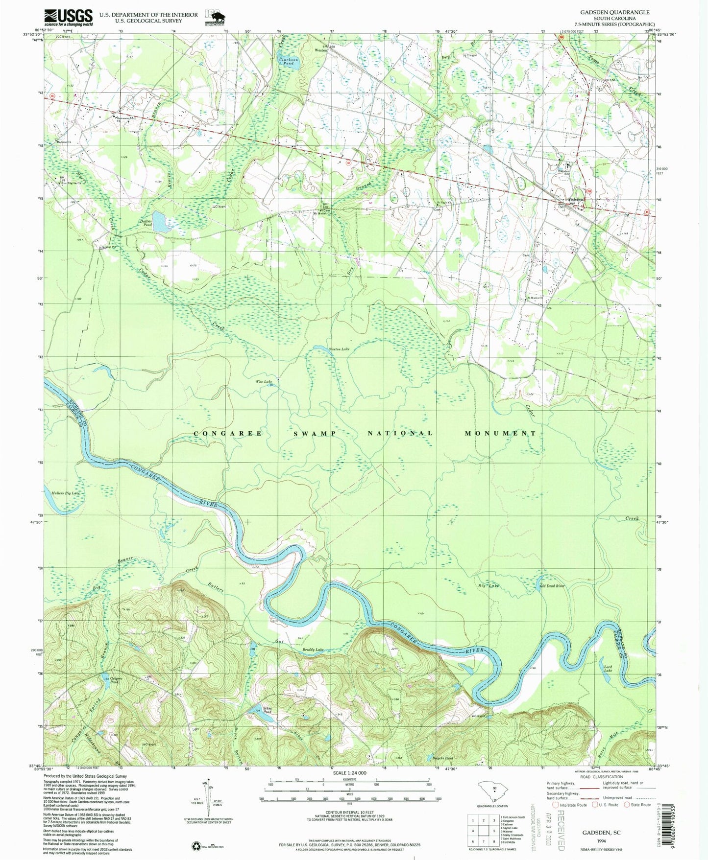
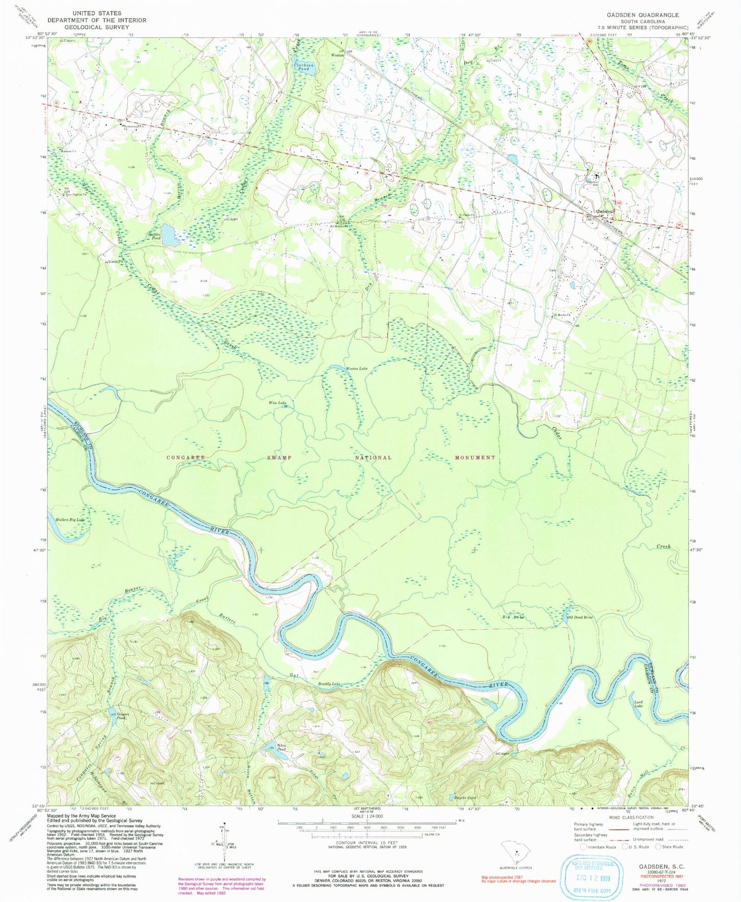
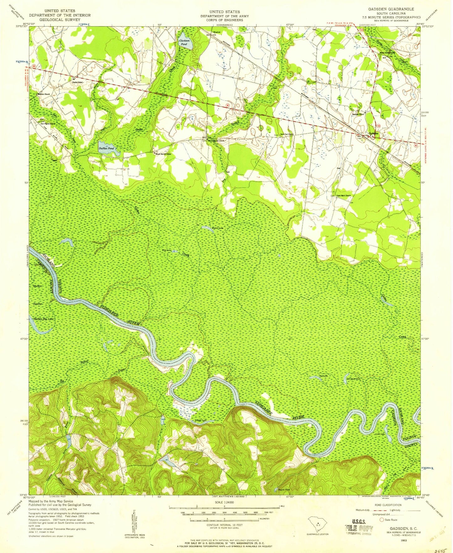
Classic USGS Gadsden South Carolina 7.5'x7.5' Topo Map
Couldn't load pickup availability
Historical USGS topographic quad map of Gadsden in the state of South Carolina. Typical map scale is 1:24,000, but may vary for certain years, if available. Print size: 24" x 27"
This quadrangle is in the following counties: Calhoun, Richland.
The map contains contour lines, roads, rivers, towns, and lakes. Printed on high-quality waterproof paper with UV fade-resistant inks, and shipped rolled.
Contains the following named places: Big Lake, Braddy Lake, Butlers Gut, Buyck Bottom, Buycks Pond, Clarkson Pond, Congaree Spring Branch, Damascus Number 2 Church, Dry Branch, Duffies Pond, Geigers Pond, Hildebrand Branch, Lord Lake, Madison Church, Mount Moriah Church, Mullers Big Lake, Old Dead River, Reeves Branch, Sikes Creek, Sikes Pond, Weston Lake, Wise Lake, Zion Pilgrim Church, Weston, Congaree National Park Wilderness, Clarkson Pond D-0599 Dam, Duffies Pond D-0600 Dam, South Carolina Noname 09009 D-2622 Dam, South Carolina Noname 09010 D-2623 Dam, Brady Pond Dam D-2624, Brady Pond, Big Beaver Creek, Bannisters Bridge, Big Lake Cattle Mount, Bradys Cattle Mount, Cedar Creek Hunt Club, Clayton School (historical), Cooners Cattle Mount, Gadsden Post Office, Mount Ararat Church (historical), Mount Moriah School (historical), Old Dead River Cattle Mount, Red Hill Church (historical), Gadsden, Gadsden School, Myers Creek, Saint Marks Church, Saint Pauls Church, Hopkins Division, Columbia - Richland Fire Department Gadsden, Gadsden Census Designated Place, Big Lake, Braddy Lake, Butlers Gut, Buyck Bottom, Buycks Pond, Clarkson Pond, Congaree Spring Branch, Damascus Number 2 Church, Dry Branch, Duffies Pond, Geigers Pond, Hildebrand Branch, Lord Lake, Madison Church, Mount Moriah Church, Mullers Big Lake, Old Dead River, Reeves Branch, Sikes Creek, Sikes Pond, Weston Lake, Wise Lake, Zion Pilgrim Church, Weston, Congaree National Park Wilderness, Clarkson Pond D-0599 Dam, Duffies Pond D-0600 Dam, South Carolina Noname 09009 D-2622 Dam, South Carolina Noname 09010 D-2623 Dam, Brady Pond Dam D-2624, Brady Pond, Big Beaver Creek, Bannisters Bridge, Big Lake Cattle Mount, Bradys Cattle Mount, Cedar Creek Hunt Club, Clayton School (historical), Cooners Cattle Mount, Gadsden Post Office, Mount Ararat Church (historical), Mount Moriah School (historical), Old Dead River Cattle Mount, Red Hill Church (historical), Gadsden, Gadsden School, Myers Creek, Saint Marks Church, Saint Pauls Church, Hopkins Division, Columbia - Richland Fire Department Gadsden, Gadsden Census Designated Place